
The Intergovernmental Panel on Climate Change’s first assessment report since 2013 describes two illustrative scenarios that keep warming below 2°C—and several others that go wildly offtrack.
Hazards & Disasters
Posted inScience Updates
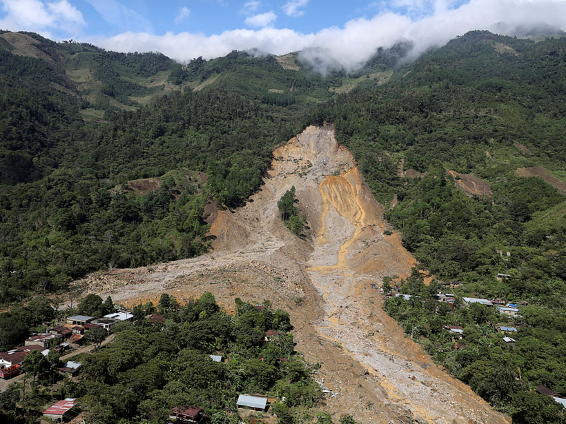
Satellites Support Disaster Response to Storm-Driven Landslides
Extreme precipitation can trigger deadly landslides. Satellite-based tools provide regional perspectives on landslide hazards, help assess risks in near-real time, and guide emergency responses.

Posted inNews
Las mujeres aún no son escuchadas en la conversación sobre política climática
Un estudio de caso en Brasil apunta a una profunda brecha de género que aún debe abordarse en el debate sobre la formulación de políticas.
Posted inNews
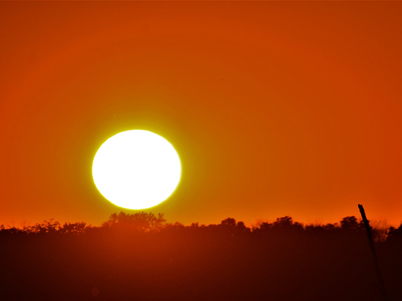
Rapidly Increasing Chance of Record-Shattering Heat Extremes
A new study warns that we need to expect and prepare for unprecedented heat waves in the near future.

Posted inNews
In a Twist, a Greek Volcano Ruled by the Sea
Move over Hephaestus, Poseidon’s got this one.

Posted inResearch Spotlights
Volcanic Tremor and Deformation at Kīlauea
Two new studies investigate activity at Hawaii’s Kīlauea leading up to and following the 2018 eruption to better understand the volcano’s plumbing and behavior.
Posted inNews
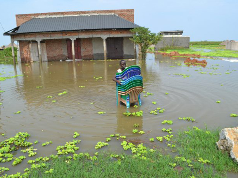
Soil Saturation Dictates Africa’s Flood Severity
The most complete hydrological data set for the African continent reveals a surprise: Soil moisture, not heavy precipitation, best explains the timing of Africa’s most severe floods.

Posted inEditors' Vox
Understanding and Anticipating Induced Seismicity
A new special collection in JGR: Solid Earth and Earth and Space Science seeks papers from across disciplines that provide insights into induced seismicity at different spatial and temporal scales.

Posted inNews
Detailed Geologic Mapping Helps Identify Health Hazards
A team of geologists and nursing researchers created an interactive radon hazard map for Kentucky residents—and it was possible only because of the high-resolution bedrock mapping in the state.