
Stunning images of the center of the Milky Way showcase technology and techniques that may be a starting point for more discoveries.
imagery
Posted inEditors' Vox
High-Definition Imaging of the Subsurface with Cosmic Ray Muons
A new book describes muography, an imaging technique that can be used to visualize the internal density composition of geological structures.
Posted inEditors' Highlights
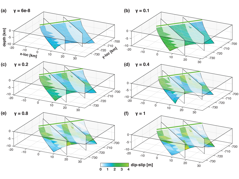
New Inversion Method Improves Earthquake Source Imaging
A new method uses Bayesian inference to jointly invert for non-planar fault geometry and spatially variable slip (with associated uncertainties) in earthquake source modeling, based on geodetic data.
Posted inEditors' Highlights
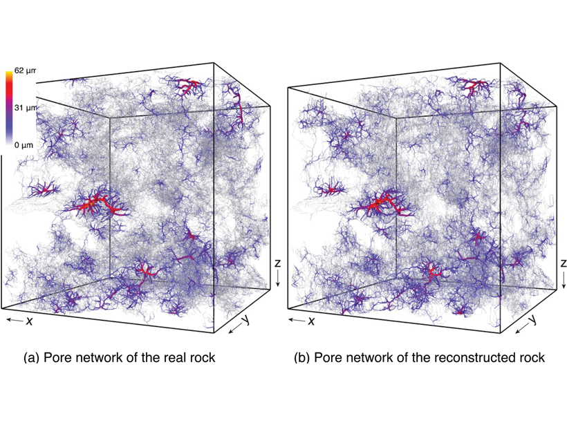
Reconstructing Rocks with Machine Learning
Machine learning can be used to accurately reconstruct high-resolution, 3D images of rocks from 2D cross-sections, which opens the door to more detailed simulations.
Posted inEditors' Highlights
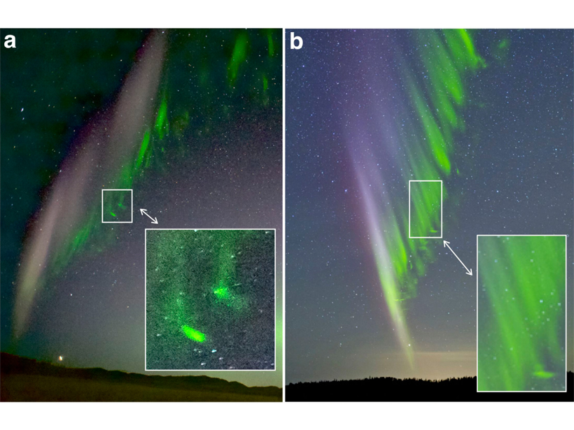
Citizen Scientists Observe Mysterious Green Streaks Below STEVE
Citizen scientists provided images of sub-auroral STEVE (Strong Thermal Emission Velocity Enhancements) showing fine-scale green features with narrow streaks propagating poleward toward STEVE.
Posted inResearch Spotlights
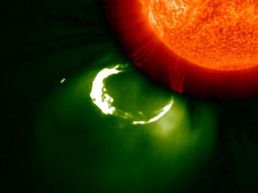
The “Complicated” Complexity of Solar Storms
Researchers turned to crowdsourced science to identify patterns in coronal mass ejections.
Posted inNews
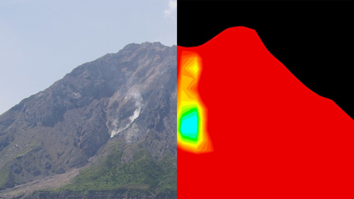
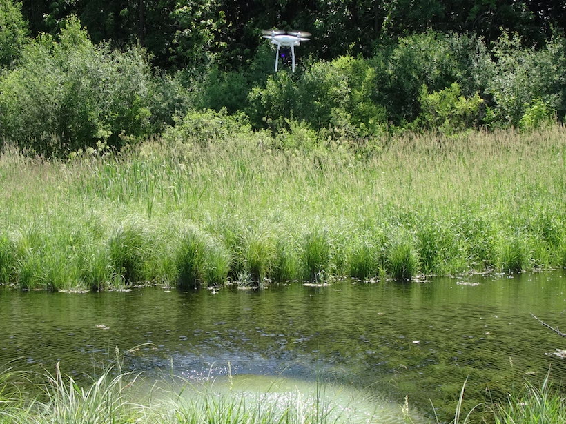
Taking an Aerial View Underground
Wisconsin geologists are testing using drones equipped with thermal cameras to measure shallow soil depths in areas prone to groundwater contamination.
Posted inEditors' Highlights
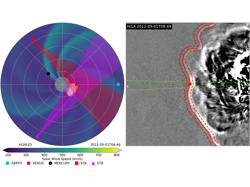
Ensemble Modeling of Coronal Mass Ejection Arrival at 1 AU
Heliospheric imaging data can be used in ensemble modeling of CME arrival time at Earth to improve space weather forecasts, treating the solar wind as a 1-D incompressible hydrodynamic flow.

Posted inResearch Spotlights
World’s Deepest Freshwater Cave May Be a Kilometer Deep
The Czech Republic’s Hranice Abyss is more than twice as deep as researchers thought.
Posted inNews
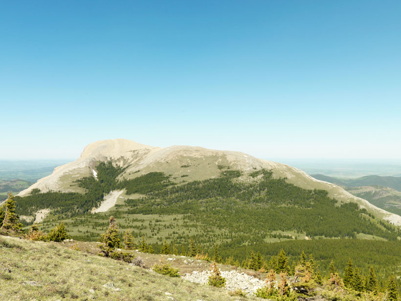
Canada’s Rocky Mountain Forests Are on the Move
Using century-old surveying photos, scientists have mapped 100 years of change in the Canadian Rockies to document the climate-altered landscape.