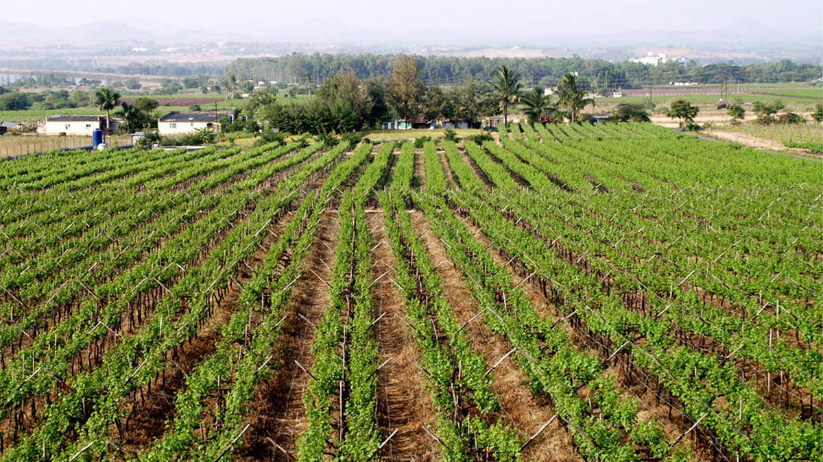
Tropical weather is unpredictable, but a new tool could help farmers get a better grasp on it.
machine learning & AI

Posted inEditors' Highlights
Inductive Approach Reveals Controls on Dissolved Organic Carbon
Machine learning leverages large data sets to reveal hidden patterns explaining when, where, and why dissolved organic carbon moves from hillslopes to streams.

Posted inEditors' Highlights
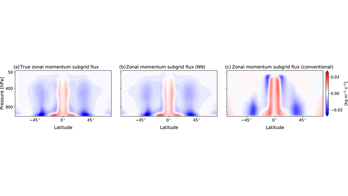
New Machine Learning Parameterization Tested on Atmospheric Model
For the first time, a neural network parameterization of subgrid momentum transport is developed by training on a coarse-grained high-resolution atmospheric simulation.
Posted inResearch Spotlights
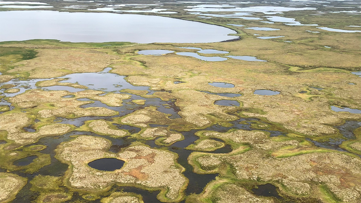
Neural Networks Map the Ebb and Flow of Tiny Ponds
Ponds play an outsized role in carbon emissions, but their size makes them hard to track. Enter machine learning.

Posted inEditors' Highlights
Analyzing Sources of Pollution in the Great Lakes
Understanding how agriculture and land use affect nutrient flows and concentrations in the vast area of the Great Lakes is an essential step to developing sustainable management strategies.

Posted inEditors' Vox
How Big Data is Helping Environmental and Climate Research
A new special collection invites papers focusing on the processing, modeling, and analysis of all types of big datasets in the Earth and space sciences, including the influence of solar forcing on Earth’s climate.

Posted inResearch Spotlights
Tree Ring Width Predicted by Machine Learning
When predicting a tree’s annual growth, consider the whole weather system and not just the sum of its parts.
Posted inEditors' Highlights
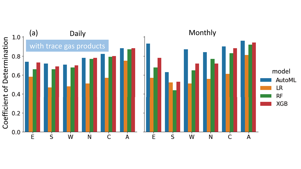
Unleashing the Power of AutoML for Atmospheric Research
Automated Machine Learning liberates domain scientists from selecting learners and hyperparameters and discovers the importance of atmospheric trace gases for improving surface PM2.5 estimates.

Posted inENGAGE, News
“Icefin” Investigates a Glacial Underbelly
An instrument-laden submersible reveals where—and how rapidly—the Antarctic glacier is melting.