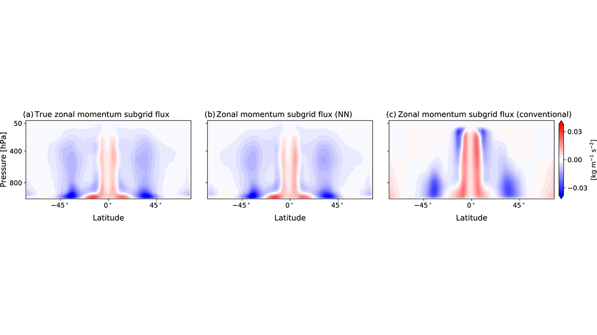
For the first time, a neural network parameterization of subgrid momentum transport is developed by training on a coarse-grained high-resolution atmospheric simulation.
Modeling

Posted inENGAGE, News
Climate Change Knocks It Out of the Park
A climate curve ball: Short-term gains in home runs might soon give way to long-term problems when it gets too hot to play.
Posted inEditors' Highlights
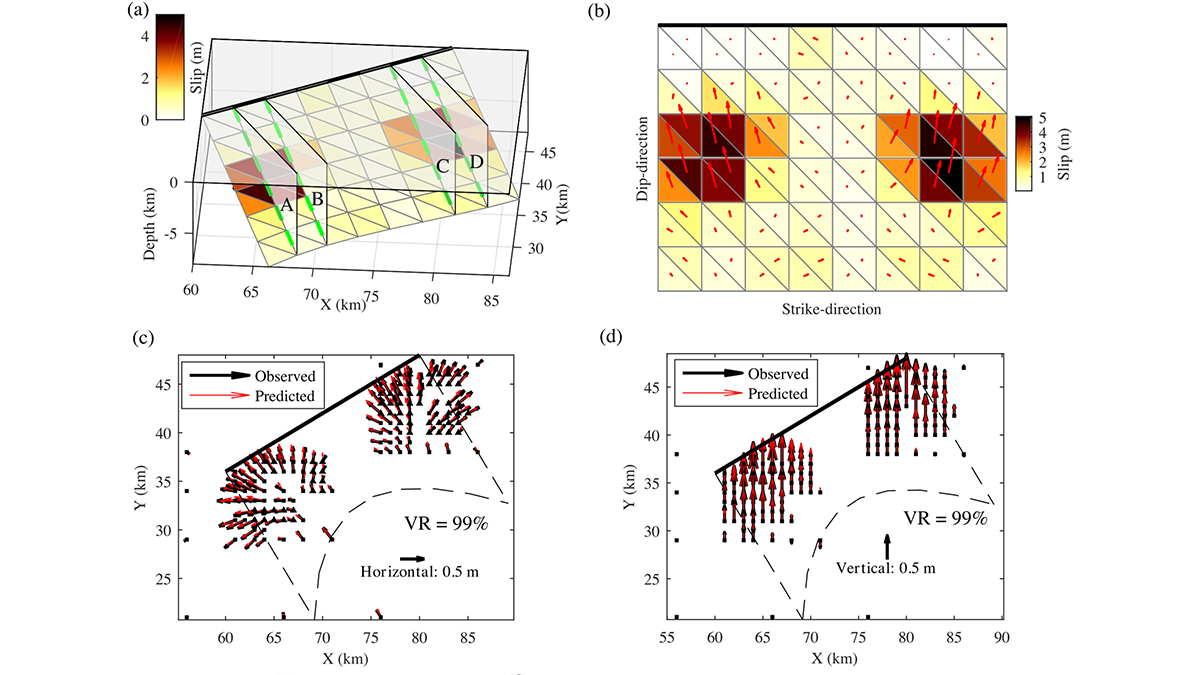
Bayesian Inversion Used to Recover Geometry of Ruptured Fault
A new Bayesian inversion framework is used to solve non-planar geometry of a ruptured fault from spatially variable slip and rake measured with geodesy.
Posted inEditors' Highlights
Quantifying Extreme Events from Short Weather Forecast Data
Subseasonal weather forecast ensembles are a useful tool for overcoming the inherent difficulty of quantifying extreme weather risk caused by data scarcity.

Posted inEditors' Vox
What We Know and Don’t Know About Climate Tipping Elements
As climate change continues, parts of the Earth system such as ice sheets, frozen soils, or the Amazon rainforest could shift—some quickly, some slowly—after crossing key thresholds or tipping points.

Posted inEditors' Highlights
Analyzing Sources of Pollution in the Great Lakes
Understanding how agriculture and land use affect nutrient flows and concentrations in the vast area of the Great Lakes is an essential step to developing sustainable management strategies.
Posted inNews
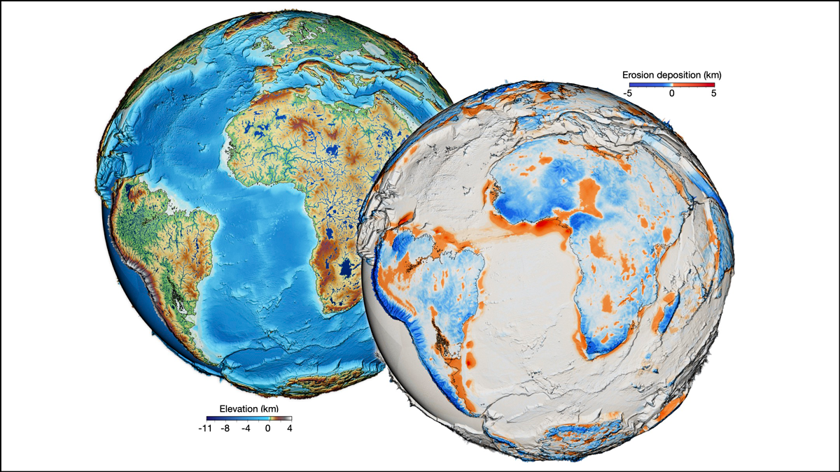
One Surface Model to Rule Them All?
For the first time, scientists have forged a nearly all-encompassing model of Earth’s surface evolution over the past 100 million years.

Posted inEditors' Highlights
Meshless Methods Tell Us What Lurks Beneath the Surface
Limitations with resolving complex underground targets with sufficiently fine resolution may be alleviated through the adoption of meshless electromagnetic methods.
Posted inEditors' Highlights
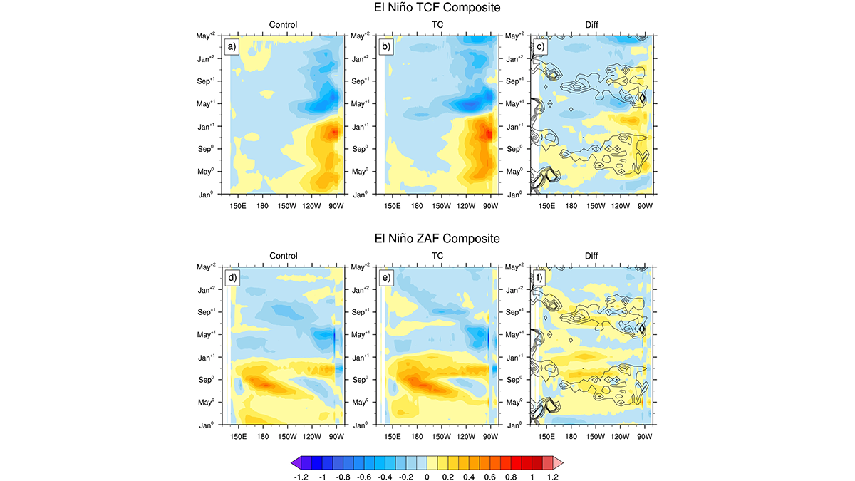
Impact of Tropical Cyclones on El Niño-Southern Oscillation
A suite of Earth Systems model experiments is used to explore how tropical cyclones influence the frequency, magnitude, and timing of El Niño-Southern Oscillation events.