
Geomagnetic storms could significantly disrupt electrified train operations in the United Kingdom once every few decades, according to a new study.
Modeling
Posted inEditors' Highlights
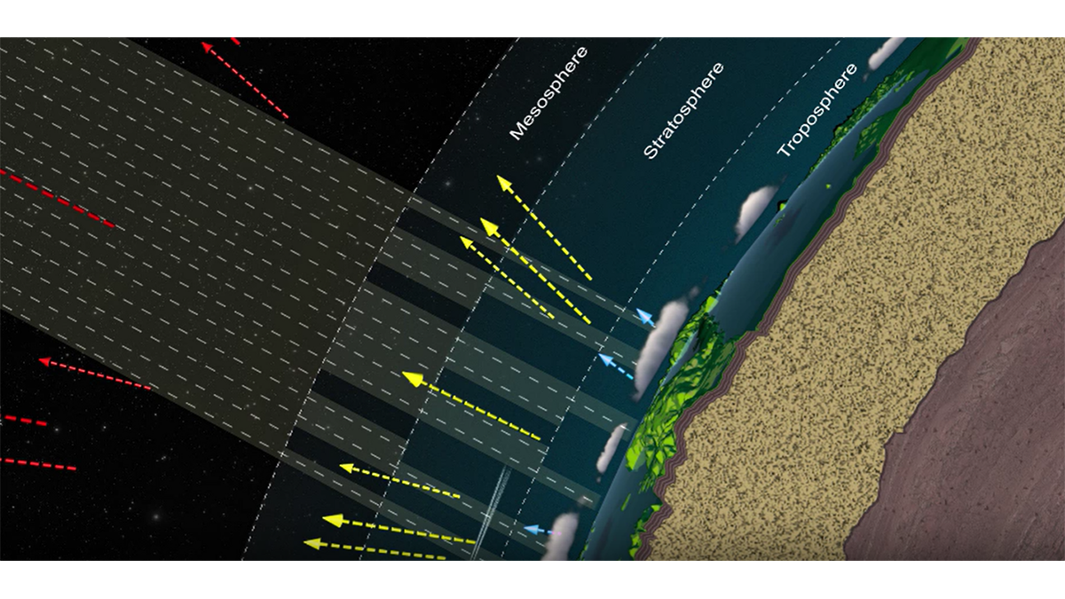
Updated Reference Standard for Total Solar Irradiance
Version 2 of the Total and Spectral Solar Irradiance Sensor-1 Hybrid Solar Reference Spectrum captures a spectral resolution spanning 0.115-200 micrometers and integrates nearly 100% of the TSI energy.

Posted inEditors' Vox
How Big Data is Helping Environmental and Climate Research
A new special collection invites papers focusing on the processing, modeling, and analysis of all types of big datasets in the Earth and space sciences, including the influence of solar forcing on Earth’s climate.
Posted inEditors' Highlights
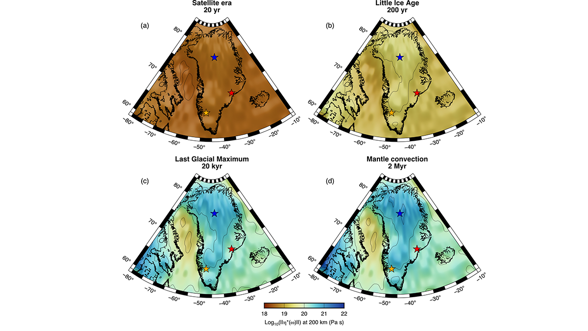
4D Viscosity Constraints from Greenland
The mantle’s resistance to flow appears different for glacial and plate tectonic timescales but this behavior can be reconciled with new thermo-mechanical models of the asthenosphere.
Posted inNews
Supercharged El Niño Could Speed Up Southern Ocean Warming
Projected changes to El Niño will likely accelerate warming of the deep oceans around the Antarctic, supplying heat that could drive ice loss and sea level rise.
Posted inEditors' Highlights
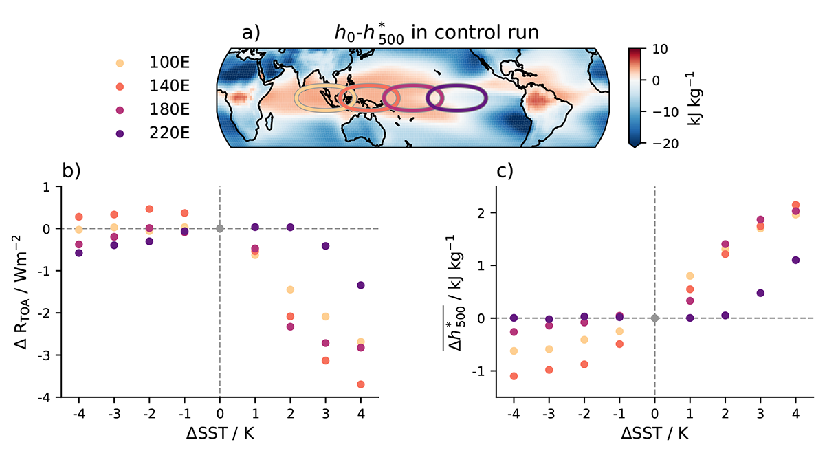
Non-Linear Climate Response to Tropical Sea Surface Temperatures
A new study shows the importance of considering non-linear responses to isolated sea surface temperature (SST) changes and the implications for the linear frameworks used to quantify the SST pattern effect.

Posted inNews
Climate Models Aren’t Dusty Enough
Mineral dust aloft in the atmosphere has a cooling effect not accounted for in current climate models.

Posted inEditors' Highlights
Gulf Stream Closes the Valve of the Labrador Current
Virtual particles released in the Labrador Current revealed that the westward penetration of the current into the shelf seas is inhibited by warm core rings emanating from the Gulf Stream.
Posted inEditors' Highlights
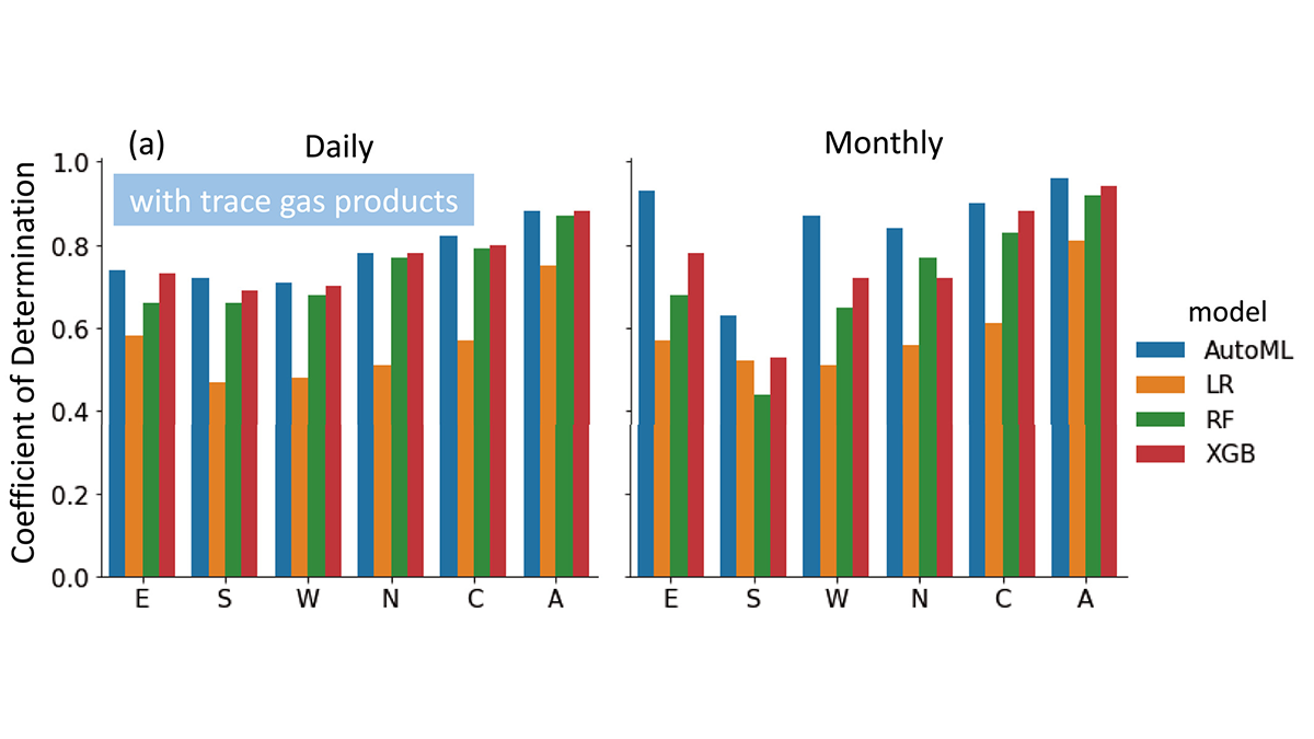
Unleashing the Power of AutoML for Atmospheric Research
Automated Machine Learning liberates domain scientists from selecting learners and hyperparameters and discovers the importance of atmospheric trace gases for improving surface PM2.5 estimates.

Posted inResearch Spotlights
El dióxido de carbono antropogénico es rastreado hacia el océano
Con ayuda de un modelo de circulación oceánica, un equipo de investigadores logró etiquetar y rastrear el carbono emitido antropogénicamente para determinar si su destino es la atmósfera o el océano.