• About
  • Special Reports
  • Topics
    • Climate
    • Earth Science
    • Oceans
    • Space & Planets
    • Health & Ecosystems
    • Culture & Policy
    • Education & Careers
    • Opinions
  • Projects
    • Postcards From the Field
    • ENGAGE
    • Editors’ Highlights
    • Editors’ Vox
    • Eos en Español
    • Eos 简体中文版
    • Print Archive: 2015–2025
  • Policy Tracker
  • Blogs
    • Research & Developments
    • The Landslide Blog
  • Newsletter
  • Submit to Eos
  • AGU.org
  • Career Center
  • Join AGU
  • Give to AGU
  • About
  • Special Reports
  • Topics
    • Climate
    • Earth Science
    • Oceans
    • Space & Planets
    • Health & Ecosystems
    • Culture & Policy
    • Education & Careers
    • Opinions
  • Projects
    • Postcards From the Field
    • ENGAGE
    • Editors’ Highlights
    • Editors’ Vox
    • Eos en Español
    • Eos 简体中文版
    • Print Archive: 2015–2025
  • Policy Tracker
  • Blogs
    • Research & Developments
    • The Landslide Blog
  • Newsletter
  • Submit to Eos
Skip to content
  • AGU.org
  • Career Center
  • Join AGU
  • Give to AGU
Eos

Eos

Science News by AGU

Support Eos
Sign Up for Newsletter
  • About
  • Special Reports
  • Topics
    • Climate
    • Earth Science
    • Oceans
    • Space & Planets
    • Health & Ecosystems
    • Culture & Policy
    • Education & Careers
    • Opinions
  • Projects
    • Postcards From the Field
    • ENGAGE
    • Editors’ Highlights
    • Editors’ Vox
    • Eos en Español
    • Eos 简体中文版
    • Print Archive: 2015–2025
  • Policy Tracker
  • Blogs
    • Research & Developments
    • The Landslide Blog
  • Newsletter
  • Submit to Eos

plate tectonics

A map showing vertical motions in southwest Japan 7 years after the 1946 Nankai earthquake
Posted inResearch Spotlights

Déjà Vu: Understanding Subduction Zones’ Cycle of Seismicity

by Terri Cook 3 June 201918 January 2022

A unique geodetic data set from Japan’s Nankai subduction zone offers an unparalleled opportunity to study surface deformation spanning almost an entire seismic cycle.

The Sun peeks over a ridge near the top of Mount Kinabalu in northern Borneo.
Posted inScience Updates

Deciphering the Fate of Plunging Tectonic Plates in Borneo

by S. Pilia, N. Rawlinson, A. Gilligan and F. Tongkul 28 May 201925 August 2022

What happens when subduction stops? A team of scientists installed a dense seismic network in Borneo to investigate causes and consequences of subduction termination.
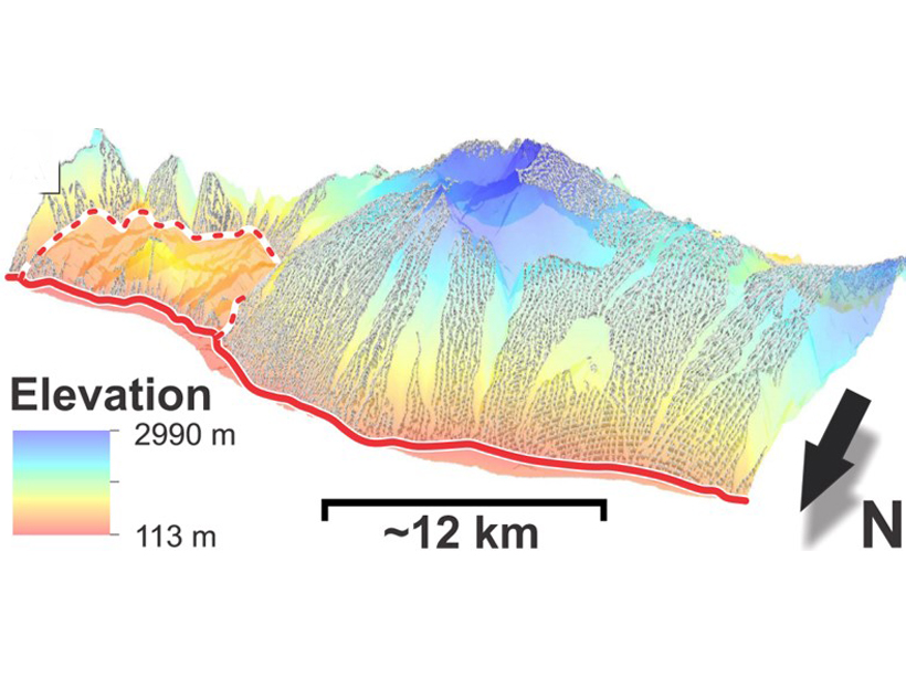
Posted inEditors' Highlights

Low-angle Normal Fault in Papua New Guinea is Rolling Along

by N. Niemi 22 May 20196 October 2021

Geologic and geomorphic observations of an active low-angle normal fault reveal a rolling-hinge mechanism accommodating the exhumation of a metamorphic core complex in Papua New Guinea.

Beartooth Uplift in Montana
Posted inScience Updates

Linking Observations and Modeling of Flat-Slab Subduction

by J. E. Saylor, E. Finzel and M. Jadamec 26 April 201918 January 2022

The Center for Tectonics and Tomography: Workshop on Flat Slab Subduction; Houston, Texas, 18–20 January 2019
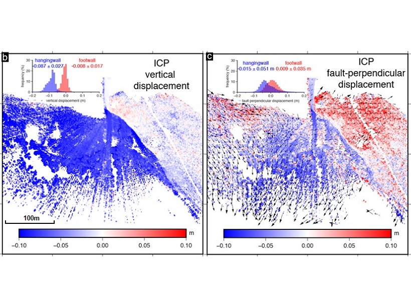
Surface deformation imaged around the fault.
Posted inEditors' Highlights

Imaging an Earthquake Rupture in High Definition

by G. P. Hayes 4 April 201911 May 2022

New field measurements using terrestrial laser scanning provide a detailed, centimeter-scale image of surface deformation patterns caused by the Magnitude 6.6 earthquake in Norcia, Italy.
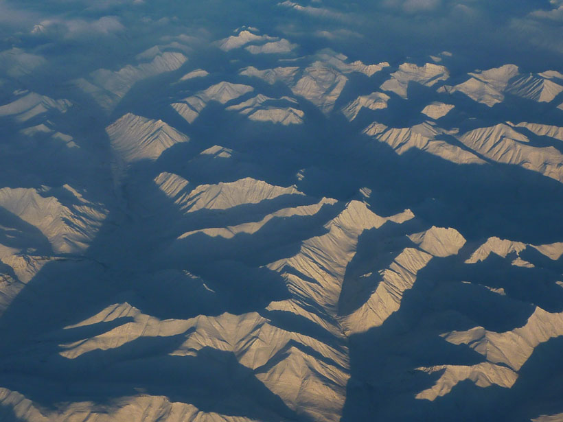
An aerial view of the Mackenzie Mountains
Posted inResearch Spotlights

Resolving a Cordilleran Conundrum

by Terri Cook 15 March 201927 October 2021

A novel geophysical technique documents the existence of a “missing” fault, along which major displacement could have occurred during the Cretaceous on North America’s northwest margin.

Quill volcano Sint Eustatius Island
Posted inScience Updates

Project VoiLA: Volatile Recycling in the Lesser Antilles

by S. Goes, J. Collier, J. Blundy, J. Davidson, N. Harmon, T. Henstock, J. M. Kendall, C. Macpherson, A. Rietbrock, K. Rychert, J. Prytulak, J. van Hunen, J. J. Wilkinson and M. Wilson 14 March 201927 January 2023

Deep water cycle studies have largely focused on subduction of lithosphere formed at fast spreading ridges. However, oceanic plates are more likely to become hydrated as spreading rate decreases.
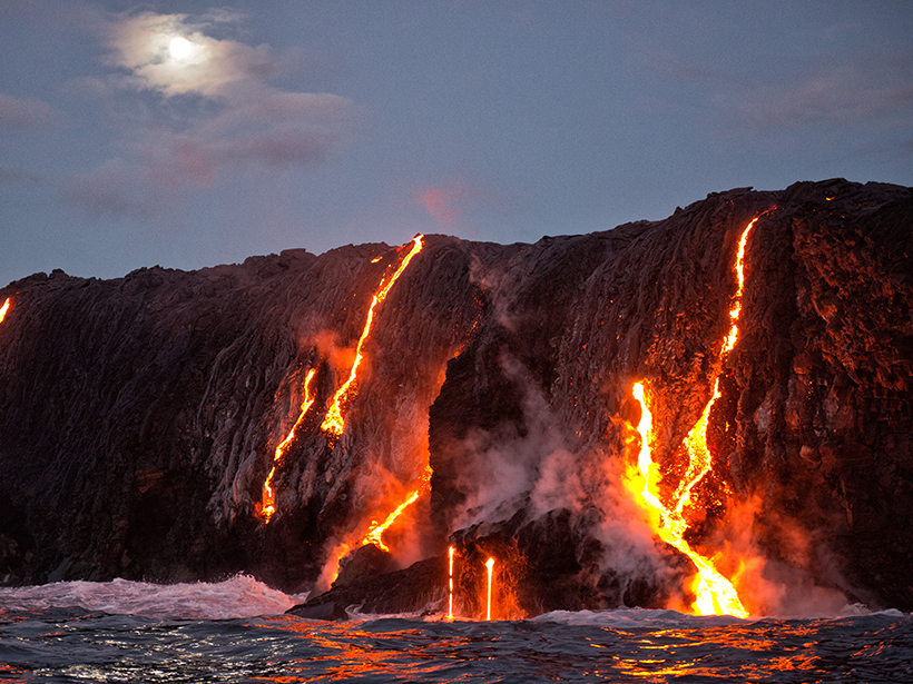
A view of Hawaii’s Kīlauea volcano erupting and flowing into the ocean
Posted inResearch Spotlights

Magnetic Anomalies on the Pacific Plate Reveal True Polar Wander

Aaron Sidder, freelance science writer by Aaron Sidder 11 March 201920 December 2021

A new study rebuffs the standard approach to paleomagnetism and offers an updated methodology and new locations of paleomagnetic poles.
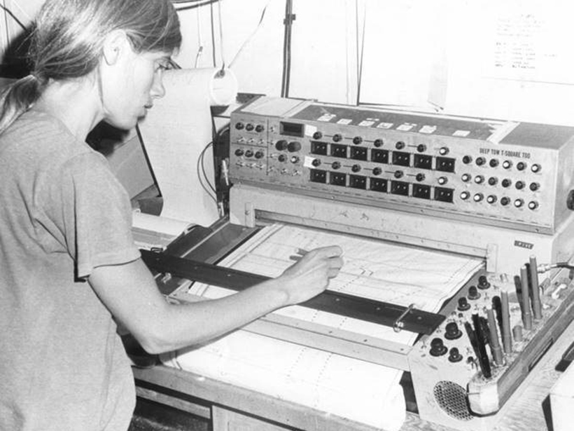
Kathy Crane instrument
Posted inNews

Podcast: Rifts Beneath the Ocean Floor

by J. Speiser 25 February 20196 March 2026

In the latest episode of its Centennial series, AGU’s Third Pod from the Sun features the pioneering work of a deep-sea explorer.
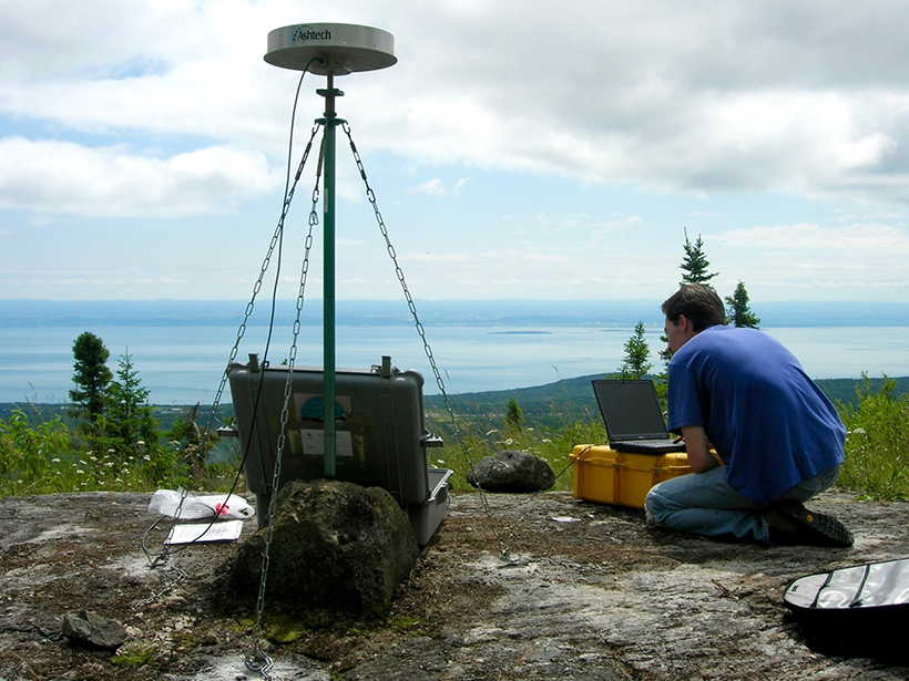
A scientist installs GPS equipment to monitor earthquakes.
Posted inResearch Spotlights

Ancient Faults Amplify Intraplate Earthquakes

by Terri Cook 23 January 20194 October 2022

A comparison of deformation rates from Canada’s Saint Lawrence Valley offers compelling evidence that strain in the region is concentrated along ancient structures from previous tectonic cycles.

Posts pagination

Newer posts 1 … 18 19 20 21 22 … 28 Older posts
Over a dark blue-green square appear the words Special Report: The State of the Science 1 Year On.

Features from AGU Publications

Research Spotlights

Why Marine Heat Waves and Acidification Strike Together

24 August 202624 August 2026
Editors' Highlights

The Magnetic Face of Plasma Irregularities on Mars

25 August 202618 August 2026
Editors' Vox

Climate Model Benchmarking: Building Trust and Advancing Science

24 August 202624 August 2026
Eos logo at left; AGU logo at right

About Eos
ENGAGE
Awards
Contact

Advertise
Submit
Career Center
Sitemap

© 2026 American Geophysical Union. All rights reserved Powered by Newspack