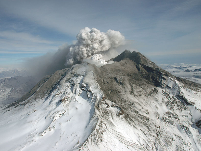
Satellite data have revealed that ground radiant temperatures around volcanoes rose in the years leading up to eruptions. The observation may help in forecasting future volcanic activity.
remote sensing
Posted inResearch Spotlights
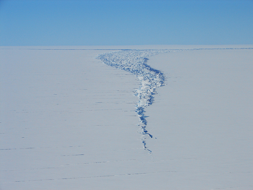
Satellite Captures Detaching Iceberg in Near-Real Time
NASA’s ICESat-2 satellite recorded the cleaving of a 315-billion-ton iceberg from Amery Ice Shelf in 2019, as well as years of subtle cracking and splitting prior to the calving event.
Posted inEditors' Highlights
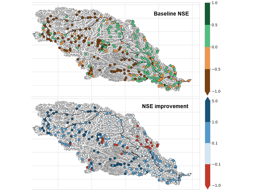
Gauging Ungauged River Basins with Smart Remote Sensing
A clever combination of hydrologic modelling and discharge estimates from the Landsat satellite provides good discharge estimates throughout the Missouri river basin.

Posted inOpinions
An Observational Gap at the Edge of Space
Ongoing climate change in Earth’s middle and upper atmosphere will affect the rapidly expanding space and telecommunications sectors. Maintaining observations of this region is more crucial than ever.
Posted inResearch Spotlights
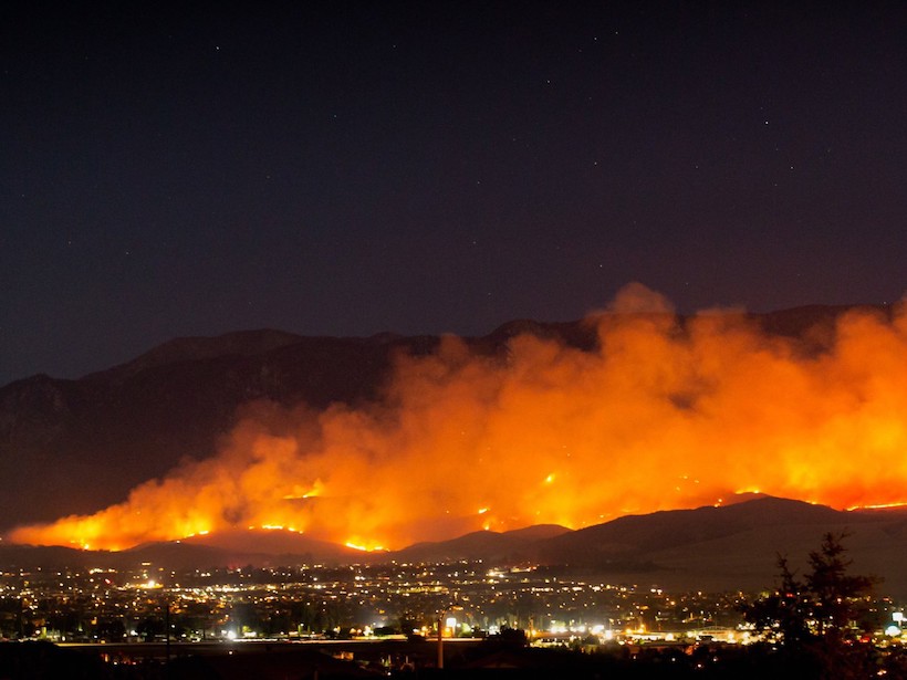
Uncovering Patterns in California’s Blazing Wildfires
A study of trends in wildfire occurrence over the past 30 years shows that environmental, climatic, and human-related factors can point out regions with high fire probabilities.

Posted inScience Updates
Advances in Satellite Data for Wildfire Smoke Forecasting
Observations from the newest geostationary Earth-observing satellites are offering valuable views of fire progression and smoke plume development and helping simulate impacts from large wildfires.
Posted inResearch Spotlights
A Global Look at Surface Soil Organic Carbon
Soil organic carbon is an important element of ecosystem and climate health. Remote sensing can now give scientists a global look at this important piece of the carbon puzzle.

Posted inEditors' Highlights
Devastation of Hurricane Maria to Puerto Rican Landscape
The destructive winds and rain of Hurricane Maria in 2017 caused a dramatic transformation to Puerto Rico’s landscape and altered the characteristics of land-air interaction.
Posted inScience Updates
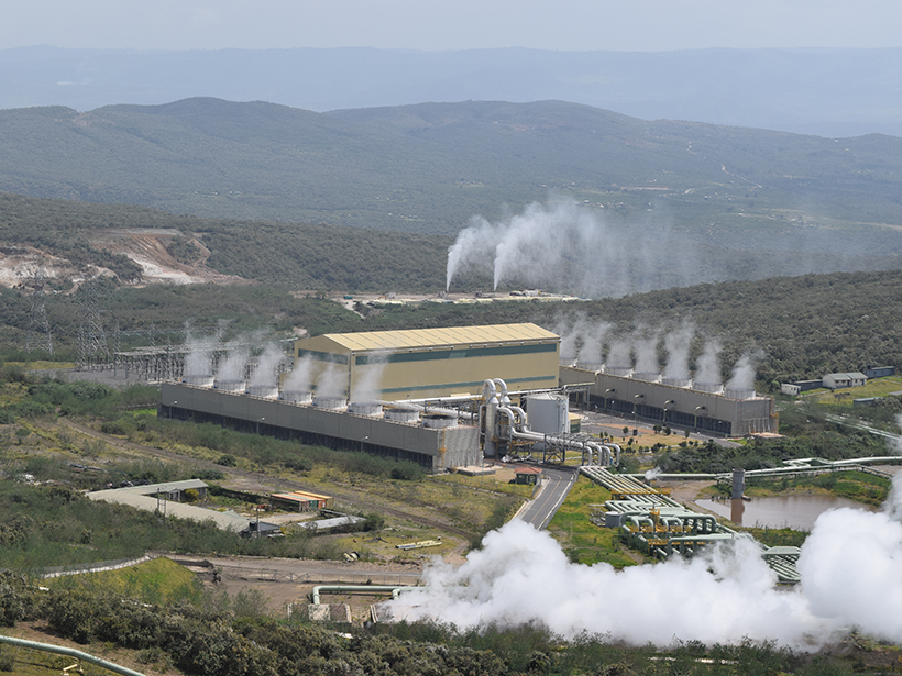
Geoscientific Monitoring of Olkaria’s Geothermal Motor
In situ geophysical measurements from Kenya’s Olkaria geothermal field, integrated with remote sensing and meteorological data, shed light on subsurface energy transport to and from the surface.
Posted inScience Updates
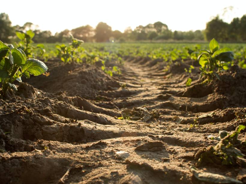
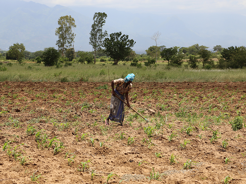
Sowing Seeds of Food Security in Africa
An innovative program focused on collaboration and capacity building is looking to improve outcomes for smallholder farmers, reduce hunger, and alleviate food insecurity in sub-Saharan Africa.