
Researchers combined satellite geodetic measurements of surface motion with a new geophysical data inversion method to probe the Chilean subduction zone in the wake of the 2010 Maule earthquake.
remote sensing

Posted inNews
Keeping a Close Eye on the Ocean—from Afar
Remote sensing technology proves effective in monitoring key regions of the world’s oceans, where upwelling and other essential ecosystem services occur.
Posted inEditors' Highlights
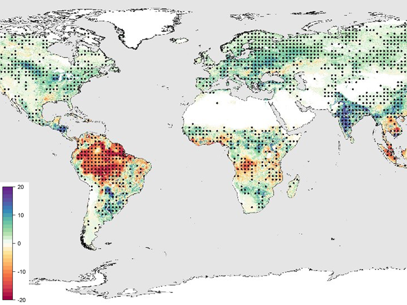
Water Stress Controls the Capacity of the Terrestrial Carbon Sink
Despite increased photosynthetic activity at northern latitudes in recent decades, plant productivity in tropical zones suffers because of water limitations.

Posted inScience Updates
A Fresh Perspective on Intricate Volcanic Plumbing Systems
Combining commercial hydrocarbon and mineral exploration data with novel academic research and modeling capabilities helps answer key questions about underground magma systems.
Posted inNews
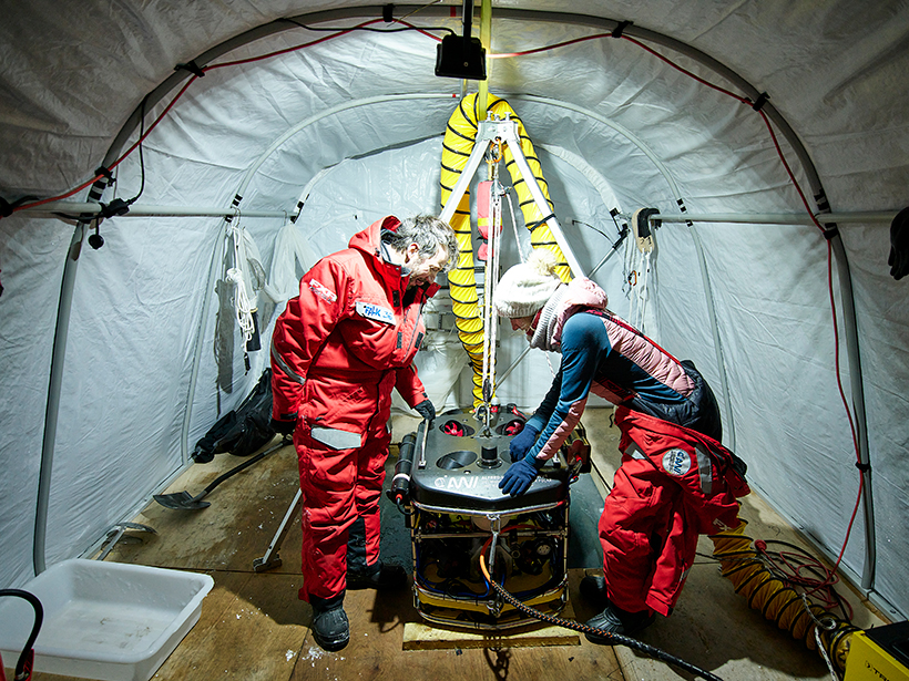
Beast of the Central Arctic
Feast your eyes on Beast, the first remotely operated vehicle to brave the Arctic for 1 year.
Posted inEditors' Highlights
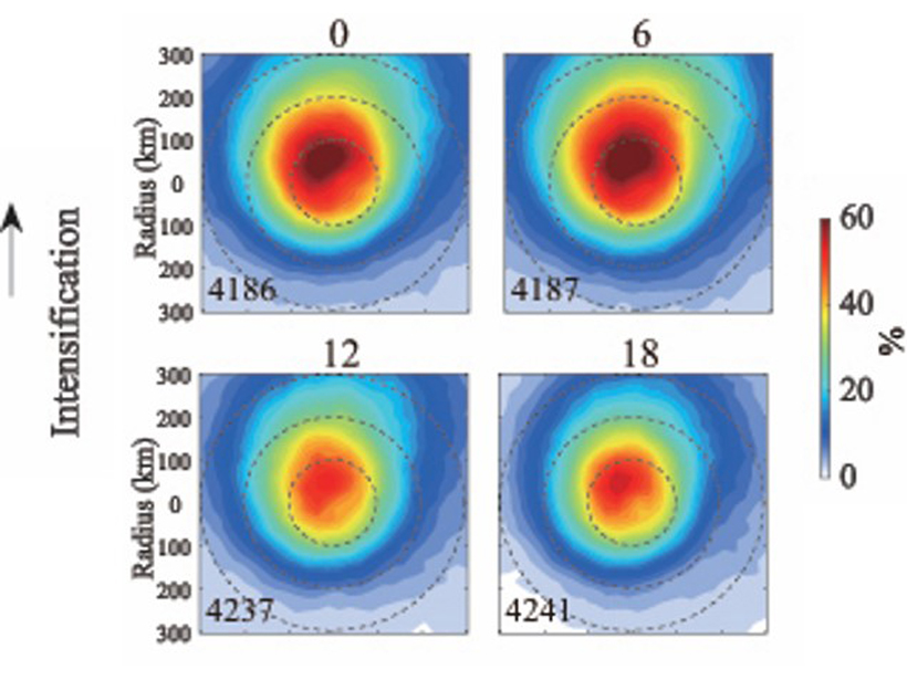
How Tropical Cyclones Increase in Intensity Overnight
The diurnal variations of tropical cyclone intensification and decay are analyzed using satellite data for deep convective clouds.
Posted inResearch Spotlights
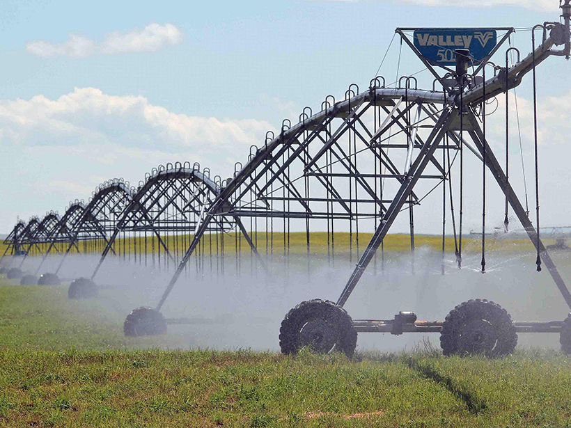
Can Satellites Fill Gaps in Agricultural Water Monitoring?
Past studies that have estimated irrigation water usage based on satellite remote sensing have had large uncertainties that could hamper effective water management.
Posted inEditors' Highlights
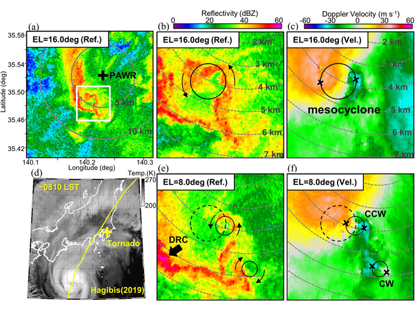
Radar Observations of a Tornado Associated with Typhoon Hagibis
Analysis of tornadogenesis processes on a shallow supercell associated with Typhoon Hagibis using finely resolved rapid-scan radar observations at a very close range.
Posted inNews
Have We Got Dust All Wrong?
Scientists are challenging conventional notions of how dust particles are aligned; “everything we’ve so far hypothesized about the impact of dust on the atmosphere might be misplaced.”

Posted inEditors' Highlights
Streamer Corona Discharges in Thunderstorms Detected from Space
Concurrent detection from space and the ground of blue optical flashes from streamer corona discharges at altitudes between 8.5 and 14 kilometers and radio waves.