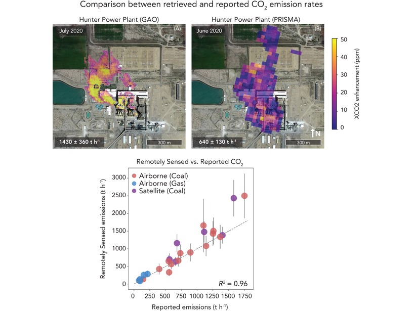
Airborne and satellite imaging spectrometers provide accurate quantifying of CO2 emissions at the facility scale, which is important to emission budgets and policy constraints.
remote sensing

Posted inOpinions
Integrating Data to Find Links Between Environment and Health
Several obstacles stand in the way of integrating social, health, and Earth science data for vital geohealth studies, but there are tools and opportunities to overcome these obstacles.

Posted inResearch Spotlights
Convective Transport Explains “Missing” Ice near the Tropical Tropopause
Spaceborne lidar shows that more ice than expected is leaving the tropical tropopause layer in the atmosphere.

Posted inEditors' Highlights
The Promise of Spaceborne High Spectral Resolution Lidar
New spaceborne high spectral resolution lidar measurements provide a new view of global aerosols.
Posted inNews
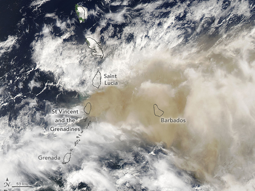
Eyeing Explosive Ash Clouds from Above and Below
Satellites in the sky combined with computers on the ground detect and track volcanic ash clouds, like those produced by Soufrière St. Vincent in April, in near-real time.

Posted inNews
A Reminder of a Desert’s Past, Before Dingo Removal
A fence spans Australia’s Strzelecki Desert, keeping dingoes out of the southern side. Drone and satellite technology have illustrated how removing this top predator changes vegetation growth.

Posted inEditors' Vox
Tropical Carbon and Water Observed from Above
Satellite observations show how tropical forest carbon fluxes respond to changes in water from climate variability.
Posted inNews
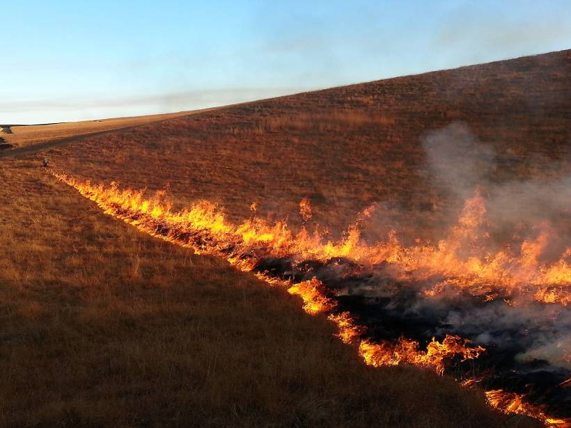
Zooming In on Small Fires in Africa
By analyzing high-resolution satellite images, researchers found that fires burning in Africa were undercounted by as much as 80%.
Posted inEditors' Highlights
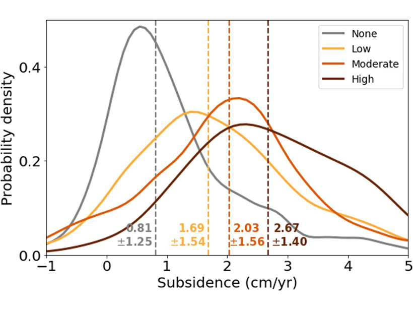
SE Asia Peatlands Subsidence Tied to Drainage Density
Human-made channelization significantly accelerates peat decomposition and drives ground-surface deformation in tropical wetlands.

Posted inScience Updates
Slipping and Locking in Earth’s Earthquake Factories
Geodetic observations collected during back-to-back decadal research campaigns have revealed crucial new insights into the start–stop and slow-motion behavior of subduction zones.