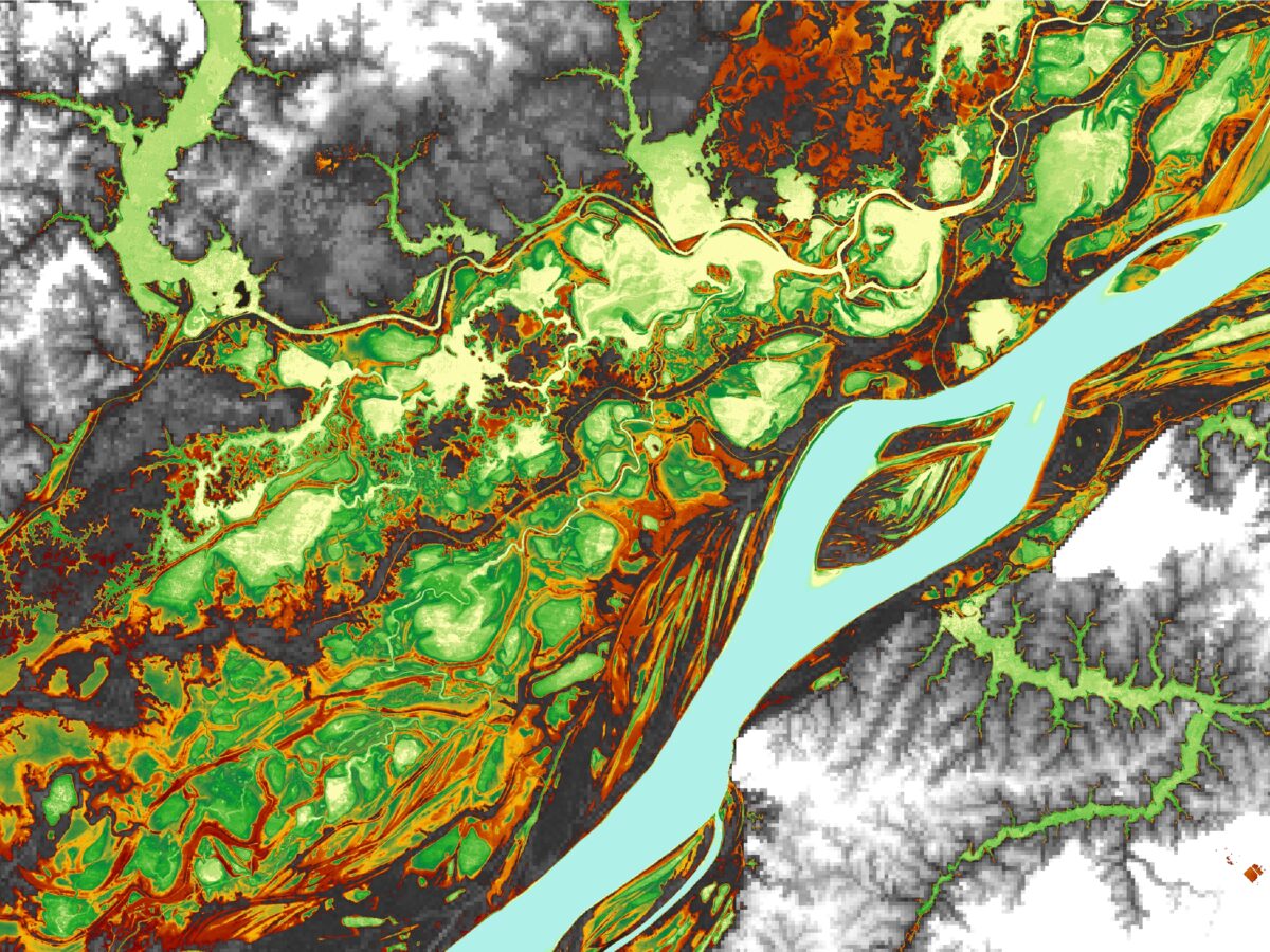
Satellite observations offer invaluable insights into hydrological processes and environmental change in the Amazon.
remote sensing

Posted inResearch Spotlights
The Perspective from Space Unlocks the Amazon Water Cycle
Satellite imaging and remote sensing offer unique insights into the Amazon’s complex hydrology. A new review summarizes decades of findings and charts a path forward for new remote sensing missions.
Posted inNews
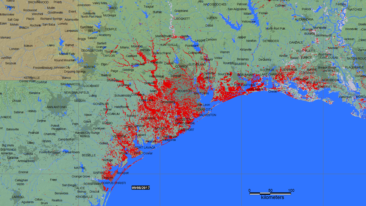
Remote Sensing Could Predict Well Water Quality After Floods
After a flood, most people rely on officials to test public water sources. Private well owners are on their own, with little data to guide testing and treatment. New research seeks to change that.

Posted inNews
Mercury-Based Gold Mining Haunts Peruvian Rain Forests
In Peru, gold mining harms rain forests and human health. Satellite data can now track forest recovery in protected areas and the migration of informal miners to less regulated areas.
Posted inENGAGE, News
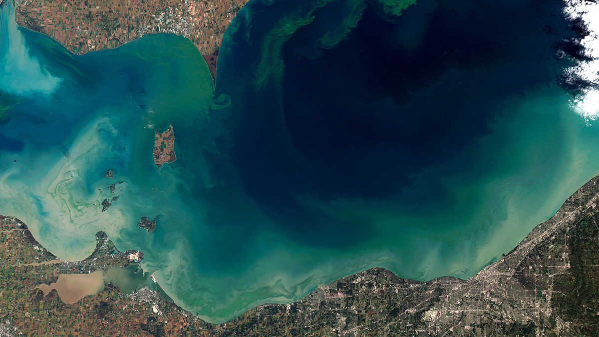
A New Technique Could Identify Algae from Space
Some types of algal blooms produce dangerous toxins, while others are relatively harmless to humans.

Posted inEditors' Vox
New Insights into Polar Stratospheric Clouds
New satellite observations of polar stratospheric clouds have advanced our understanding of how, when, and where they form, their composition, and their role in ozone depletion.

Posted inEditors' Vox
Tools for Improved Drought and Flood Response
A new book presents recent advances in the modeling and remote sensing of droughts and floods of use to emergency response organizations and policy makers on a global scale.
Posted inEditors' Highlights
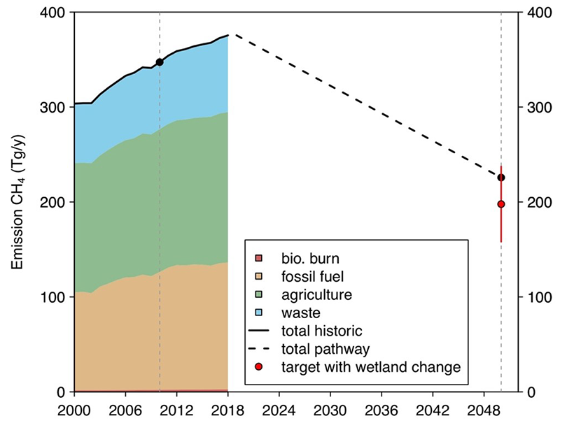
Bottom-up Meets Top-down Estimates of Wetland Methane Emissions
An innovative integration of models and satellite observations indicates weak temperature sensitivity of CH4 emissions from tropical wetlands, but temperature sensitivity is high at higher latitudes.

Posted inNews
Satellites Allow Scientists to Dive into Milky Seas
Satellites may finally be able to report the fleeting phenomena of milky seas in near-real time, allowing researchers to potentially study an ocean mystery that has survived more than 2 centuries.

Posted inNews
Tracking Sustainability Goals with Creative Data Sources
Nontraditional sources of data could assist in charting the U.N. Sustainable Development Goals, helping design appropriate policies and investments to improve the state of the environment.