
A particular kind of storm coincided with 13 of the 21 recent calving events in Antarctica.
remote sensing

Posted inScience Updates
A Sharper Look at the World’s Rivers and Catchments
Digital hydrographic maps have transformed global environmental studies and resource management. A major database update will provide even clearer and more complete views of Earth’s waterways.
Posted inEditors' Highlights
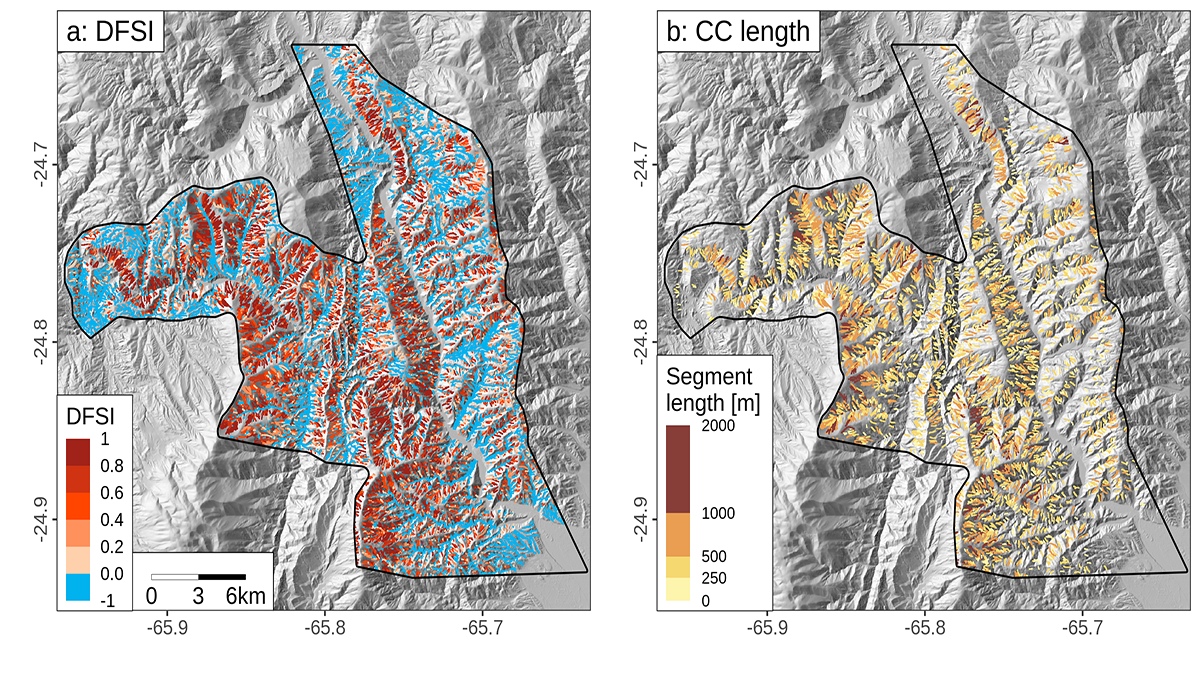
Debris Flows Keep the Landscape on the Straight and Narrow
New methods for identifying debris flow-shaped channels improve hazard quantification and highlight how high uplift rates and fractured bedrock facilitate debris flow-dominated landscape evolution.

Posted inNews
Satellites Reveal Slow Shift of the Entire Boreal Biome
According to a new study, warmer temperatures and high soil nitrogen levels are causing Earth’s largest land biome to advance northward.
Posted inNews
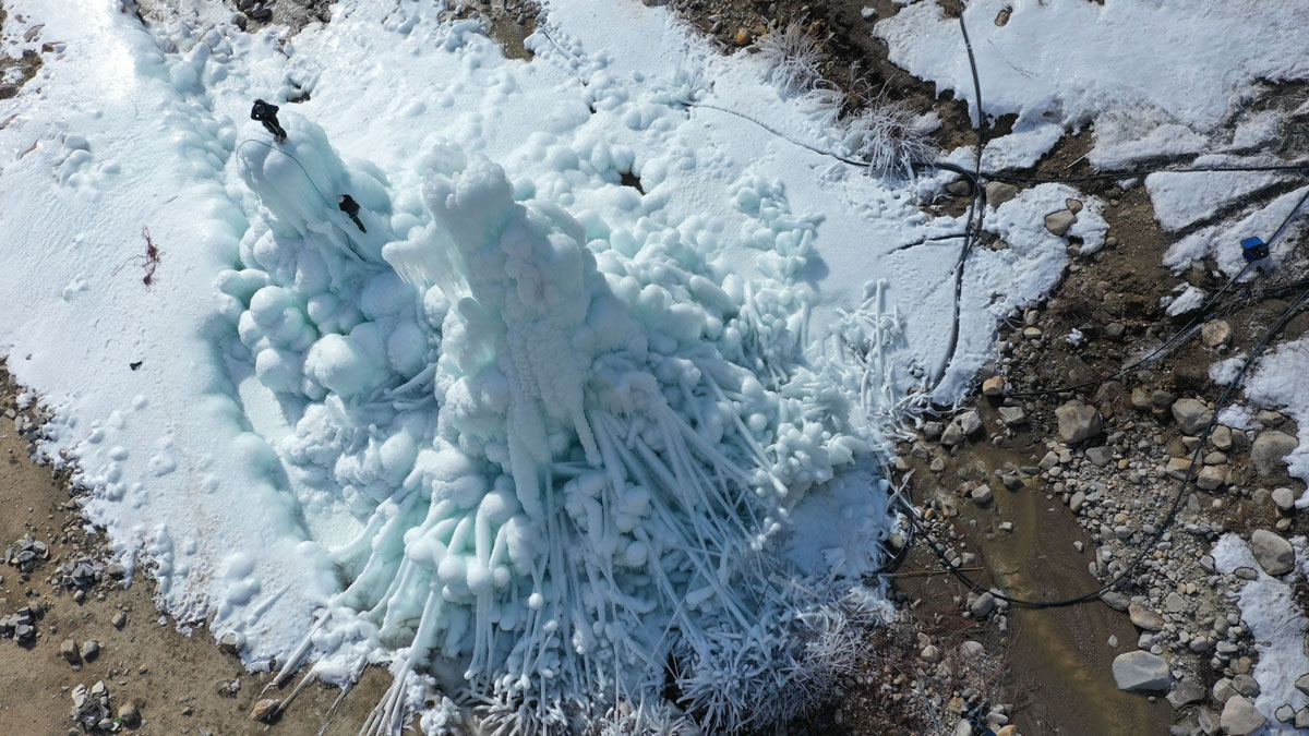
Ice Towers May Hold Promise—and Water—for Some Cold, Dry Places
A new study that cues into the formation of ice cones for storing glacial meltwater reveals how the structures can be built more efficiently and which climatic conditions work best.
Posted inNews
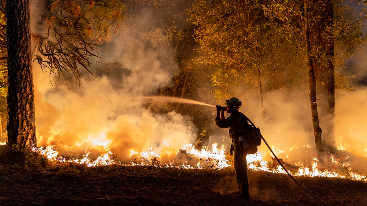
Warmer Nights Are Adding Fuel to Nighttime Fires
Cool, moist nights are rarer than they were a few decades ago, and that’s giving wildfires an edge over crews trying to hold fire lines.

Posted inFeatures
The Nutrient-Rich Legacy in the Amazon’s Dark Earths
Fertile terra preta soils were created through centuries of carefully managed land use. Scientists are taking cues from these soils to better sequester carbon and improve soil for agriculture.
Posted inEditors' Highlights
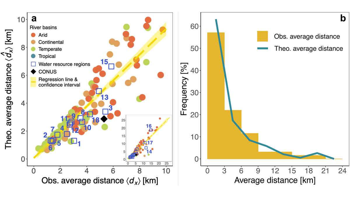
Urbanization and Surface Water Loss Go Together
Mapping surface water loss from satellite data confirms decreases away from urban areas. A simple exponential distance-decay model approximates the impact of urbanization.

Posted inNews
El sorprendente alcance de las gigantescas ondas atmosféricas de Tonga
Los resultados empiezan a llegar: Científicos de alrededor del mundo explican las gigantescas ondas atmosféricas que emanaron de la erupción del volcán Hunga Tonga-Hunga Ha’apai.

Posted inENGAGE, News
The Surprising Reach of Tonga’s Giant Atmospheric Waves
Results are beginning to pour in: Scientists around the globe explain the massive atmospheric waves that emanated from the Hunga Tonga–Hunga Ha’apai eruption.