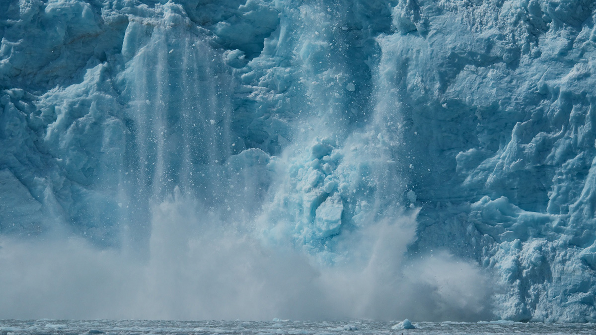
If a glacier calves into the Arctic Ocean, does it make a sound? Some scientists say yes and have devised a clever way to use those sounds to calculate the size of the fallen ice chunks.
remote sensing

Posted inEditors' Highlights
Coseismic Displacement of 1987 Earthquake from Aerial Images
Differencing digital surface topography models constructed from historical aerial photographs reveal the coseismic surface displacement field of the 1987 earthquake in northern New Zealand.

Posted inResearch Spotlights
When the Aral Sea Dried Up, Central Asia Became Dustier
Winds kick up large amounts of dust from the desert that has formed as the world’s fourth largest lake has disappeared, spreading it around the region and raising concerns about public health.
Posted inEditors' Highlights
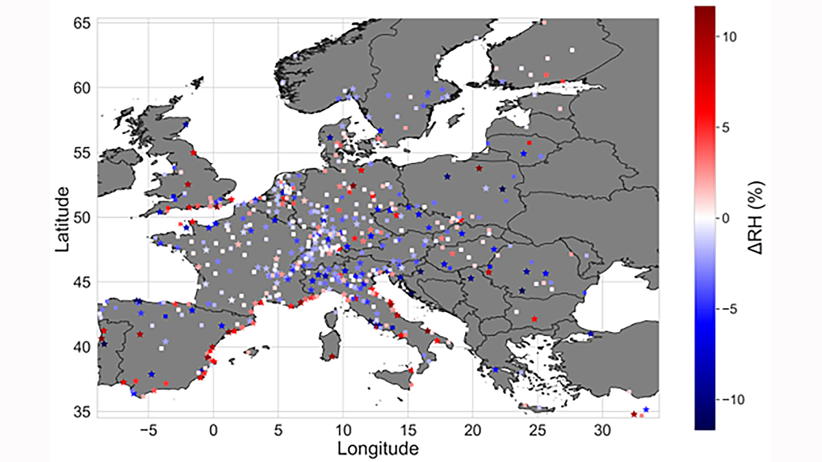
The Lower Humidity of Urban Areas Moderates Outdoor Heat Stress
Data scarcity of traditional observations cannot reveal whether surface temperature capture the potential for urban heat stress. This study improves the dataset with 40,000 citizen weather stations.

Posted inENGAGE, News
Satellites Get First Full-Year View of Arctic Sea Ice Thickness
The AI-based monitoring method may unlock data that could improve shipping safety and climate predictions.

Posted inNews
Monitoring Moisture from Afar
Undisturbed tropical rain forests are experiencing more frequent droughts, but the ecosystems are isolated and difficult to assess. Scientists are using remote sensing to expand the depth and scope of monitoring efforts.
Posted inNews
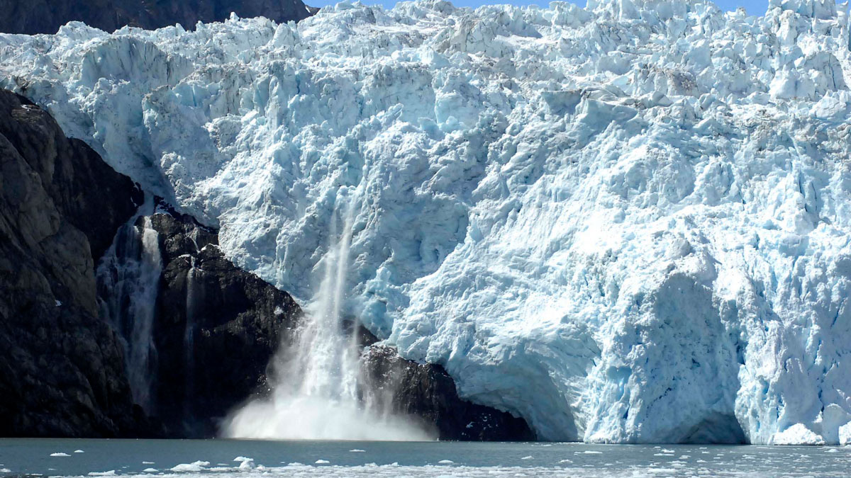
Alaskan Glaciers Advance and Retreat in Satellite Imagery
Researchers tracked 19 maritime glaciers in Kenai Fjords National Park over several decades and found that tidewater glaciers tended to experience less ice loss than other types of glaciers.

Posted inFeatures
Seeing Through Turbulence to Track Oil Spills in the Ocean
After oil and tar washed up on eastern Mediterranean beaches in 2021, scientists devised a way to trace the pollution back to its sources using satellite imagery and mathematics.

Posted inFeatures
Jacqueline Campbell: Studying Oceans from Above
Planetary scientist studies oceans with a combination of laboratory work and satellite imagery.
Posted inFeatures
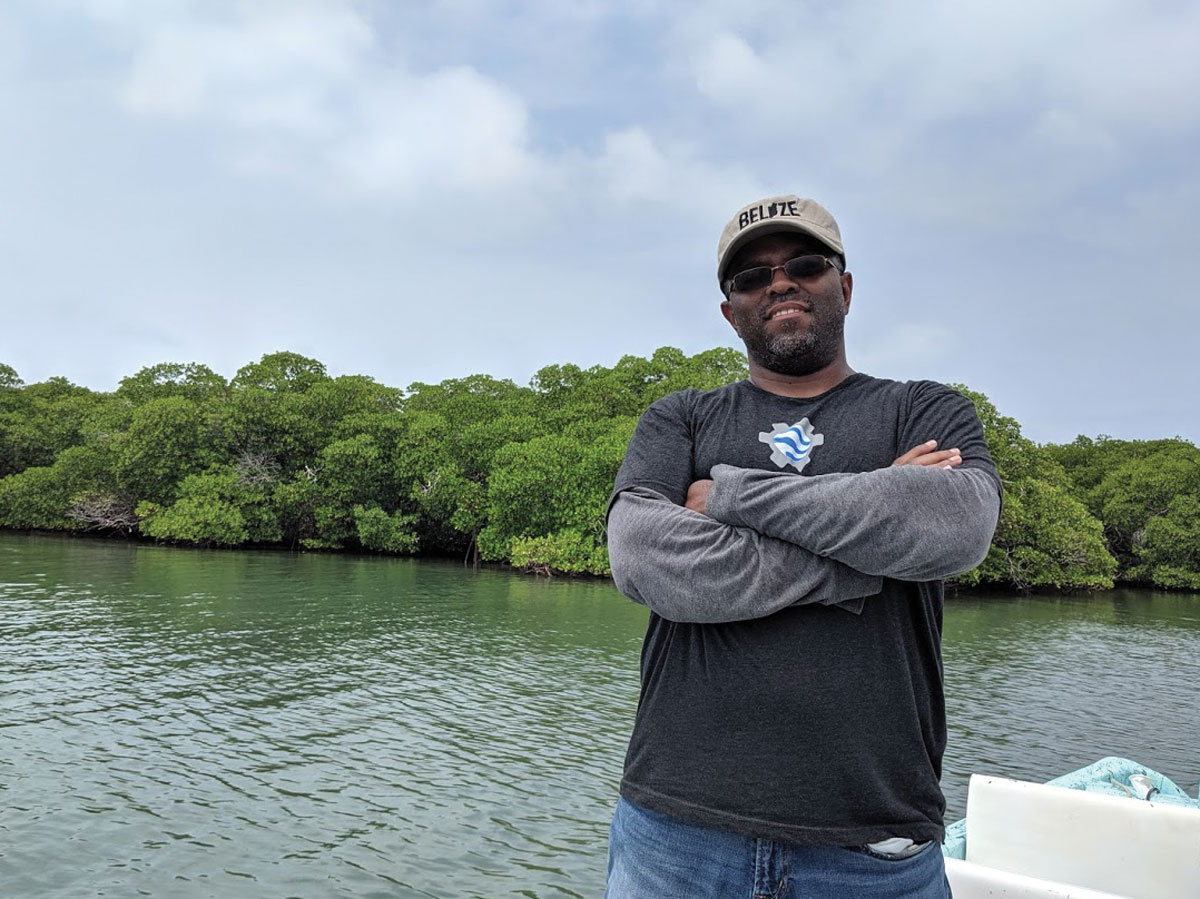
Emil Cherrington: Bringing Satellite Data Down to Earth
Showing how eyes in the sky can help people on the ground.