
A more accessible, open data-sharing infrastructure will engage a broader community of contributors, helping to develop satellite data products that benefit Earth science research and applications.
remote sensing
Posted inEditors' Highlights
Updated Reference Standard for Total Solar Irradiance
Version 2 of the Total and Spectral Solar Irradiance Sensor-1 Hybrid Solar Reference Spectrum captures a spectral resolution spanning 0.115-200 micrometers and integrates nearly 100% of the TSI energy.
Posted inEditors' Highlights
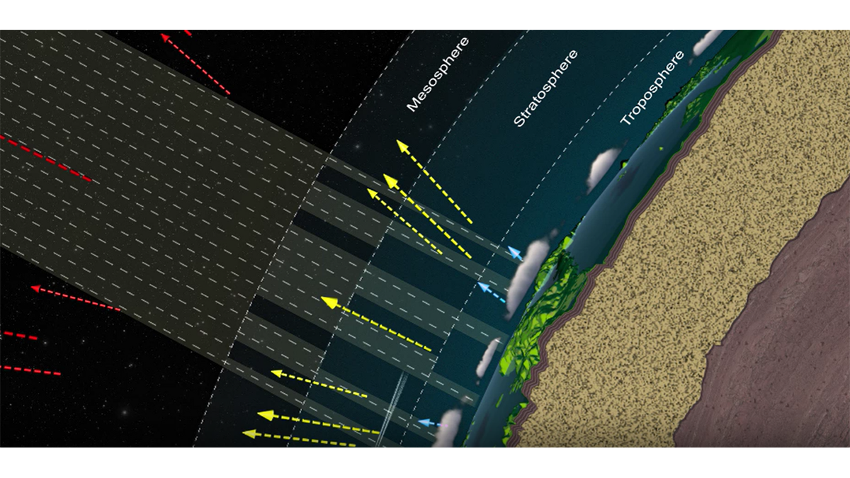
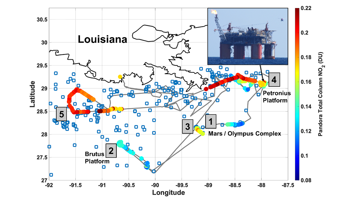
Remote Sensors See NO2 ‘Hot Spots’ from Offshore Oil Activity
Satellites can see NO2 pollution from space, but can they detect individual oil and natural gas operations, and are the measurements accurate?
Posted inNews
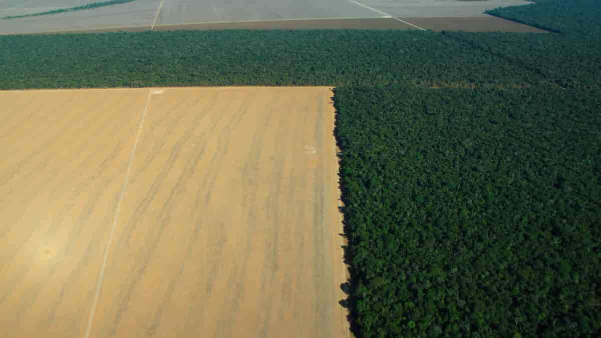
Tracking Land Use and Deforestation in the Amazon
A new study mapped 2 decades of deforestation in the Amazon and concluded that some types of land management are more effective than others.

Posted inEditors' Highlights
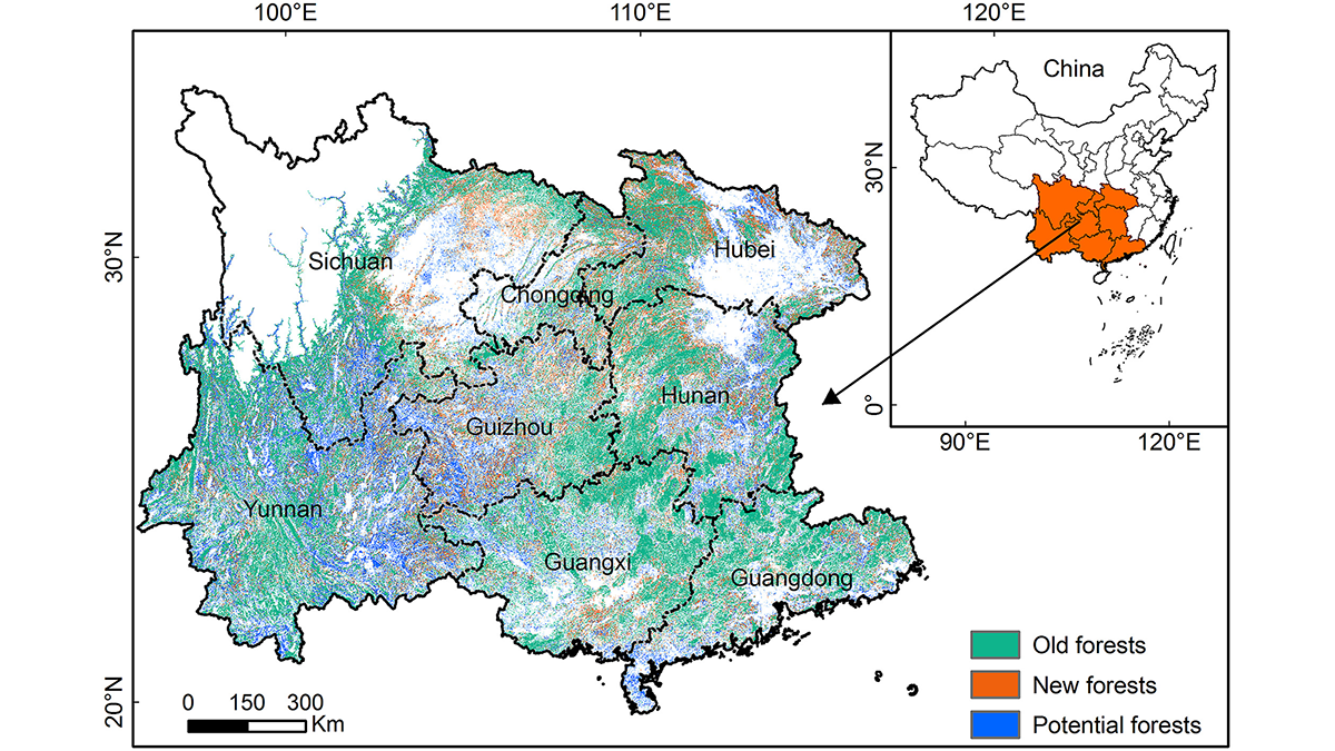
Quantifying the Potential of Forestation for Carbon Storage
Forestation projects in southern China over the past few decades have sequestered large amounts of carbon in tree biomass, but the region is approaching saturation of forest carbon storage capacity.
Posted inNews
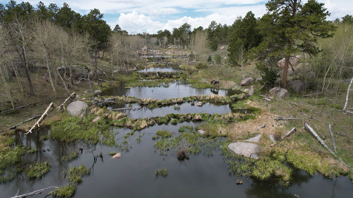
Scientists EEAGER-ly Track Beavers Across Western United States
Efficiently tracking nature’s engineers—beavers—at the scale of entire watersheds over time is now possible, thanks to a new artificial intelligence–trained model called EEAGER.

Posted inEditors' Highlights
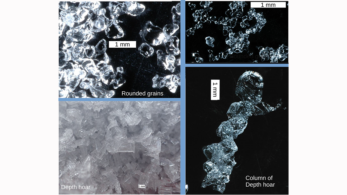
Measuring the Microstructure of Snow from Space
There is more to snow than flakes. Microwave measurements are shown to be capable of illuminating the microstructure of snow in ways that will improve our ability to monitor snow fields from space.

Posted inENGAGE, News
Glacial Ice Offers Polar Bears a Precarious Climate Refuge
An isolated polar bear population in southeastern Greenland survives in fjords, despite spotty sea ice. But this pocket of bears is not a sign of how the species could be saved.