• About
  • Special Reports
  • Topics
    • Climate
    • Earth Science
    • Oceans
    • Space & Planets
    • Health & Ecosystems
    • Culture & Policy
    • Education & Careers
    • Opinions
  • Projects
    • Postcards From the Field
    • ENGAGE
    • Editors’ Highlights
    • Editors’ Vox
    • Eos en Español
    • Eos 简体中文版
    • Print Archive: 2015–2025
  • Policy Tracker
  • Blogs
    • Research & Developments
    • The Landslide Blog
  • Newsletter
  • Submit to Eos
  • AGU.org
  • Career Center
  • Join AGU
  • Give to AGU
  • About
  • Special Reports
  • Topics
    • Climate
    • Earth Science
    • Oceans
    • Space & Planets
    • Health & Ecosystems
    • Culture & Policy
    • Education & Careers
    • Opinions
  • Projects
    • Postcards From the Field
    • ENGAGE
    • Editors’ Highlights
    • Editors’ Vox
    • Eos en Español
    • Eos 简体中文版
    • Print Archive: 2015–2025
  • Policy Tracker
  • Blogs
    • Research & Developments
    • The Landslide Blog
  • Newsletter
  • Submit to Eos
Skip to content
  • AGU.org
  • Career Center
  • Join AGU
  • Give to AGU
Eos

Eos

Science News by AGU

Support Eos
Sign Up for Newsletter
  • About
  • Special Reports
  • Topics
    • Climate
    • Earth Science
    • Oceans
    • Space & Planets
    • Health & Ecosystems
    • Culture & Policy
    • Education & Careers
    • Opinions
  • Projects
    • Postcards From the Field
    • ENGAGE
    • Editors’ Highlights
    • Editors’ Vox
    • Eos en Español
    • Eos 简体中文版
    • Print Archive: 2015–2025
  • Policy Tracker
  • Blogs
    • Research & Developments
    • The Landslide Blog
  • Newsletter
  • Submit to Eos

remote sensing

Remote sensing image of the Pan-Third Pole region
Posted inEditors' Vox

Harmonizing Theory and Data with Land Data Assimilation

by Xin Li and Feng Liu 7 May 20249 May 2024

Land data assimilation advances scientific understanding and serves as an engineering tool for land surface process studies, reflecting the trend of harmonizing theory and data in the big data era.

Greenland seen from overhead, with dark stone mountaintops poking out above white snow
Posted inResearch Spotlights

Beneath the Ice: Greenland’s Geology Revealed in New Map

Aaron Sidder, freelance science writer by Aaron Sidder 26 April 202426 April 2024

Advances in remote sensing offered an opportunity to redraw Greenland’s geologic map for the first time in 15 years.

Aerial photo of a large rupture caused by an earthquake.
Posted inResearch Spotlights

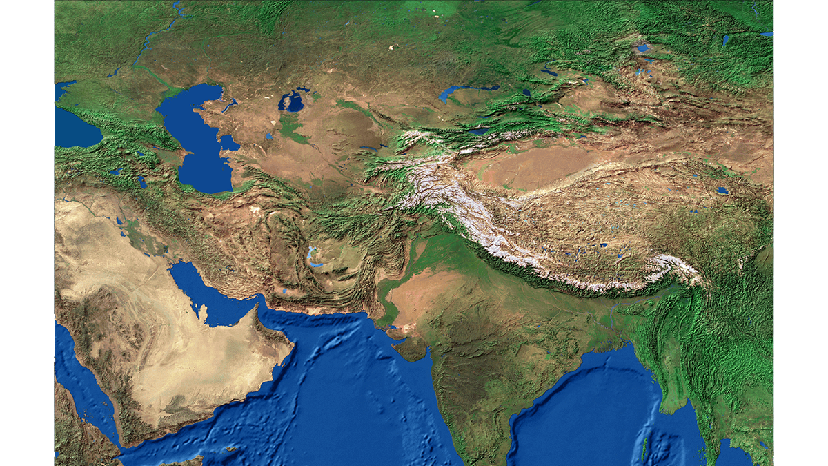
Fault Maturity or Orientation: Which Matters More for Quakes?

Sarah Stanley, Science Writer by Sarah Stanley 10 April 20248 July 2024

Close examination of a 2021 earthquake on the Tibetan Plateau provides hints that, counter to prior assumptions, the influence of fault orientation can sometimes trump that of maturity.

A bright circle of light appears behind clouds, and part of that circle is obscured.
Posted inNews

Low-Level Clouds Disappear During a Solar Eclipse

Katherine Kornei, Science Writer by Katherine Kornei 22 March 202426 March 2024

Cumulus clouds rapidly dissipate as the land surface cools, a finding that has implications for Sun-obscuring geoengineering efforts.

A black and white satellite image shows sea ice, with cracks appearing bright white, beside snow-covered landfast ice (gray) and land (dark).
Posted inScience Updates

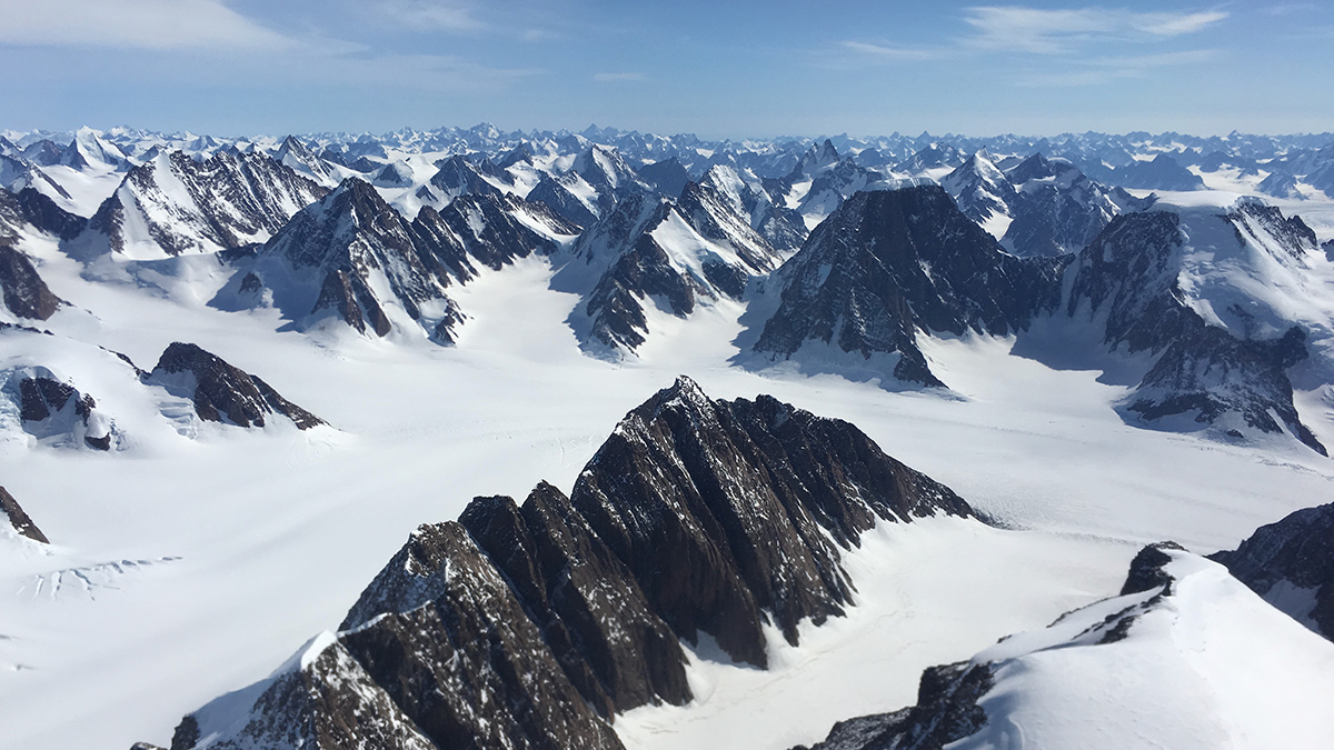
Monitoring Polar Ice Change in the Twilight Zone

by Ted Scambos, Christopher Shuman, Mark Fahnestock, Tasha Snow and Christopher Crawford 20 February 202426 February 2026

Landsat’s new extended data collection program is mapping Arctic and Antarctic regions year-round, even in polar twilight.

Photo of a sunset
Posted inEditors' Vox

Accounting for Small-Scale Processes in Large-Scale Models

by Yangang Liu and Pavlos Kollias 16 February 202415 February 2024

A new book explores how fast processes can be better represented in atmospheric models to improve weather and climate prediction.

Map of the world with the ocean appearing in black and land surfaces appearing in rainbow colors denoting land surface temperatures.
Posted inScience Updates

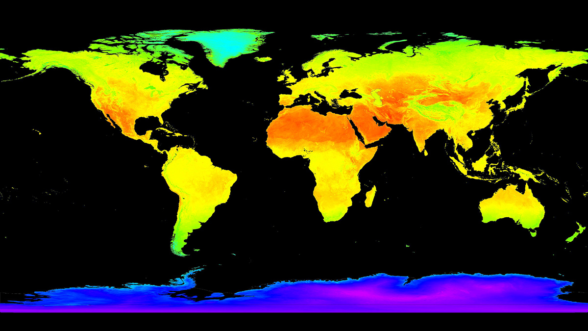
Trustworthy Satellite Earth Observations for Science and Society

by Fabrizio Niro, Michael Cosh and Jaime Nickeson 8 February 20248 February 2024

Enhancing confidence in satellite observations of terrestrial properties like land surface temperature and soil moisture requires advances in validation and data quality assessment practices.

Photo of a glacier sitting on top of rock.
Posted inEditors' Highlights

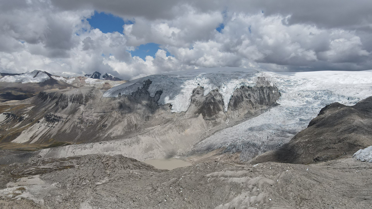
Plants Reveal the History of Earth’s Largest Tropical Ice Cap

by Ann Rowan 16 January 20249 January 2024

Rooted plants buried by advancing outlet glaciers illustrate rapid changes in the extent of Quelccaya Ice Cap in Peru during the Holocene.

Aerial view of a tall metal frame tower towering over a forest under a cloudy sky and with snow-covered mountains in the distance. An illustrated rainbow-colored beam from the tower to the ground is superimposed on the photo.
Posted inScience Updates

Ecosystem Observations from Every Angle

by Zoe Pierrat, Troy Magney, Xi Yang, Anam Khan and Loren Albert 14 December 202314 December 2023

Proximal remote sensing provides a bridge between ecosystem flux data at Earth’s surface and optical data from satellite sensors, improving our grasp of feedbacks between terrestrial ecosystems and climate.

Illustration of a fence topped with barbed wire in front of a burnt orange background.
Posted inNews

Satellites Map Environmental Vulnerabilities in U.S. Prisons

Kimberly M. S. Cartier, News Writing and Production Intern for Eos.org by Kimberly M. S. Cartier 11 December 202311 December 2023

Geoscientists are using remote sensing to gather data on risks including increased exposure to air and soil pollution, excessive heat, wildfire, and flooding.

Posts pagination

Newer posts 1 … 3 4 5 6 7 … 38 Older posts
Over a dark blue-green square appear the words Special Report: The State of the Science 1 Year On.

Features from AGU Publications

Research Spotlights

The Speedy Particles That Could Help Us Learn More About Uranus

18 June 202618 June 2026
Editors' Highlights

Where Methane is Emitted Matters for Global Burden

18 June 202616 June 2026
Editors' Vox

Small-Scale Indian Ocean Dynamics Underpin Marine Ecology and Climate

4 June 20263 June 2026
Eos logo at left; AGU logo at right

About Eos
ENGAGE
Awards
Contact

Advertise
Submit
Career Center
Sitemap

© 2026 American Geophysical Union. All rights reserved Powered by Newspack