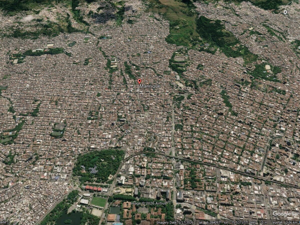
A new study (Vega et al. 2026) shows that patterns of reported structural damage in Medellin are probably caused by deep-seated deformation driven by a series of ancient landslides under the city. Medellin is the second largest metropolitan area in Colombia, with a population of around 4 million people. It has grown rapidly, expanding into […]
SAR & inSAR
Synthetic Aperture Radar and Interferometric Synthetic Aperture Radar
Posted inNews
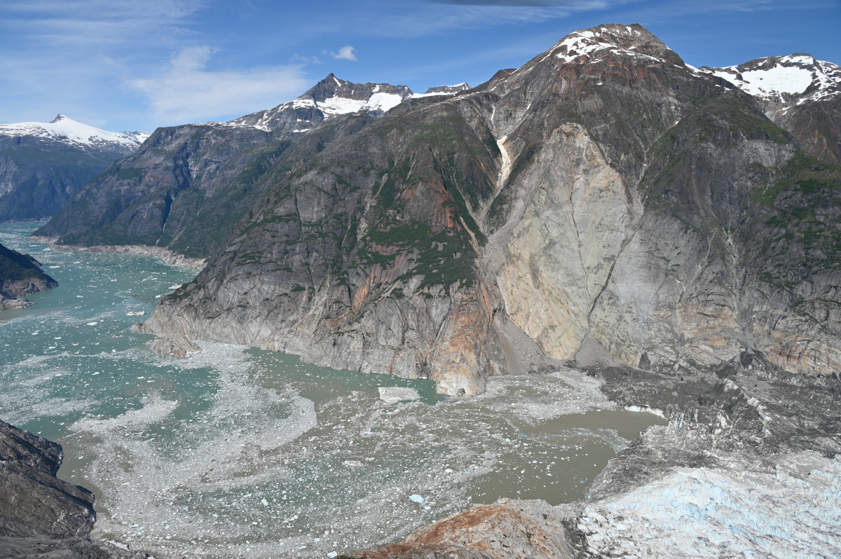
The Forensics of a Skyscraper-Sized Tsunami
A landslide in Tracy Arm Fjord in Alaska created the second-largest tsunami on record. A new analysis links this abrupt event to the retreat of a glacier and, ultimately, to climate change.
Posted inNews
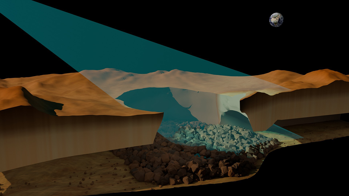
New Evidence Points to Venusian Lava Tubes, and They’re Really Big
Researchers bring new life to 30-year-old Magellan data to unearth the first direct evidence of the long-hypothesized structures.
Posted inResearch & Developments
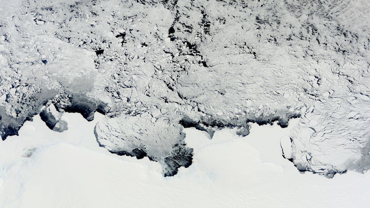
Antarctic Ice Sheet Has Lost a Connecticut-Sized Amount of Ice Over the Past 30 Years
A new study of Antarctica has found that since 1996, its ice sheet has lost 12,820 square kilometers (nearly 5,000 square miles) of ice—nearly enough to cover the state of Connecticut, or 10 cities the size of Greater Los Angeles.
Posted inFeatures
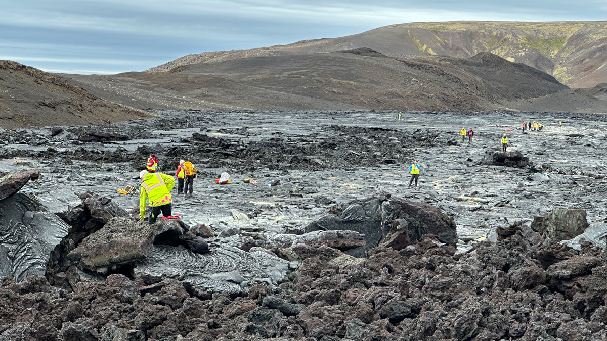
Discovering Venus on Iceland
Scientists trekked across Icelandic lava flows that served as stand-ins for Venus’s volcanic landscapes, testing tools and methods the upcoming VERITAS mission will use when it reaches the planet.
Posted inFeatures
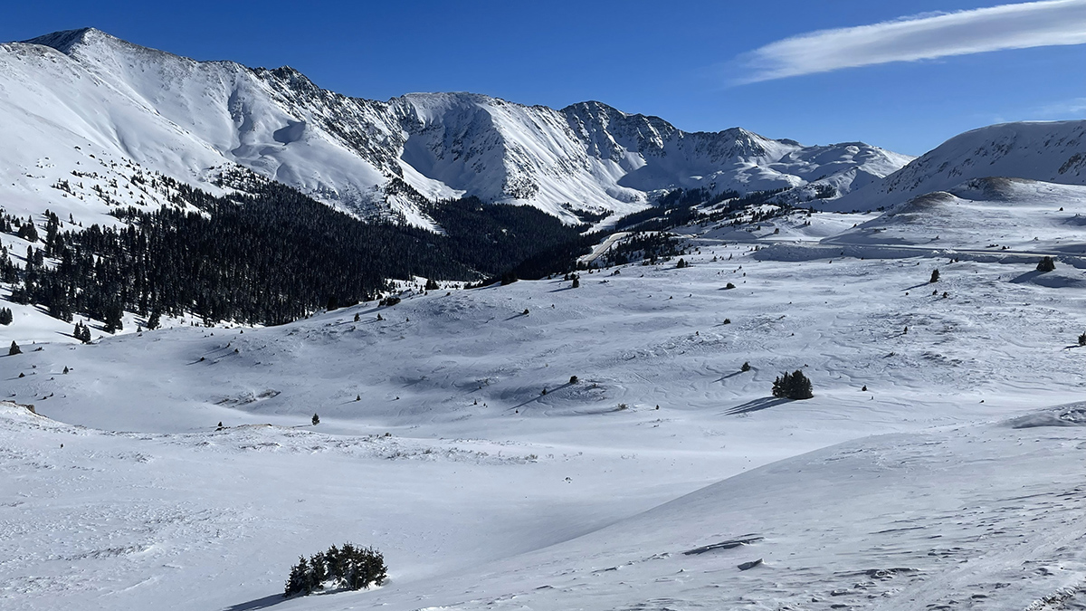
Satellite Radar Advances Could Transform Global Snow Monitoring
The recent SnowEx campaign and the new NISAR satellite mission are lighting the way to high-resolution snowpack monitoring and improved decisionmaking in critical river basins around the world.

Posted inNews
Parts of New Orleans Are Sinking
Areas near the airport, along floodwalls, and in nearby wetlands are subsiding because of a combination of natural and anthropogenic forces.
Posted inEditors' Highlights
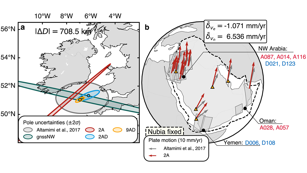
Mapping the Whereabouts of Continents
A new method integrates Interferometric Synthetic Aperture Radar (InSAR) with conventional ground geodetic networks, taking us closer to high-resolution mapping of plate motions.

Posted inThe Landslide Blog
Movement of the Joshimath landslide in India
A new paper (Dalal et al. 2025) in the journal Engineering Geology examines movement of a major landslide complex in India. It shows that the slope reactivated in 2018, probably as a result of the loss of vegetation and poor management of water. Loyal readers will remember a series of posts that I made back […]
Posted inResearch Spotlights
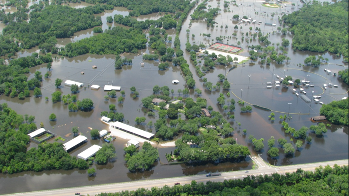
Subtle Coastal Sinking Raises Storm Surge Risks
New detection of millimeter-scale subsidence along vulnerable coastlines means flood risk predictions may be inaccurate.