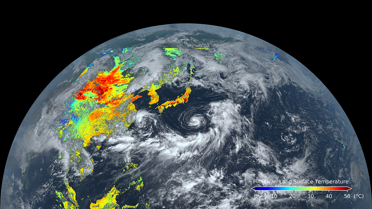
Known for their weather-observing prowess, these satellites can also track land surface processes and disturbances over broad areas in near-real time.
satellite imagery
Posted inThe Landslide Blog
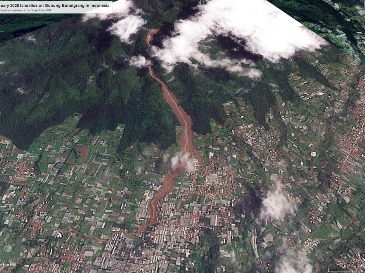
Satellite imagery of the 24 January 2026 landslide on Gunung Burangrang in Indonesia
Imagery is now available that shows the aftermath of 3.1 km long landslide that killed about 90 people in West Bandung. On 24 January 2026, a major landslide occurred on the flanks of Gunung Burangrang (Mount Burangrang) in West Bandung, Indonesia. The search has been long and painstaking, but it is thought that 92 people […]
Posted inNews
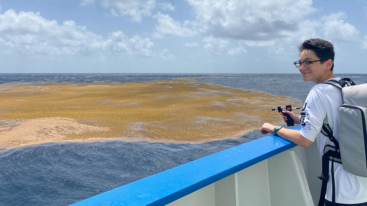
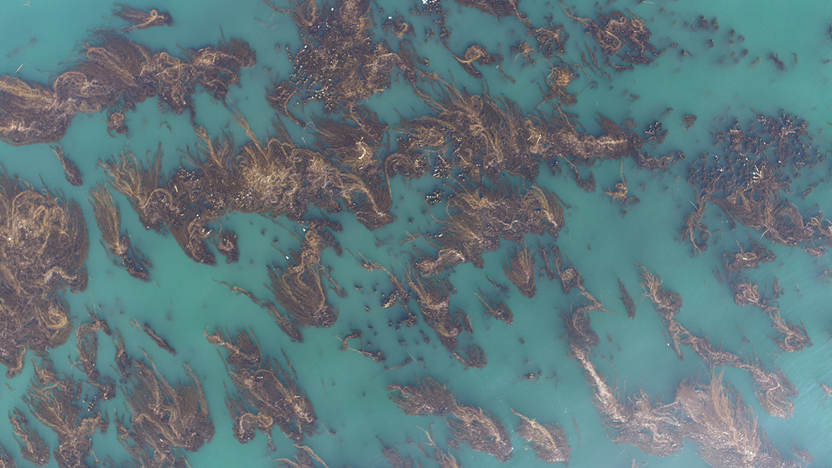
The Northern Sargasso Sea Has Lost Much of Its Namesake Algae
There’s less than a tenth as much Sargassum as there was a few years ago, a shift that may be linked to increasing sea surface temperatures in the Gulf of Mexico.
Posted inNews
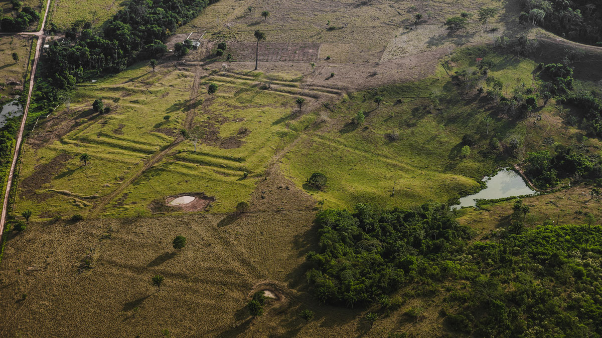
How Ancient Indigenous Societies Made Today’s Amazon More Resilient
Portions of the forest managed by pre-Columbian populations hold higher biomass and are more able to withstand climate change.
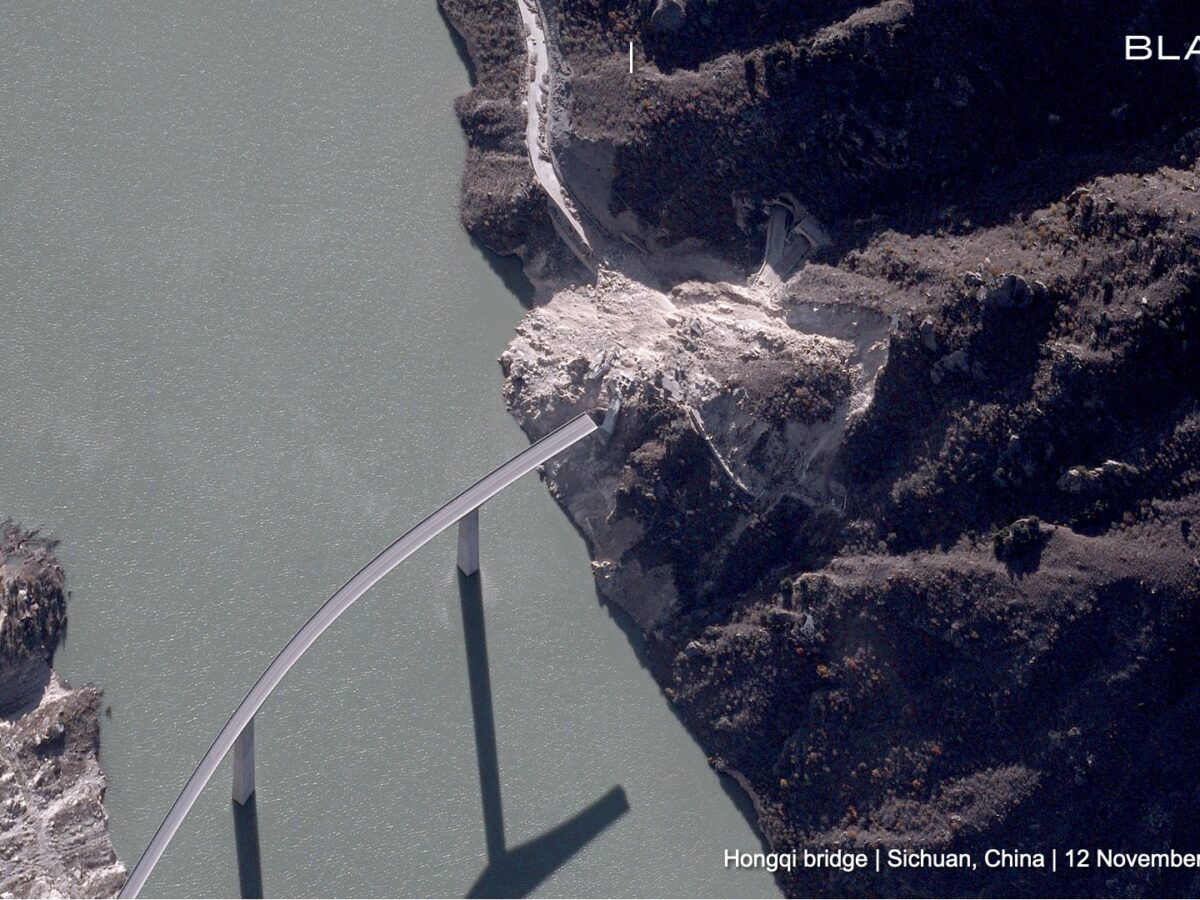
Posted inThe Landslide Blog
Satellite imagery of the 11 November 2025 landslide at Hongqi Bridge in China
The Landslide Blog is written by Dave Petley, who is widely recognized as a world leader in the study and management of landslides. Satellite company Blacksky has released a high resolution satellite image, captured on 12 November 2025, showing the aftermath of the 11 November 2025 landslide at Hongqi Bridge in China. The image was […]
Posted inResearch Spotlights
Satellite Scans Can Estimate Urban Emissions
As more cities strive to meet climate goals, space-based observations may help fill in the gaps on tracking emissions.
Posted inNews
Marine Protected Areas Show Promise for Kelp Forest Recovery
Kelp forests are under increasing stress as oceans warm, but decades of satellite data have revealed the importance of maintaining fishing-restricted areas for climate resilience.

Posted inResearch Spotlights
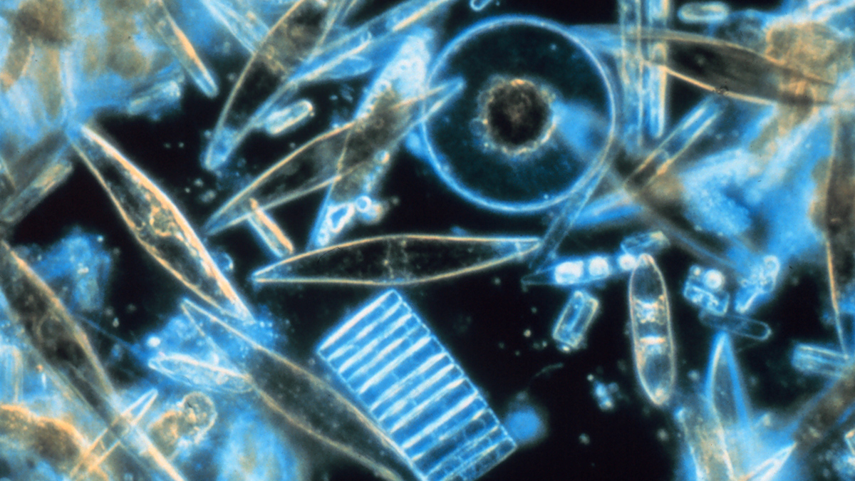
Mysteriously Bright Waters near Antarctica Explained
Shiny-shelled diatoms make a remote part of the Southern Ocean appear especially reflective in satellite imagery.

Posted inFeatures
How Researchers Have Studied the Where, When, and Eye of Hurricanes Since Katrina
Twenty years after one of the country’s deadliest storms, scientists reflect on improvements in the ability to understand and predict disasters.