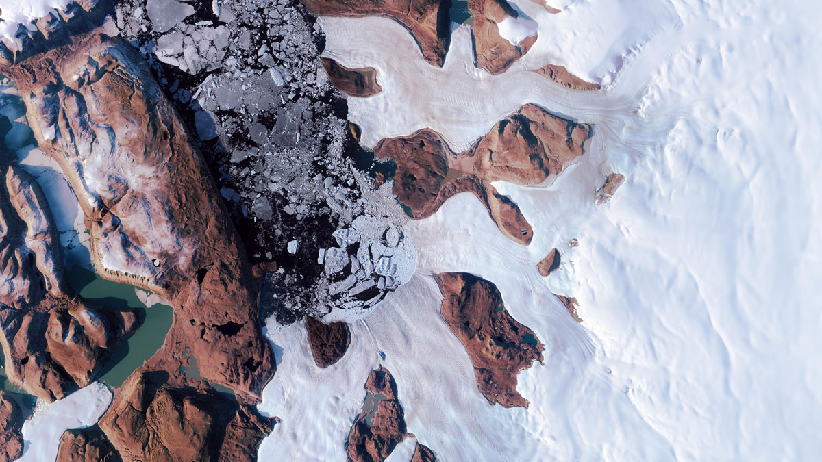
When a lake beneath the Greenland Ice Sheet drained, its water burst through the ice sheet’s surface. This surprising event may have affected the movement of a nearby glacier.
satellite imagery
Posted inNews
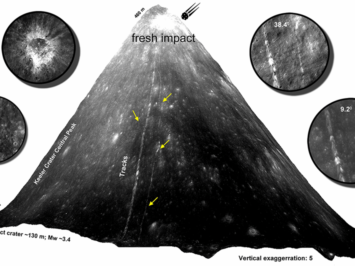
Scientists Track Down Fresh Boulder Falls on the Moon
By poring over thousands of satellite images, researchers geolocated 245 fresh boulder tracks, revealing signs of seismic activity or impact events within the last half-million years.
Posted inFeatures
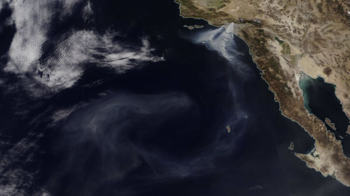
Scrambling to Study Smoke on the Water
Timely action shows the impact of urban fires on freshwater and marine ecosystems.
Posted inOpinions
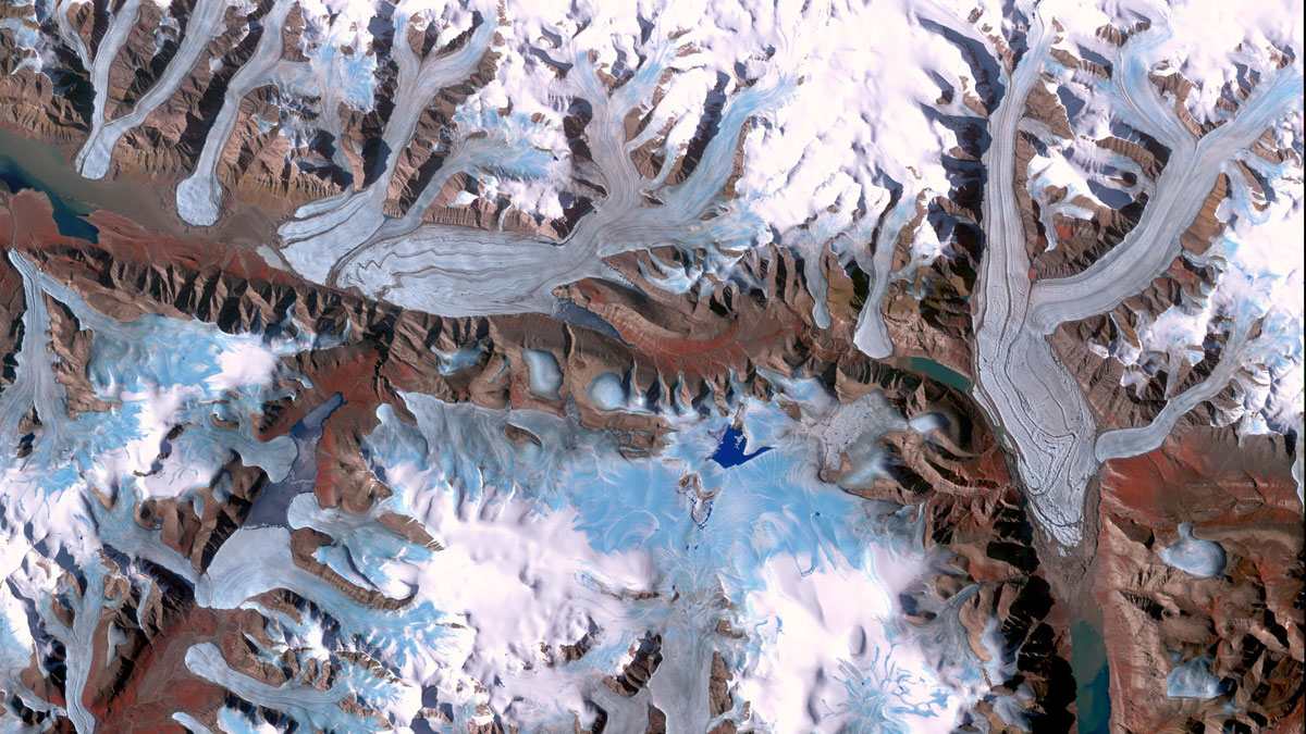
Glacier Monitoring from Space Is Crucial, and at Risk
A new community effort shows that Earth has lost 5% of its global glacier mass since 2000. The work highlights the necessity of spaceborne glacier observations and upcoming gaps in long-term monitoring.
Posted inEditors' Highlights
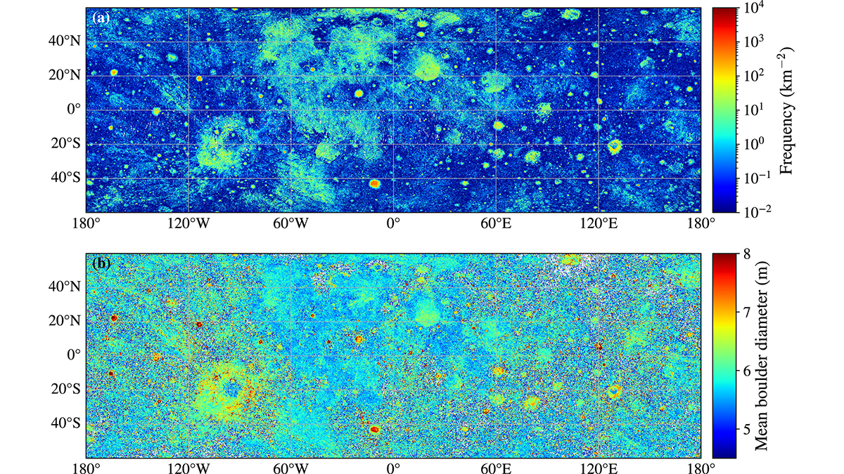
Nearly 94 Million Boulders Mapped on the Moon Using Deep Learning
Scientists used a deep learning algorithm to map the size and location of nearly 94 million boulders on the lunar surface, highlighting differences in boulder densities and size distributions.
Posted inResearch & Developments
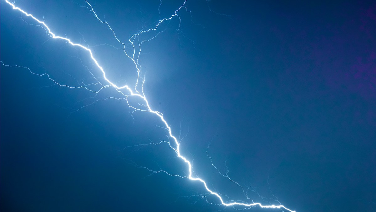
There’s a New Record for the Longest Lightning Flash
515 miles—roughly the distance from Washington, D.C. to Detroit, one-third the length of the Colorado River, and now, the longest lightning bolt ever recorded.
That’s right: A new analysis of satellite data has revealed that a 22 October 2017 storm over the U.S. Midwest created a lightning bolt that reached 829 kilometers (515 miles), from eastern Texas to nearly Kansas City. The record-setting bolt lasted about 7 seconds.

Posted inNews
New Satellite Adds Evidence of an Earth-Shaking Wave
A tsunami struck a fjord in East Greenland in 2023, ringing seismometers for nine straight days. A new satellite study provides the first observational evidence of the waves.
Posted inEditors' Vox
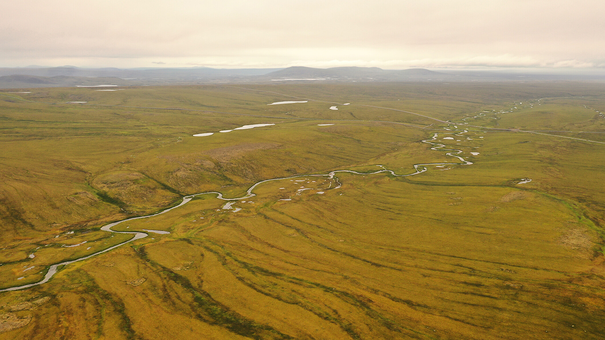
Water Tracks: The Veins of Thawing Landscapes
Tracing and tracking change in permafrost flowpaths could reveal the dynamics of warming poles.
Posted inThe Landslide Blog
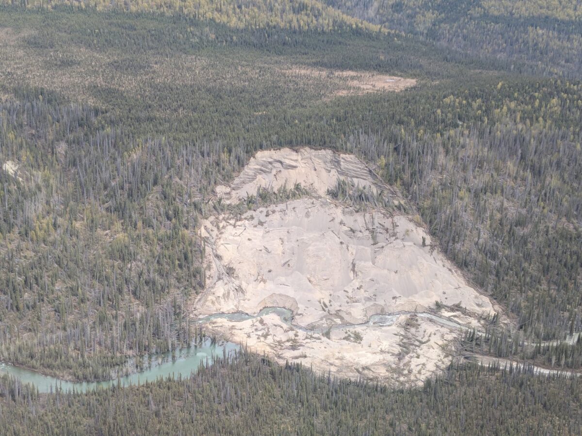
A landslide on the Lakina River in Alaska
A recent Facebook post has highlighted a reasonably large slump landslide in a remote area of Alaska. Satellite images suggest that this occurred in late October or early November 2024. Loyal reader Andrew McNown kindly highlighted a recent Facebook post that provided some images of a landslide that has partially blocked the Lakina River in […]
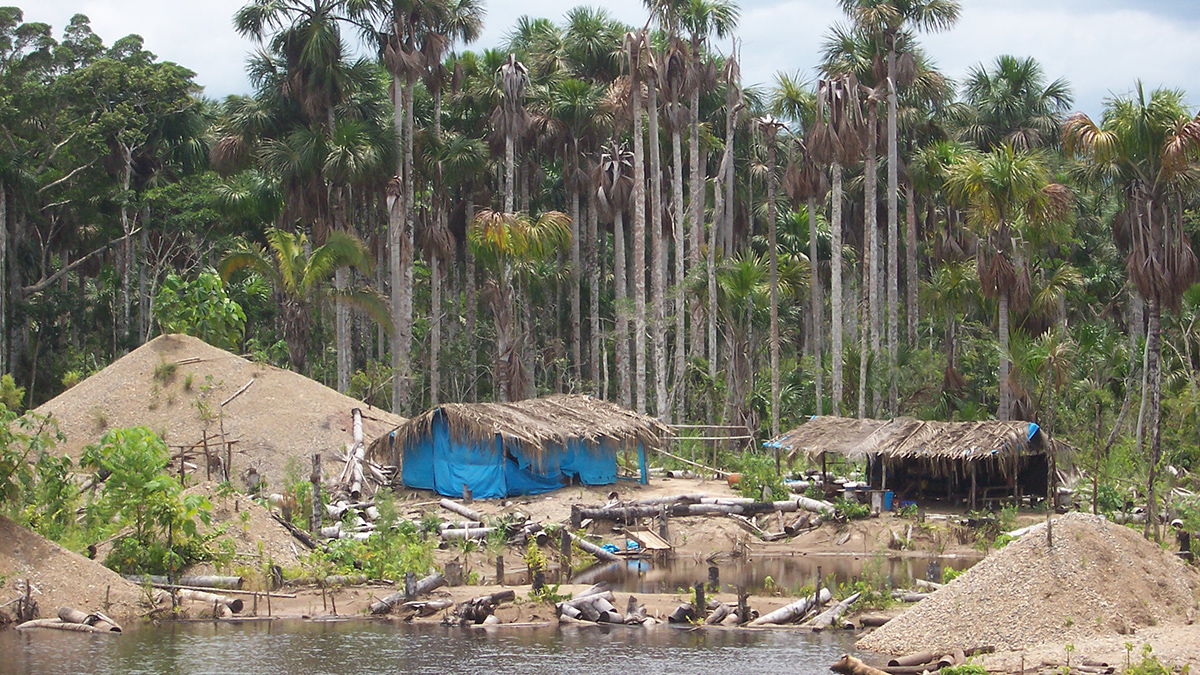
Posted inNews
Artisanal Gold Mining Is Destroying Amazonian Peatlands
A new analysis of archived satellite imagery has revealed that the growing presence of small-scale mining in the Peruvian Amazon is threatening carbon reserves and unique ecosystems.