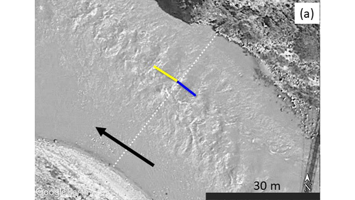
Critical flow theory can predict river discharge based on the spacing of standing waves captured by Google Earth images.
satellite imagery
Posted inNews
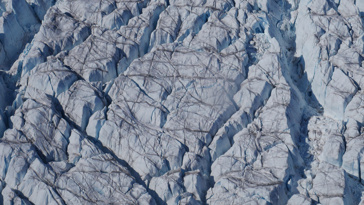
Crevasses on the Greenland Ice Sheet Are Growing
High-resolution 3D maps show crevasse volume is increasing across most of the Greenland Ice Sheet as it accelerates toward the ocean, which could affect future ice loss and sea level rise.

Posted inThe Landslide Blog
Another tailings storage facility failure – Beposa TSF at Iduapriem Mine in Ghana
The Landslide Blog is written by Dave Petley, who is widely recognized as a world leader in the study and management of landslides. The Environmental Protection Authority in Ghana released a statement on 27 February 2025 describing an “environmental incident” at the Beposo Tailings Storage Facility (TSF) at the AngloGold Ashanti mine at Iduapriem Mine. […]

Posted inNews
Megadroughts Have Grown in Size and Scope
A new study maps and ranks the largest, longest-lasting, and most severe multiyear droughts from 1980 to 2018.

Posted inThe Landslide Blog
Landslides from the 17 December 2024 Mw=7.3 Port Vila earthquake in Vanuatu
The Landslide Blog is written by Dave Petley, who is widely recognized as a world leader in the study and management of landslides. In terms of “natural” disasters, attention is currently focused on events in Los Angeles, which will in due course may have substantial implications for landslides. A large atmospheric river event in the […]

Posted inResearch Spotlights
Las tormentas están tirando cada vez más árboles
La cantidad de árboles derribados por el viento ha incrementado casi cuatro veces en la región, probablemente por tormentas más fuertes.

Posted inNews
Satellite Measurements Make Major Seafloor Map Improvements
Though ship-based sounding has mapped some areas of the ocean floor in higher resolution, researchers have used SWOT data to create a detailed new map of the seafloor, including thousands of previously undetected small seamounts.

Posted inNews
Coastlines Around the World Are Losing Sediment
A new tool maps coastal sediments on the basis of water color. It shows that 75% of the world’s coastlines may be losing suspended sediment.

Posted inNews
Snowmelt Sends Caribou Packing
Researchers compared caribou tracking data with satellite observations to learn whether snowpack conditions trigger the animals’ arduous annual migration.
Posted inResearch Spotlights
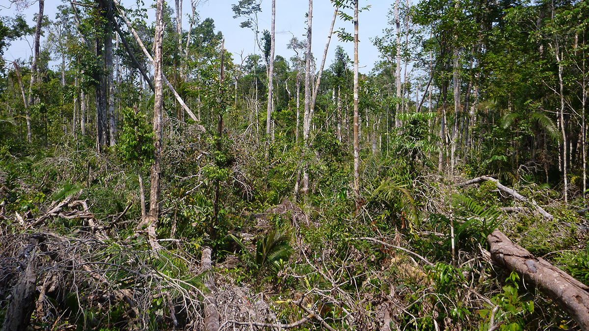
Storms Are Knocking Down More and More Trees in the Amazon
Windthrows have increased nearly fourfold in the region, likely because of stronger storms.