
A new book explores how Earth science knowledge addresses critical global challenges including sustainable development, disaster risk reduction, and climate change.
satellites

Posted inResearch Spotlights
Months of Gravity Changes Preceded the Tōhoku Earthquake
Using GRACE satellite data, researchers discovered anomalous gravimetric signals that occurred before a seismic event that started deep within Earth.
Posted inNews
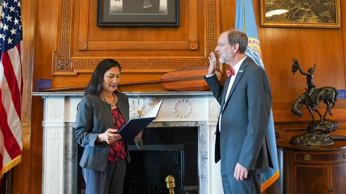
New USGS Director: Partnerships Are Our Superpower
The new director hopes to strengthen existing partnerships, build and retain a more diverse and inclusive workforce, and deliver the agency’s science to those who need it most.

Posted inFeatures
11 Discoveries Awaiting Us at Solar Max
Each solar cycle might seem like the same old story, but one thing has changed significantly since the previous solar maximum–our technology.

Posted inFeatures
Emil Cherrington: Bringing Satellite Data Down to Earth
Showing how eyes in the sky can help people on the ground.

Posted inNews
Galaxy Mapper Tracks Asteroids Closer to Home
The Gaia mission’s asteroid survey will help dig deeper into the solar system’s rocky history.
Posted inEditors' Highlights
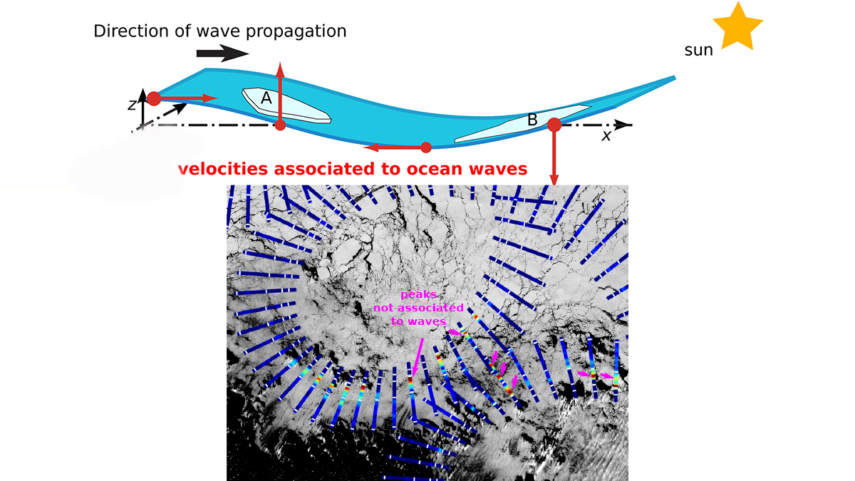
Satellites Remotely Measure Ocean Waves and Sea Ice Interactions
A new method for using satellite observations from multiple sensors improves measurements of ocean waves as they propagate through and interact with sea ice.
Posted inEditors' Highlights
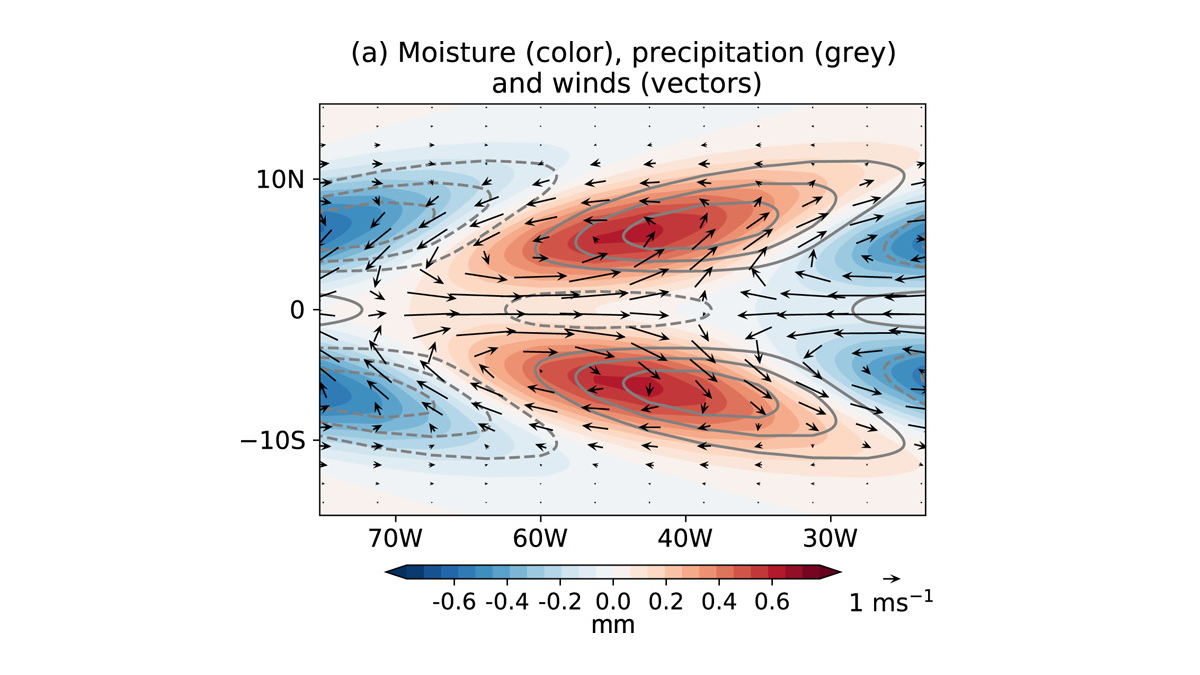
New Western Hemisphere Moisture Mode
A new study presents the first evidence of the existence of an intraseasonal westward-propagating moisture mode over the Western Hemisphere.

Posted inFeatures
Circling Antarctica to Unveil the Bed Below Its Icy Edge
An international initiative aims to collect a comprehensive airborne data set from the Antarctic Ice Sheet margin to better estimate ice discharge and sea level contributions today and in the future.

Posted inResearch Spotlights
卫星激光揭示地球水运动的变化
GRACE-FO卫星上基于激光的仪器可以扩展到其他地球物理应用,用来收集地球系统中月内时间尺度上的质量变化的数据。