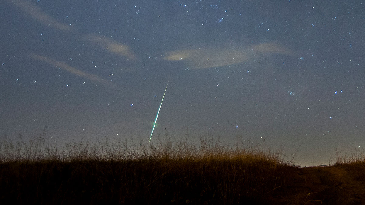
By using data from two lightning-spotting satellites, researchers measure explosions of thousands of small meteors and create a database that could help the planetary defense community.
satellites
Posted inEditors' Highlights
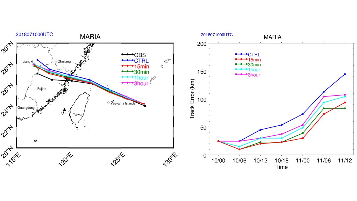
Impact of Geostationary Sounder on Typhoon Forecasts
An analysis of the impact of targeted observations from the Geostationary Interferometric Infrared Sounder at high-temporal resolution on forecasts for Typhoon Maria in 2018.

Posted inENGAGE, News
Zimbabwe’s Scientists Look Forward to Country’s First Satellite
ZIMSAT-1 promises to expand Zimbabwe’s remote sensing capabilities and allow it to better monitor natural resources.

Posted inNews
The “Internet of Things” Boosts Agricultural Livelihoods in India
New technology is bringing better connectivity to remote areas, helping farmers improve crop yields and allowing fisherfolk to venture more safely out into the sea.

Posted inNews
Supergreen Trees Can Signal Sites of Eruptions
Tree core chemistry can explain what happened before Mount Etna’s 2002 eruption and suggests that trees could play a role in rebuilding past eruptions.

Posted inEditors' Highlights
ICESat-2 Adds Estimates of Sea Level Trends to Accomplishments
The high spatial resolution and high orbit of ICESat-2 make it suited for measuring sea level close to the coast and in the polar regions, filling a gap in our sea level observational system.
Posted inResearch Spotlights
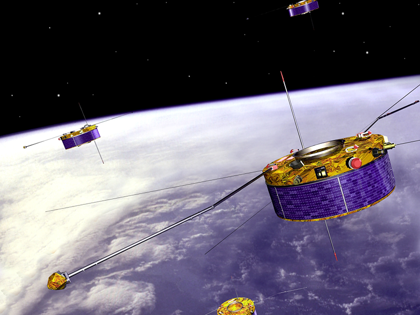
Understanding Aurora Formation with ESA’s Cluster Mission
Over 2 decades, Cluster has shed light on the auroral acceleration region, where parallel electric fields send charged particles on a collision course with the atmosphere.
Posted inResearch Spotlights
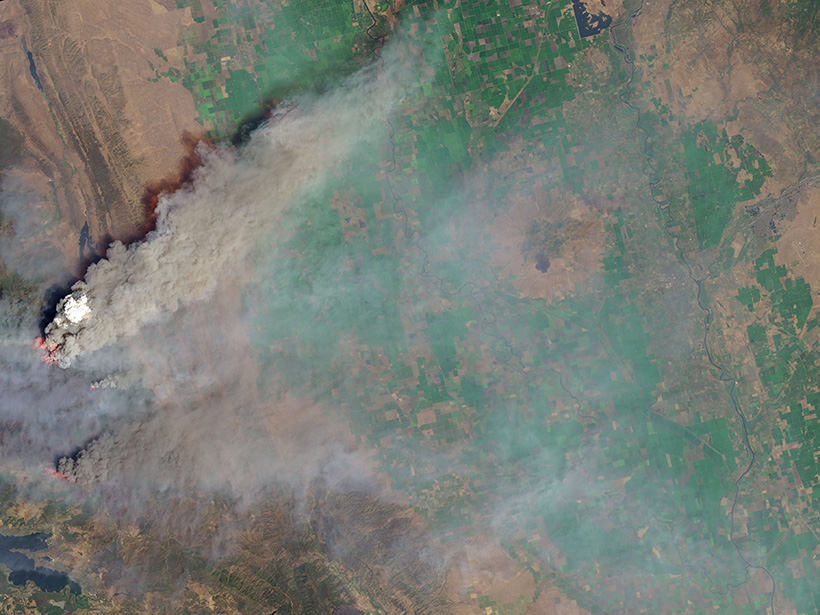
Satellite Sensor EPIC Detects Aerosols in Earth’s Atmosphere
Aerosol observations from EPIC—a sensor aboard a satellite—align well with ground- and aircraft-based data, including measurements of smoke plumes produced by recent megafires.

Posted inEditors' Vox
A New Practical Guide to Using Python for Earth Observation
A new book presents an example-driven collection of basic methods, applications, and visualizations to process satellite data sets for Earth science research.

Posted inNews
Uganda Advances Toward Launching Its First Satellite
A new ground station and an expanded education network will lead to the launch of a security and Earth observation satellite in 2022.