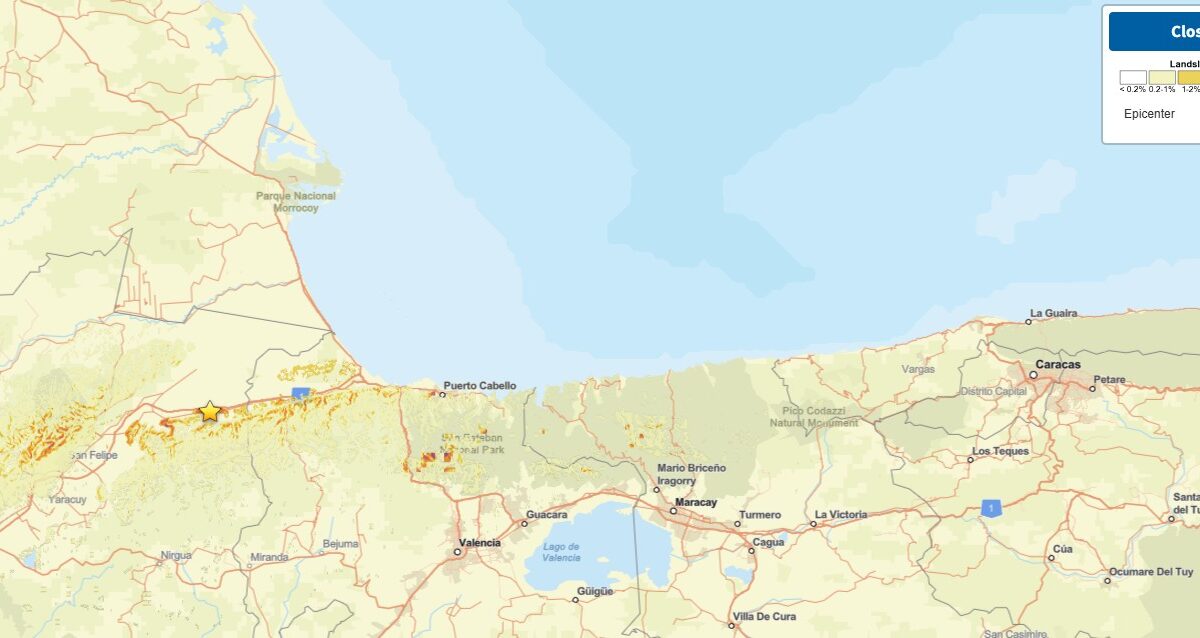
The Landslide Blog is written by Dave Petley, who is widely recognized as a world leader in the study and management of landslides. The news this morning of the “double tap” M=7.2 and M=7.5 earthquakes in Venezuela late on 24 June 2026 is grim. These are large earthquakes in their own right occurring at a […]
South America
Posted inThe Landslide Blog
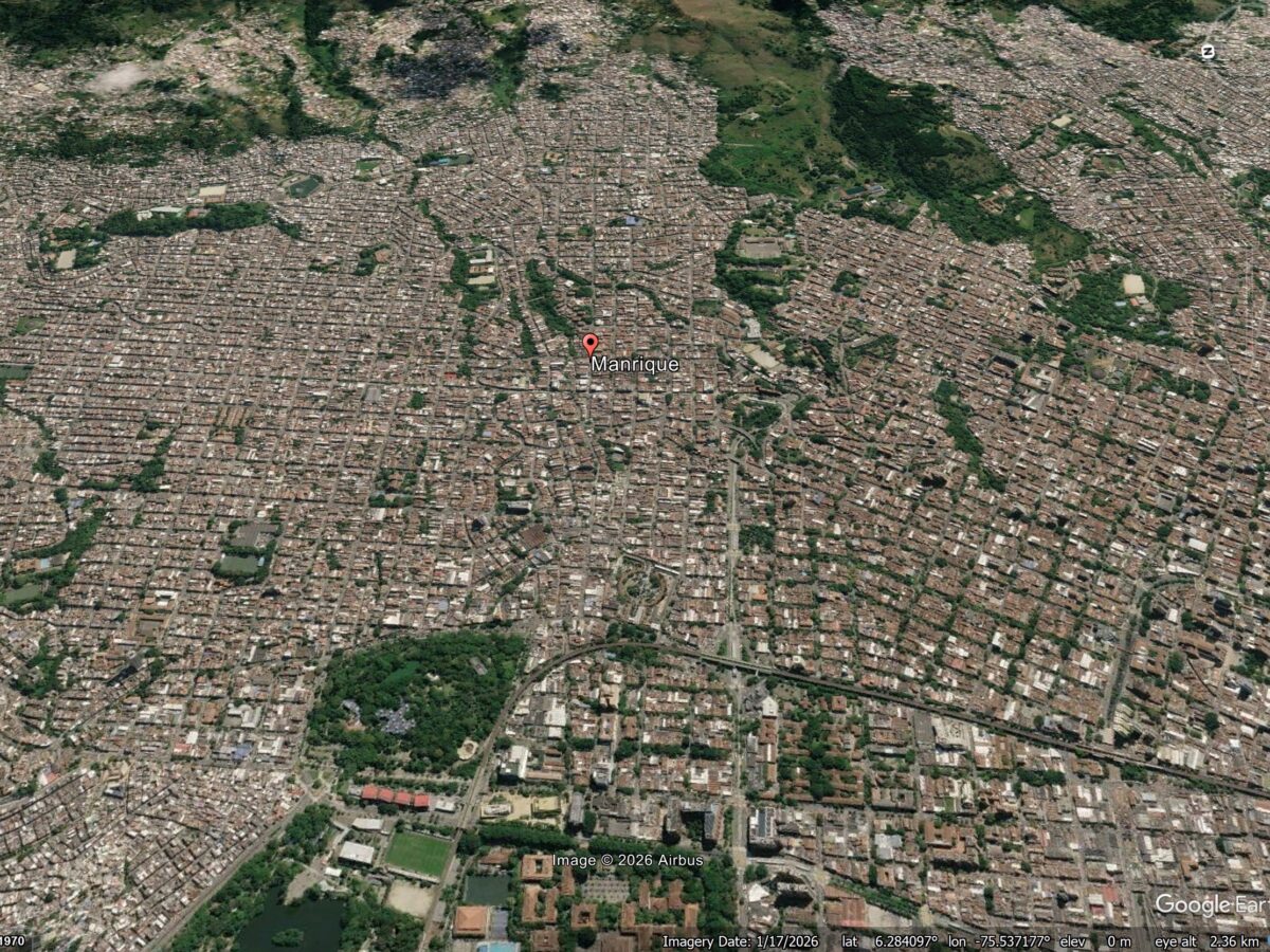
The landslide drivers of structural damage in Medellin, Colombia
A new study (Vega et al. 2026) shows that patterns of reported structural damage in Medellin are probably caused by deep-seated deformation driven by a series of ancient landslides under the city. Medellin is the second largest metropolitan area in Colombia, with a population of around 4 million people. It has grown rapidly, expanding into […]
Posted inThe Landslide Blog
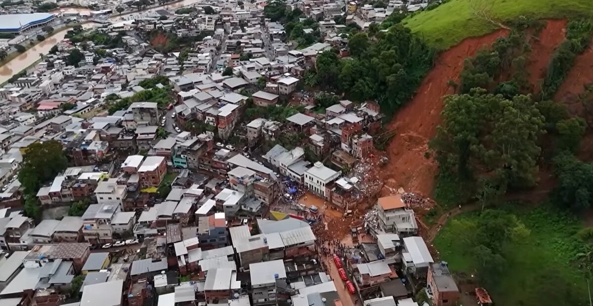
The 23-24 February 2026 landslide disaster in Juiz de Fora, Brazil
Heavy rainfall in the Zona da Mata area of Brazil has triggered multiple landslides. Over 50 people have been killed. Over the period of 23 and 24 February 2026, extremely intense rainfall struck the Zona da Mata area of Minas Gerais (MG), Brazil, triggering landslides and flooding. The most seriously affected area was the city […]
Posted inResearch Spotlights
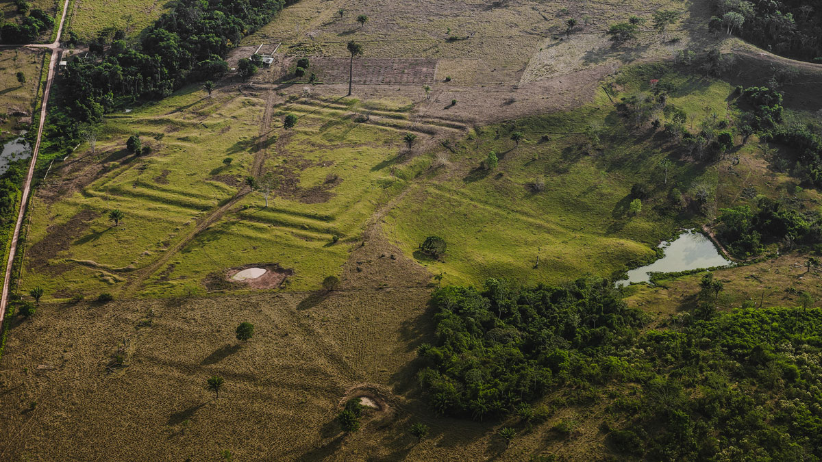
Drought Drove the Amazon’s 2023 Switch to a Carbon Source
The change was caused by thirsty vegetation taking up less carbon than normal, not by the year’s extended fire season, new research shows.
Posted inNews
How Ancient Indigenous Societies Made Today’s Amazon More Resilient
Portions of the forest managed by pre-Columbian populations hold higher biomass and are more able to withstand climate change.
Posted inEditors' Highlights
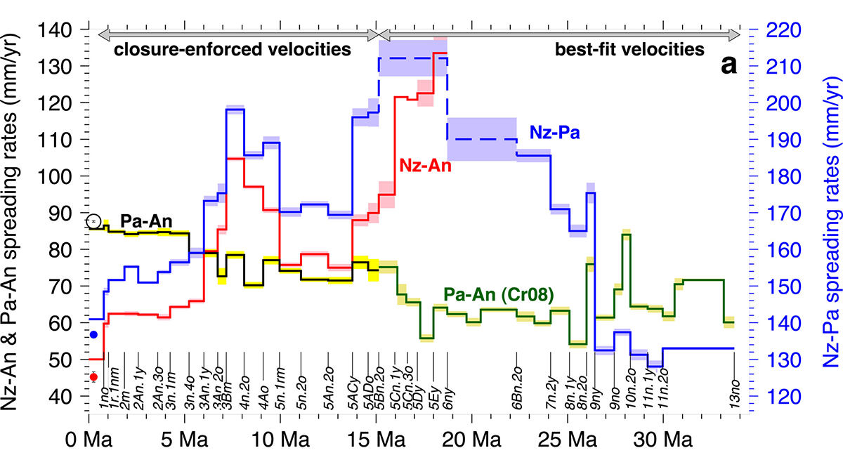
Changes in Slab Dip Cause Rapid Changes in Plate Motion
Periods of slab shallowing in the South American subduction zone appear to cause decelerations in Nazca plate motion.
Posted inThe Landslide Blog
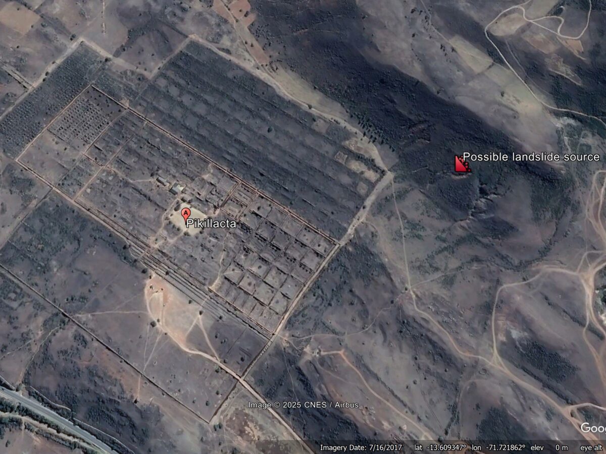
Pikillaqta in Cusco: the role of an earthquake-induced debris flow in about 900 AD
The Landslide Blog is written by Dave Petley, who is widely recognized as a world leader in the study and management of landslides. According to Wikipedia, Pikillaqta is a large archaeological site located 20 km to the east of Cusco in Peru. Inhabited by the Wari people, it was abandoned at about 900 AD for […]

Posted inThe Landslide Blog
The 22 May 1960 earthquake-induced landslides and tsunami at Lake Rupanco in Chile
Reconstruction of landslides on the banks of Lake Rupanco in Chile, triggered by the 22 May 1960 Mw-9.5 earthquake, suggests that a slope failure with a volume of 161 million cubic metres triggered a tsunami with a maximum amplitude of 33.3 metres. About 120 people were killed. A very interesting paper (Quiroga et al. 2025) […]
Posted inResearch Spotlights
Finding the Gap: Seismology Offers Slab Window Insights
Studying slow tremors has helped researchers home in on the youngest part of the Chile Triple Junction’s gap between subducting plates, which offers a window to the mantle.
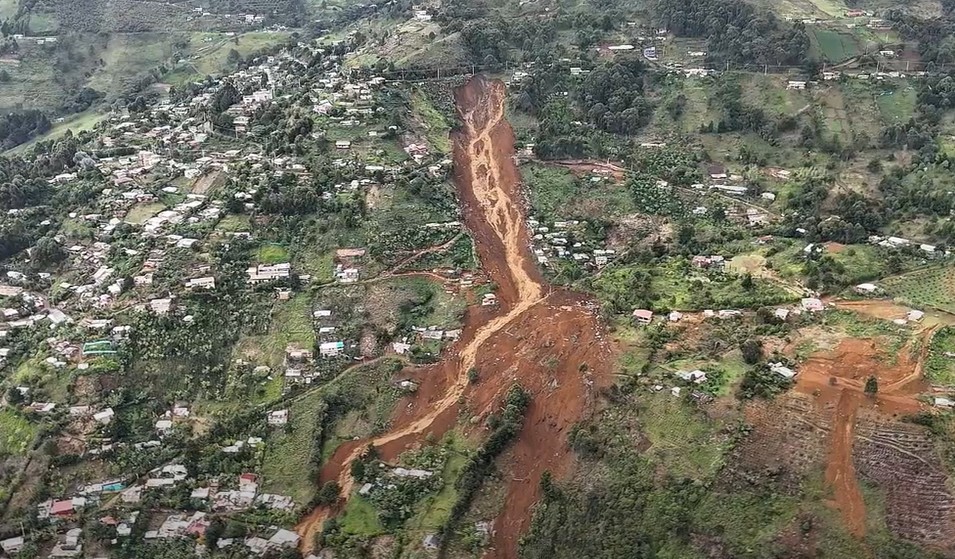
Posted inThe Landslide Blog
The 24 June 2025 landslide at Granizal near to Medellín, Colombia
A major landslide has occurred in the vicinity of Altos de Oriente and Manantiales, near to Medellín and Bello, in Colombia. It is believed that about 25 people died. On 24 June 2025 at 3:20 am, a large landslide occurred in the vicinity of Altos de Oriente and Manantiales, near to Granizal in Colombia. At […]