The Landslide Blog is written by Dave Petley, who is widely recognized as a world leader in the study and management of landslides.

On 28 April 2025, a major debris flow travelled down a channel from a major mountain, Vallunaraju, striking the communities lower down the slope. At least 100 houses were destroyed and two or three people were killed.
I am not in a position to be able to say definitively how this event occurred. Christian Huggel from the University of Zurich has a LinkedIn post that provides some detail. This is a part of what he has posted:-
“Summarizing some information on the recent glacier lake outburst flood (GLOF) that occurred in the early morning of 28 April from one of the glacier lakes at the toe of Vallunaraju (5680 m asl) and badly impacted rural and urban parts of Huaraz in the Andes of Peru. According to videos taken by mountaineers the likely origin of the GLOF (or aluvión) is a rock slope failure into a lake in some 300 m distance of the glacier margin … The analysis suggests that the rock fall triggered an impact wave in the lake with a subsequent debris flow that rushed downvalley along the Casca river, damaged some 100 houses, destroyed about 15 buildings and road infrastructure, and unfortunately also claimed the lives of 2-3 persons. The glacier lake probably formed around the 1970’s as the glaciers of Vallunaraju receded.
“Some lines of evidence suggest that there were rock fall events prior to the 28 April GLOF at this location, including pre-event slope failures likely the day before the disaster.”
This is a cloudy area, so at present I cannot access satellite imagery that shows the slopes affected by the landslide that initiated this event. However, Planet Labs has captured imagery on both 26 April 2025 (before the event) and 30 April 2025 (after the event) that provides some insights into the downstream consequences.
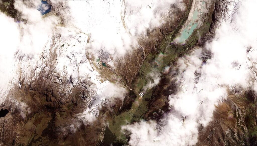
Let’s start with the main channel higher in the slopes of Vallunaraju. This Planet Labs image shows the valley immediately below the steep slope from which this event originated. The marker is at [-9.44993, -77.45431]:-
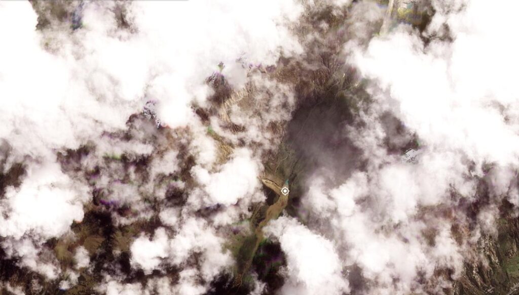
This is the same area after the landslide / GLOF:-
And here is a slider to compare the two images:-


Clearly, cloud is a major issue in the 30 April 2025 image, and we cannot see the main part of the slope itself, but at the foot of the steep slope extensive scour and erosion is evident, and there is substantial change in the channel below.
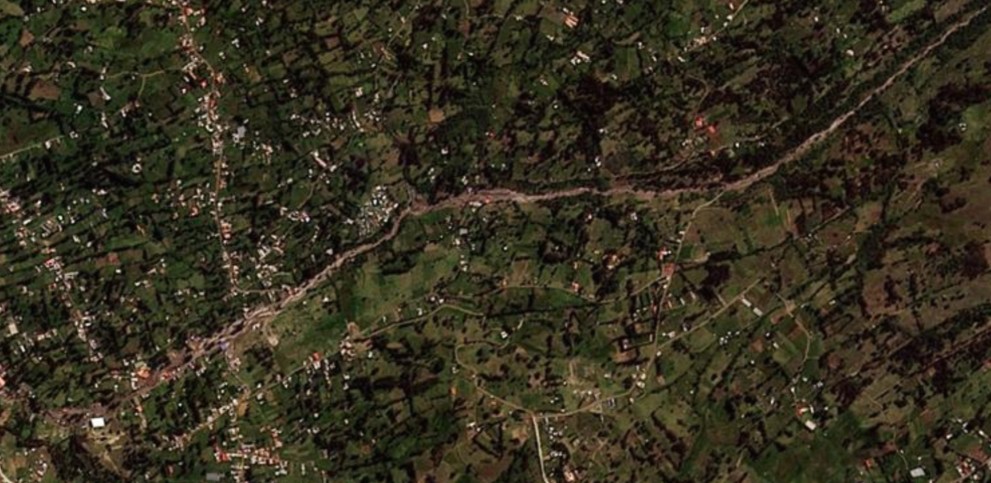
This has then led to major impacts in the channel downstream. This is a part of the 30 April 2025 image, with the channel running roughly east to west, with extensive evidence of the aftermath of the debris flow:-
Once again, this event highlights the hazards posed by events that occur high in mountain chains, but then travel into populated areas.
Reference
Planet Team 2025. Planet Application Program Interface: In Space for Life on Earth. San Francisco, CA. https://www.planet.com/