• About
  • Special Reports
  • Topics
    • Climate
    • Earth Science
    • Oceans
    • Space & Planets
    • Health & Ecosystems
    • Culture & Policy
    • Education & Careers
    • Opinions
  • Projects
    • Postcards From the Field
    • ENGAGE
    • Editors’ Highlights
    • Editors’ Vox
    • Eos en Español
    • Eos 简体中文版
    • Print Archive: 2015–2025
  • Policy Tracker
  • Blogs
    • Research & Developments
    • The Landslide Blog
  • Newsletter
  • Submit to Eos
  • AGU.org
  • Career Center
  • Join AGU
  • Give to AGU
  • About
  • Special Reports
  • Topics
    • Climate
    • Earth Science
    • Oceans
    • Space & Planets
    • Health & Ecosystems
    • Culture & Policy
    • Education & Careers
    • Opinions
  • Projects
    • Postcards From the Field
    • ENGAGE
    • Editors’ Highlights
    • Editors’ Vox
    • Eos en Español
    • Eos 简体中文版
    • Print Archive: 2015–2025
  • Policy Tracker
  • Blogs
    • Research & Developments
    • The Landslide Blog
  • Newsletter
  • Submit to Eos
Skip to content
  • AGU.org
  • Career Center
  • Join AGU
  • Give to AGU
Eos

Eos

Science News by AGU

Support Eos
Sign Up for Newsletter
  • About
  • Special Reports
  • Topics
    • Climate
    • Earth Science
    • Oceans
    • Space & Planets
    • Health & Ecosystems
    • Culture & Policy
    • Education & Careers
    • Opinions
  • Projects
    • Postcards From the Field
    • ENGAGE
    • Editors’ Highlights
    • Editors’ Vox
    • Eos en Español
    • Eos 简体中文版
    • Print Archive: 2015–2025
  • Policy Tracker
  • Blogs
    • Research & Developments
    • The Landslide Blog
  • Newsletter
  • Submit to Eos

transdisciplinary science

A fishing boat sits at sea with urban skyline in the background
Posted inOpinions

Ocean Observations for Everyone

by S. Cooley and A.Trice 12 September 201914 January 2022

As the ocean observation community expands its research enterprise, it needs to better engage the end users of its data.

World maps showing estimated width and mean discharge of all mapped reaches
Posted inEditors' Highlights

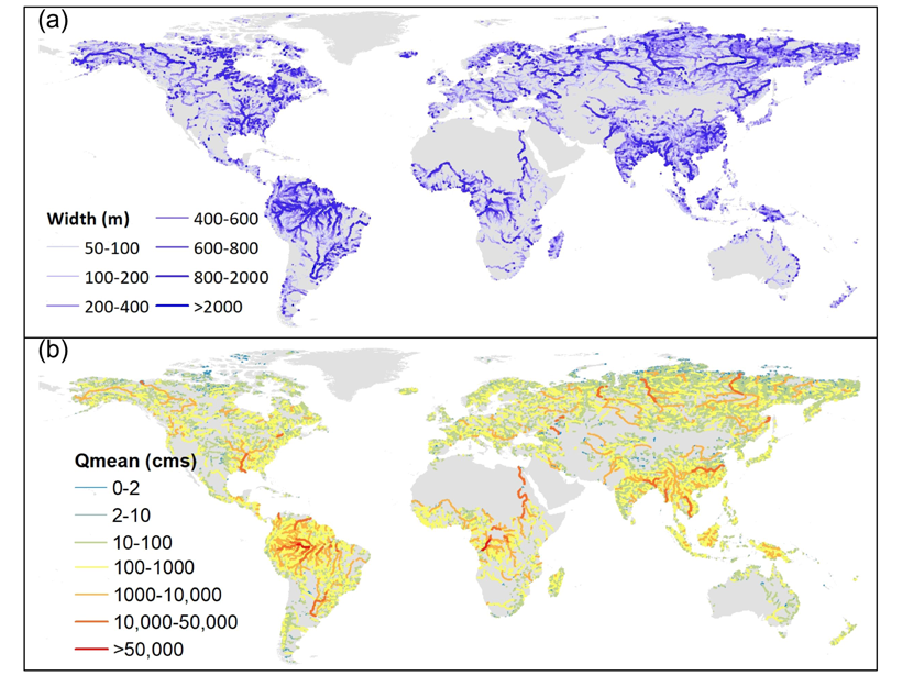
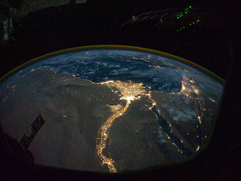
Reconstructing Natural Streamflow at Unprecedented Resolution

by Marc F. P. Bierkens 3 September 201918 July 2025

A new research effort has mapped 35 years of naturalized streamflow for 2.94 million river reaches worldwide: an invaluable dataset for hydrology, biogeochemistry, ecology, and remote sensing.

Satellite image of south Vancouver Island
Posted inFeatures

Mud on the Move

Bas den Hond, Science Writer by Bas den Hond 21 May 201914 March 2024

Powerful submarine flows known as turbidity currents are starting to give up their secrets.

A pool of meltwater sits on a vast continental glacier.
Posted inNews

Scientists Announce TiPES Project

by R. Blaustein 19 April 201922 April 2022

The European Tipping Points in the Earth System project is a multidisciplinary effort to clarify and explain the dynamics and thresholds of climate change tipping points.

Electric lights illuminate the Nile and its delta in this satellite image captured at night.
Posted inFeatures

The Renaissance of Hydrology

by V. Gabrielle 28 March 201927 October 2022

Hydrology has evolved as a transdisciplinary, data-driven science in a remarkably short period of time.

Seamap Australia assists efforts to protect species like the critically endangered spotted handfish.
Posted inScience Updates

Making the First National Seafloor Habitat Map

by V. Lucieer, C. Johnson and N. Barrett 11 March 20196 February 2023

Seamap Australia integrates seafloor maps with information on plant and animal habitats, environmental stressors, and resource management to create a first-of-its-kind resource.

R/V Sally Ride arrives in Seattle, Wash., after a cruise to Global Station Papa near the Alaska Gyre in the North Pacific.
Posted inScience Updates

Strategies for Conducting 21st Century Oceanographic Research

by A. Doyle, D. J. Fornari, E. Brenner and A. P. Teske 26 February 201914 January 2022

Planning a research cruise requires extensive coordination among research teams, ship operators, funding agencies, logistics companies, and international government entities.

Earth’s core and interior layers
Posted inAGU News

Collaboration Reveals What’s Beneath the Surface

Heather Goss, AGU Publisher by Heather Goss 8 February 20198 November 2021

How do scientists look underground? Answering questions about Earth’s interior requires an attack from many angles.

Yosemite snow surface studies
Posted inScience Updates

Preparing Graduate Students for 21st Century Climate Conversations

by M. A. Bertram, L. Thompson, J. W. Murray, C. Bretherton and C. Bitz 7 February 201910 May 2022

Graduate students at the University of Washington are becoming skilled in interdisciplinary climate science and finding opportunities to collaborate outside the academy.

Ruzbeh Akbar installs sensors at a SoilSCAPE site in California
Posted inScience Updates

Soil Moisture Data Sets Become Fertile Ground for Applications

by R. Shrestha and A. G. Boyer 4 February 201921 March 2022

An integrated data platform harmonizes many disparate soil moisture data sets to better inform disaster response planners, climate scientists and meteorologists, farmers, and others.

Posts pagination

Newer posts 1 … 11 12 13 14 15 … 23 Older posts
Over a dark blue-green square appear the words Special Report: The State of the Science 1 Year On.

Features from AGU Publications

Research Spotlights

As Wildfires Increase in the West, So Does Suppression Spending

10 June 202610 June 2026
Editors' Highlights

Pre-Existing Structure and Stress Shape Geothermal-Induced Seismicity

2 June 20261 June 2026
Editors' Vox

Small-Scale Indian Ocean Dynamics Underpin Marine Ecology and Climate

4 June 20263 June 2026
Eos logo at left; AGU logo at right

About Eos
ENGAGE
Awards
Contact

Advertise
Submit
Career Center
Sitemap

© 2026 American Geophysical Union. All rights reserved Powered by Newspack