• About
  • Sections
  • Topics
    • Climate
    • Earth Science
    • Oceans
    • Space & Planets
    • Health & Ecosystems
    • Culture & Policy
    • Education & Careers
    • Opinions
  • Projects
    • Postcards From the Field
    • ENGAGE
    • Editors’ Highlights
    • Editors’ Vox
    • Eos en Español
    • Eos 简体中文版
    • Print Archive: 2015–2025
  • Science Policy Tracker
  • Blogs
    • Research & Developments
    • The Landslide Blog
  • Newsletter
  • Submit to Eos
  • AGU.org
  • Career Center
  • Join AGU
  • Give to AGU
  • About
  • Sections
  • Topics
    • Climate
    • Earth Science
    • Oceans
    • Space & Planets
    • Health & Ecosystems
    • Culture & Policy
    • Education & Careers
    • Opinions
  • Projects
    • Postcards From the Field
    • ENGAGE
    • Editors’ Highlights
    • Editors’ Vox
    • Eos en Español
    • Eos 简体中文版
    • Print Archive: 2015–2025
  • Science Policy Tracker
  • Blogs
    • Research & Developments
    • The Landslide Blog
  • Newsletter
  • Submit to Eos
Skip to content
  • AGU.org
  • Career Center
  • Join AGU
  • Give to AGU
Eos

Eos

Science News by AGU

Support Eos
Sign Up for Newsletter
  • About
  • Sections
  • Topics
    • Climate
    • Earth Science
    • Oceans
    • Space & Planets
    • Health & Ecosystems
    • Culture & Policy
    • Education & Careers
    • Opinions
  • Projects
    • Postcards From the Field
    • ENGAGE
    • Editors’ Highlights
    • Editors’ Vox
    • Eos en Español
    • Eos 简体中文版
    • Print Archive: 2015–2025
  • Science Policy Tracker
  • Blogs
    • Research & Developments
    • The Landslide Blog
  • Newsletter
  • Submit to Eos

Uganda

Photo of a crop field with mountains in the background.
Posted inEditors' Highlights

How Satellite Data Helped Avoid Hunger from Drought

Eric Davidson, president-elect of AGU by Eric Davidson 20 January 202620 January 2026

Satellites detecting anomalies of the spectral reflectance of crops in Uganda successfully foretold imminent crop failure and automatically triggered timely governmental disaster relief.

Two men install a weather station mounted on a tall metal pole.
Posted inFeatures

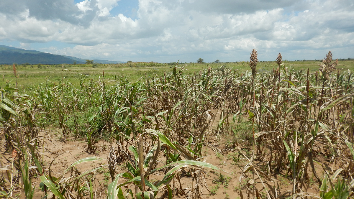
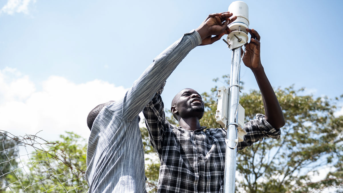
Building Better Weather Networks

by Grace van Deelen 27 October 202513 November 2025

A lack of weather data often leaves African communities vulnerable. Convergent efforts to improve observational networks throughout the continent are slowly filling the gaps.

A glacier sits atop a jagged gray mountain.
Posted inNews

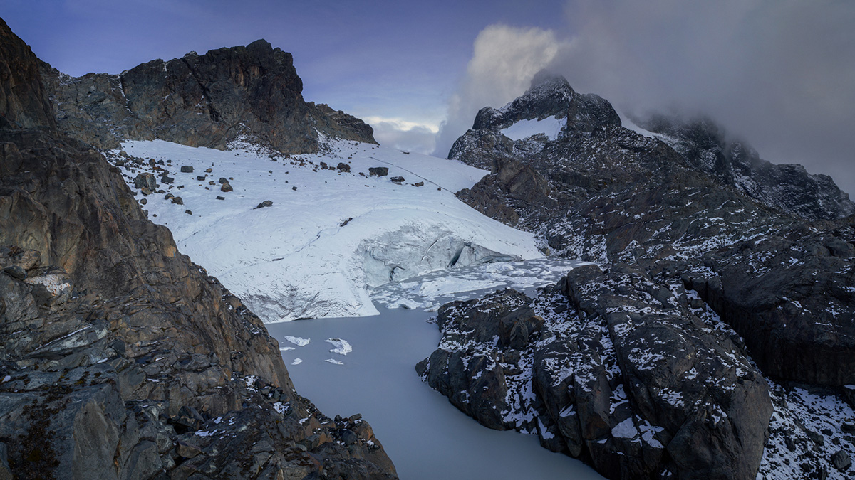
A New 3D Map Shows Precipitous Decline of Ugandan Glaciers

by Emily Dieckman 3 April 202523 June 2025

A team of dozens spent weeks in the Rwenzori Mountains capturing drone photography, GPS coordinates, and ground-penetrating radar data to document glacial retreat.

View of a dense city with buildings on hills in the background.
Posted inNews

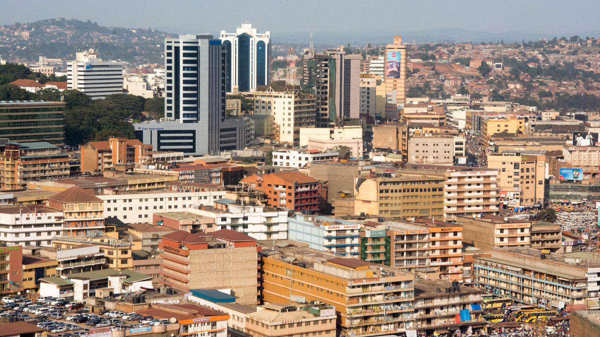
The Breath of Colonialism Continues to Taint the Air in Uganda

by Rita Aksenfeld 12 December 202412 December 2024

Potentially harmful air quality in Kampala, Uganda, follows the borders of segregated settlements from Africa’s colonial era.

Google Earth image of the site of the 9 August 2024 garbage dump landslide at Kiteezi in Uganda.
Posted inThe Landslide Blog

The 9 August 2024 landslide at the Kiteezi garbage dump in Kampala, Uganda

by Dave Petley 12 August 202412 August 2024

The Landslide Blog is written by Dave Petley, who is widely recognized as a world leader in the study and management of landslides. On 9 August 2024, a significant landslide struck the Kiteezi garbage dump in Kampala, the capital city of Uganda. At the time of writing, the reported loss of life has reached 21 […]

Two people stand near a hole in a field. One person is swinging a hoe.
Posted inNews

Refugees Are Replanting Trees in Northern Uganda

by Santiago Flórez 23 March 20231 June 2023

In the Palorinya Refugee Settlement, efforts to reduce deforestation and increase tree coverage help the ecosystem and improve refugees’ quality of life.

Ciudadanos mayores en una zona rural toman parte de un mapeo. El mapa está al centro de la foto, y cinco ciudadanos miran cómo uno de ellos dibuja el mapa.
Posted inNews

Proyecto de ciencia comunitaria ayuda a rastrear los riesgos geológicos en Uganda

by James Dacey 14 September 202222 March 2023

Un proyecto comunitario en las tierras altas de Kigezi está ayudando a identificar puntos calientes de deslizamientos de tierra e inundaciones y cómo los peligros están evolucionando.

Senior citizens in a rural setting take part in a mapping workshop in Uganda’s Kigezi Highlands.
Posted inNews

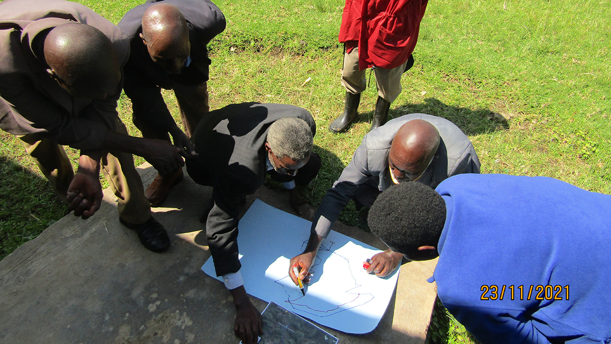
Community Science Project Helps Track Geohazard Risks in Uganda

by James Dacey 22 July 202227 March 2023

A community project in the Kigezi Highlands is helping to identify landslide and flooding hot spots and how the hazards are evolving.

Satellite dishes deployed in a wooded field in Russia
Posted inNews

Uganda Advances Toward Launching Its First Satellite

by H. Mafaranga 1 July 202114 April 2022

A new ground station and an expanded education network will lead to the launch of a security and Earth observation satellite in 2022.

A man raises a red flag, signaling severe weather, on the shores of Lake Victoria.
Posted inNews

Forecasters Navigate a Highway to Success Around Lake Victoria

by Munyaradzi Makoni 13 May 20214 November 2022

An early-warning system establishes international networks to help communities manage severe weather on Africa’s largest lake.

Posts pagination

1 2 Older posts
A view of a bridge, with the New Orleans skyline visible in the distance between the bridge and the water. A purple tint, a teal curved line representing a river, and the text “#AGU25 coverage from Eos” overlie the photo.

Features from AGU Publications

Research Spotlights

Denitrification Looks Different in Rivers Versus Streams

16 January 202616 January 2026
Editors' Highlights

Cows, Coal, and Chemistry: The Role of Photochemistry in Methane Budget

27 January 202623 January 2026
Editors' Vox

Bridging the Gap: Transforming Reliable Climate Data into Climate Policy

16 January 202616 January 2026
Eos logo at left; AGU logo at right

About Eos
ENGAGE
Awards
Contact

Advertise
Submit
Career Center
Sitemap

© 2026 American Geophysical Union. All rights reserved Powered by Newspack