The Landslide Blog is written by Dave Petley, who is widely recognized as a world leader in the study and management of landslides.

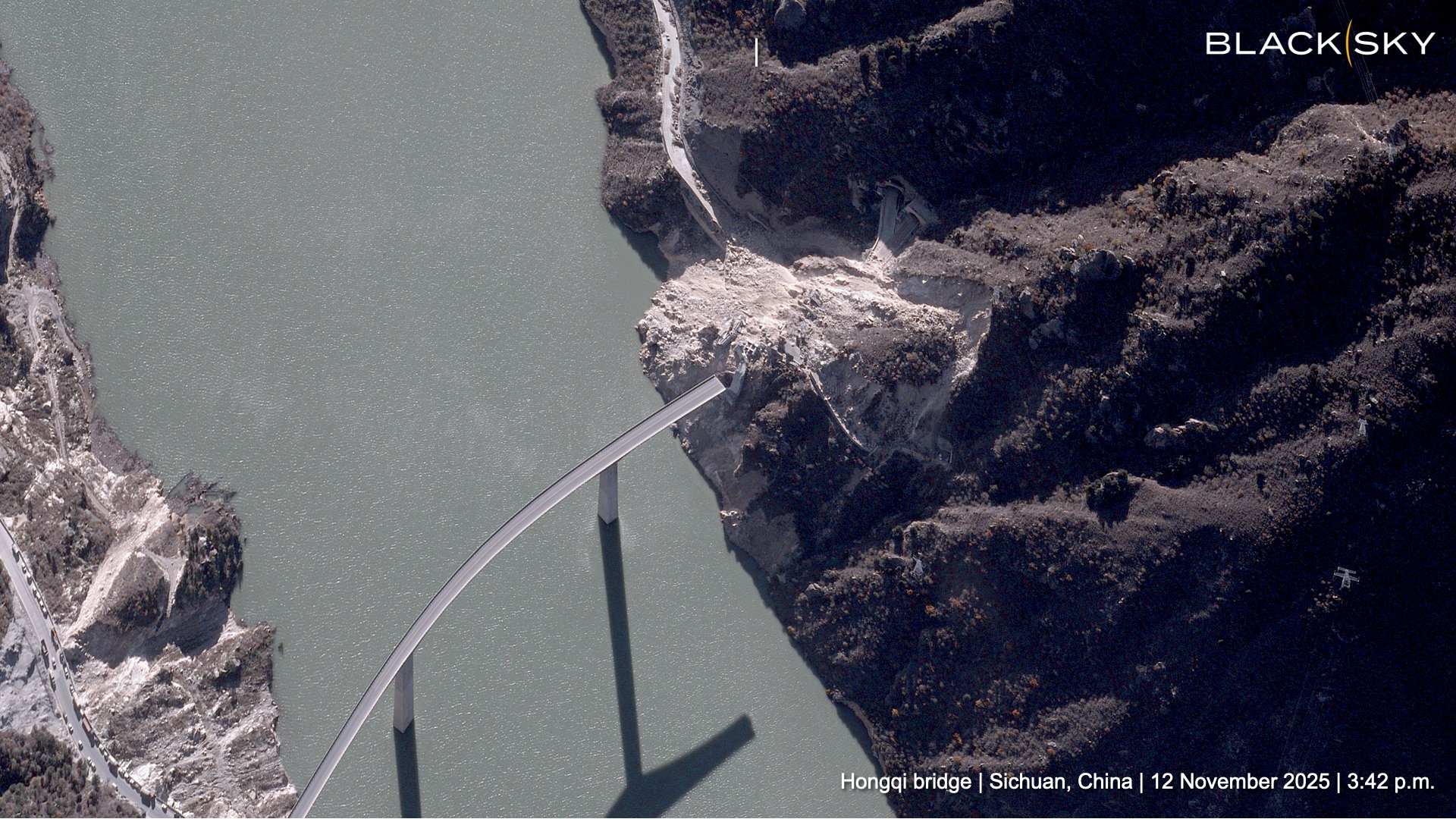
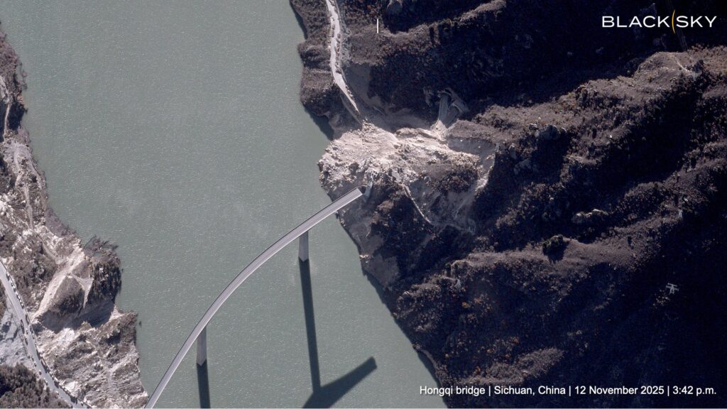
Satellite company Blacksky has released a high resolution satellite image, captured on 12 November 2025, showing the aftermath of the 11 November 2025 landslide at Hongqi Bridge in China. The image was captured by their Gen-3 instrument, and distributed via Twitter:-
On Reddit, there is a good short video of the site too, which includes this still:-
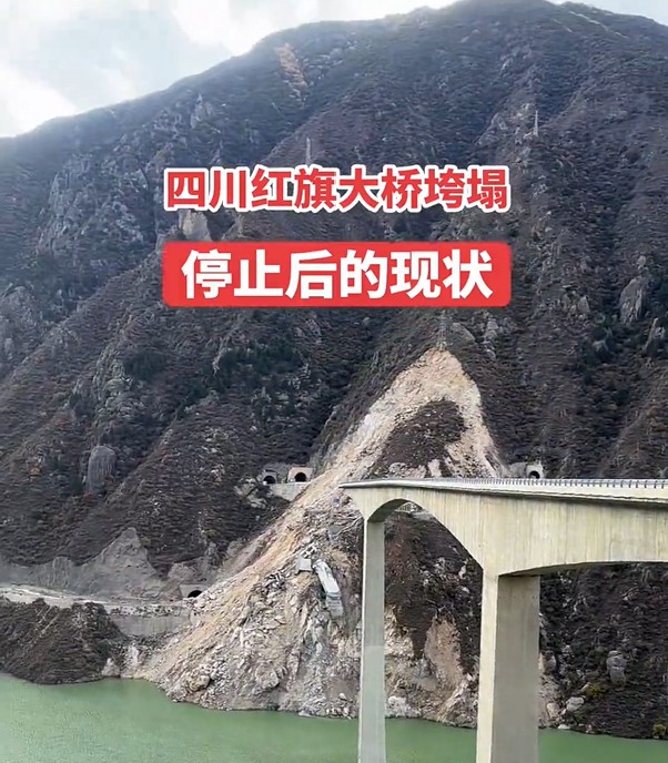
This is a rock slope landslide with several metres of movement on the back scarp. Essentially the rock spur has failed. On one side (the left on the photograph above) the slope has collapsed down to the level of the lake (and probably below), whilst the main mass has a lower level of displacement (although I suspect that the failure is still through the mass to below the lake). It appears that the tunnels remain largely intact. The main part of the cantilever bridge has performed well, with the largest piers and their bridge decks remaining intact. However, the missing section is going to be very challenging to replace.
It appears that filling of the lake might have been suspended (satellite imagery shows no change in the level since the landslide occurred). One hopes that this is to allow a reappraisal of the stability of the slopes along the reservoir banks. I would be particularly concerned about those slopes that have had excavations close to the current level of the lake. There will also be some concern about the stability of this landslide. Is it possible that further filling of the lake could induce a further collapse, endangering the main bridge pillars?
Acknowledgement
Many thanks to loyal reader Alasdair for finding the image and the video.