A recent Facebook post has highlighted a reasonably large slump landslide in a remote area of Alaska. Satellite images suggest that this occurred in late October or early November 2024.

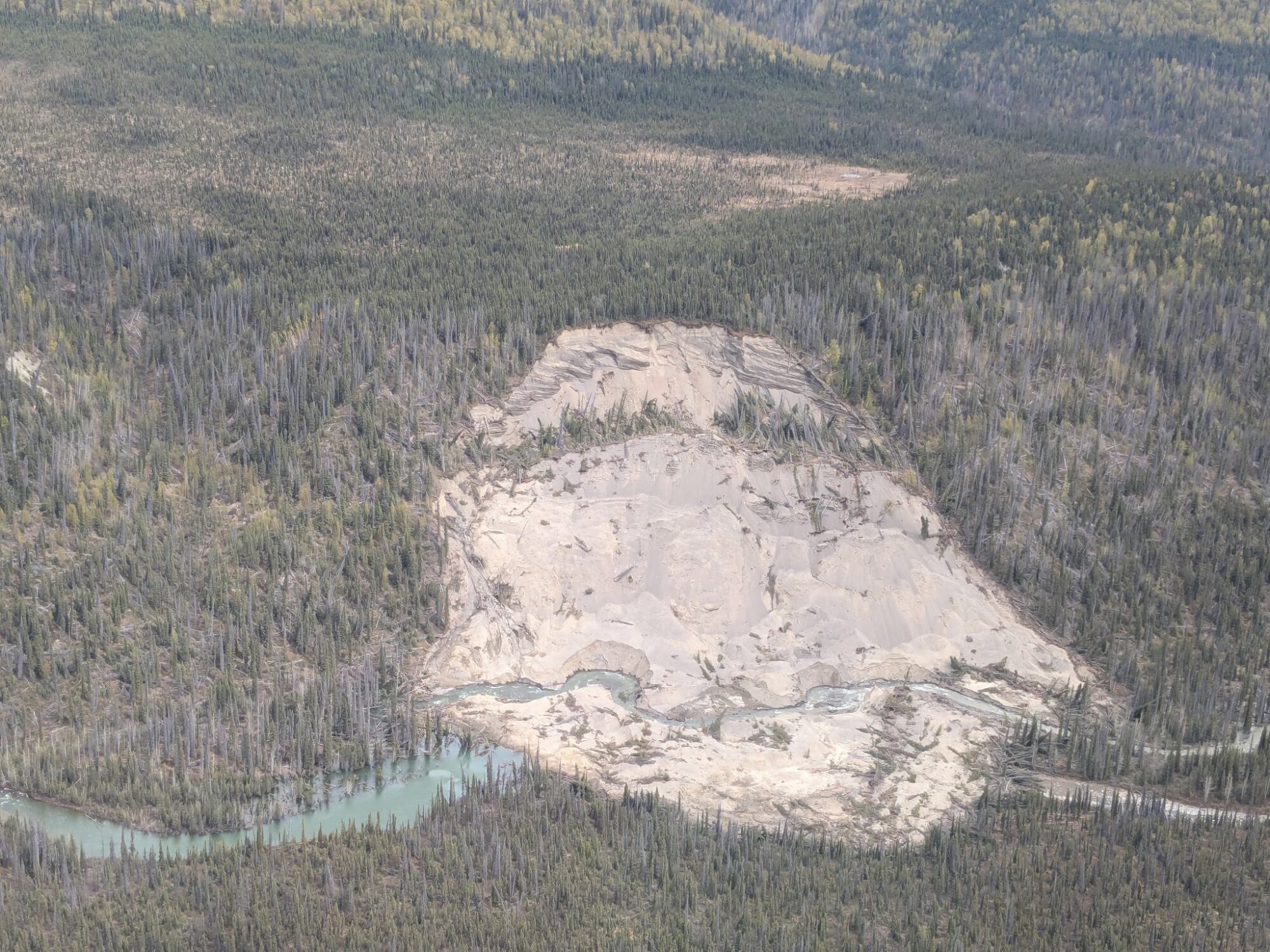
Loyal reader Andrew McNown kindly highlighted a recent Facebook post that provided some images of a landslide that has partially blocked the Lakina River in Alaska. This is one of the images, posted by John Matthews:-
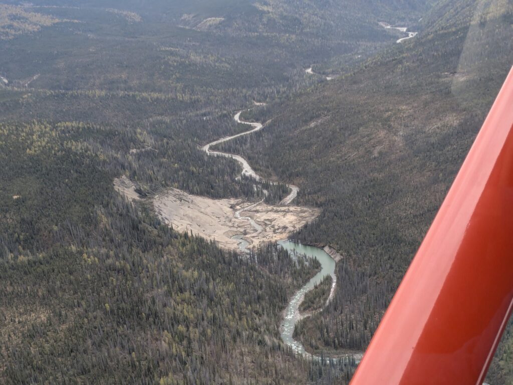
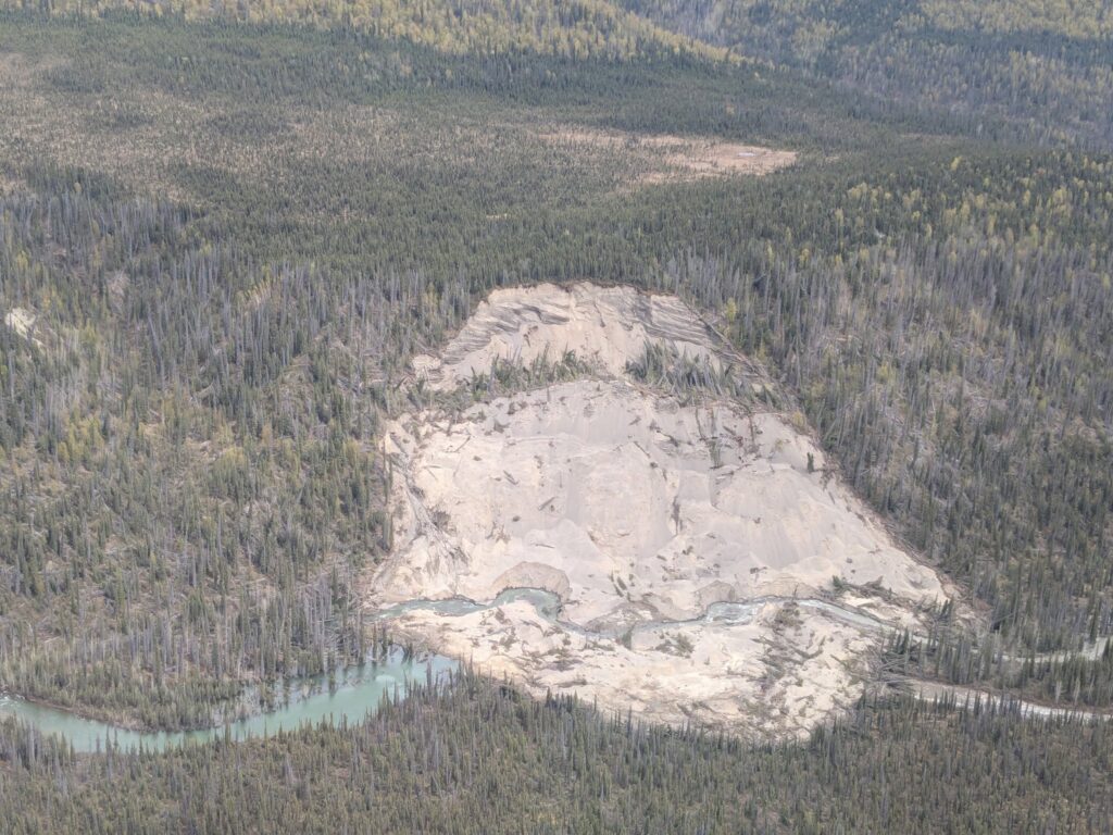
This image provides a more detailed view:-
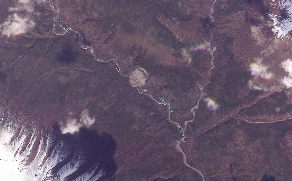
A quick review of the Planet image catalogue suggests that the location of the landslide is [61.46578, -143.27085]:-
The landslide is about 350 m from crest to toe and 300 m wide, with a surface area of about 0.085 km2. From the images, it appears to be a rotational slump in fine-graimed (presumably) glacial materials. The event blocked the river but has breached; a small lake remains on the upstream side.
In terms of timing of the event, the landslide appears to be present on a Planet image dated 4 November 2024, but it appears to be absent on one dated 24 October 2024, so it occurred sometime in that window. The trigger is unclear – this seems to be an unusual time for a landslide of this type, but perhaps there was a rapid snowmelt event.
There is a large displaced rotational block in the images in which there is erosion of the toe. This provides some potential for a further valley-blocking landslide, although this is far from inevitable. Fortunately, there are few assets at risk in the immediate downstream area, but there could be some threat to groups using or camping beside the Lakina River.
Reference
Planet Team 2025. Planet Application Program Interface: In Space for Life on Earth. San Francisco, CA. https://www.planet.com/