
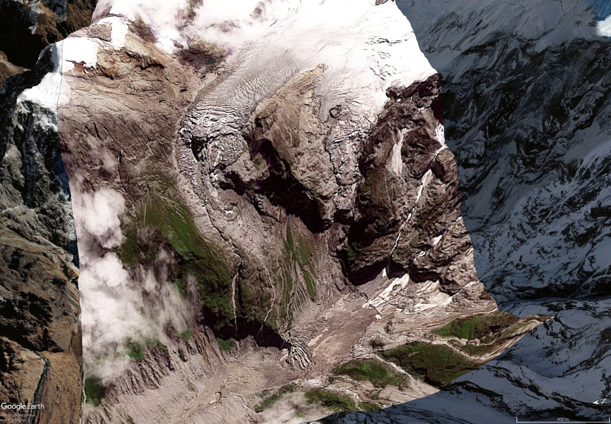
Examination of Planet Labs satellite imagery before the collapse of the slope suggests that there were surprisingly few signs of incipient failure.

The catastrophic landslide – debris flow – flood that swept through Tibet and Nepal on 26 August originated with very large rock slope failure on the flanks of Langtang Lirung, a massif located within Langtang National Park in Nepal. Good satellite imagery is available via Planet Labs from two days (12 and 25 August 2026) leading up to the failure.
Given the discussion about the potential for protecting the population through early warning systems (loyal readers will know that I have my doubts about this), thought it would be interesting to see what changed in the days leading up to the failure.
A caveat is of course that the Planet Labs imagery is of moderate spatial resolution – but that is likely to be imagery upon which this sort of system is based if an optical approach is used.
So this is the Planet Labs image from 12 August 2026 for the site of the landslide, draped onto the Google Earth DEM:-
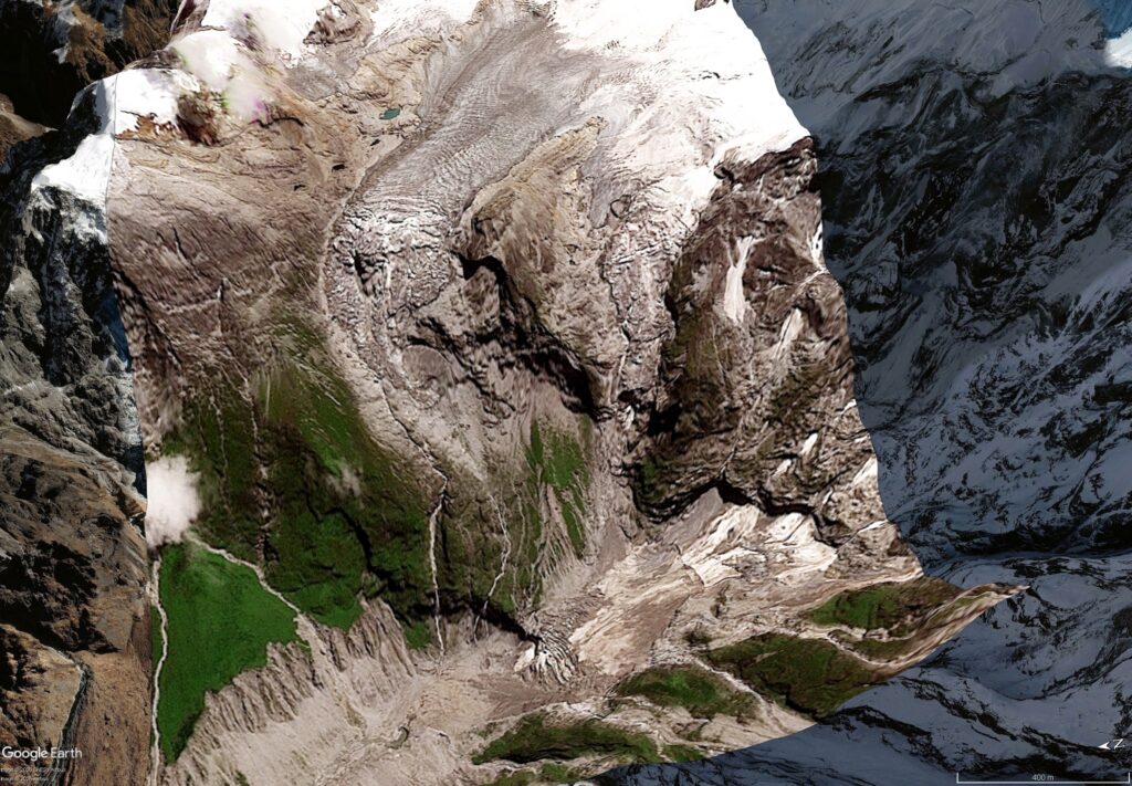
Here is the same location with an image from 25 August 2026:-
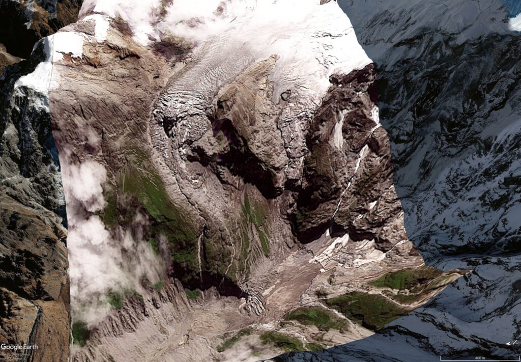
And here is a slider to allow comparison:-


Two things jump out – first, there is comparatively little change on first inspection between the two images bar the obvious (and irrelevant) shadows, clouds and suchlike. And second, the 25 August 2026 image – collected the day before the massive landslide – shows no real signs of instability. There is no obvious dust being generated for example, and there are no obvious dust deposits around the landslide.
In more detail, there are a couple of things that have changed. First, it does appear that the ice near the crown of the landslide has moved – this is the change that was picked up in the pixel tracking research that I highlighted previously. Care is needed here because of the shadows, but there is probably change in this area.
Second, there are signs of increased rockfall activity in the midslope area – this can be seen in the image below:-
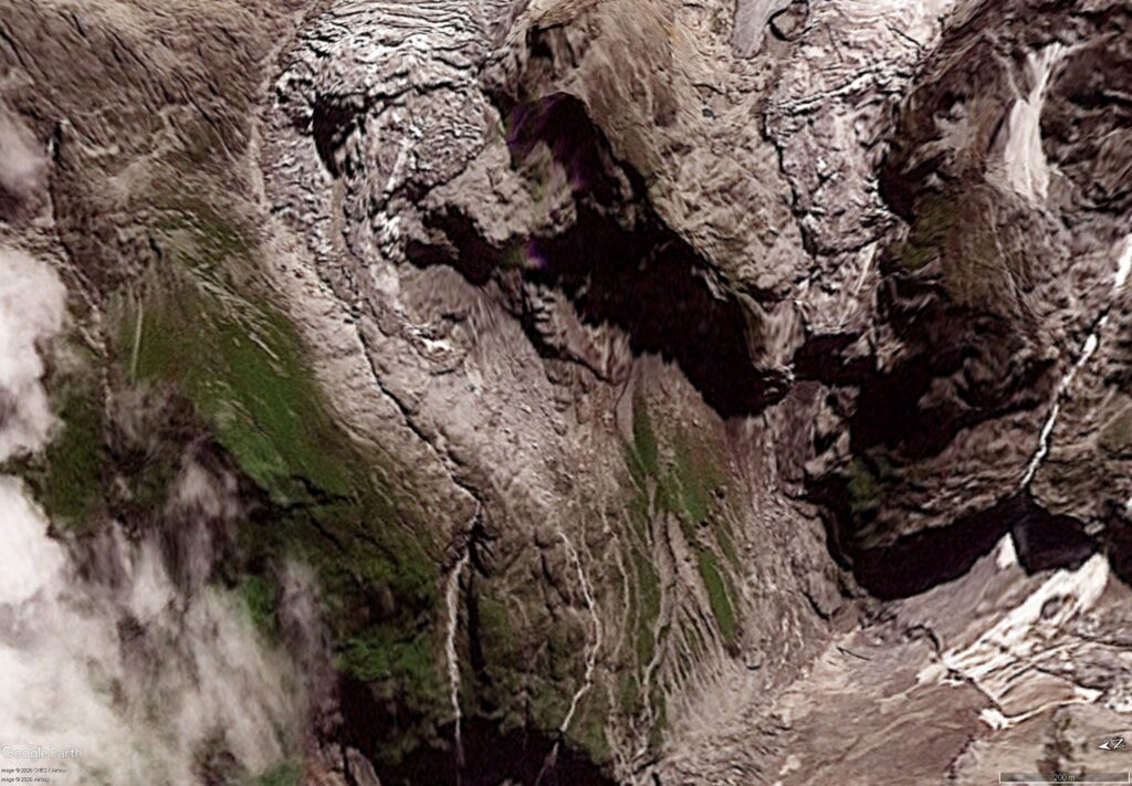
The area in the centre of the image has seen substantial change. It appears that several areas parts of the rock slope have detached, with large boulders collecting immediately below (still in the midslope area).
This indicates debuttressing of the upper part of the slope, and this was probably part of the failure process. But these are really minor changes that are probably very difficult to differentiate from the background level of activity.
It is quite interesting that this slope generated so little obvious precursory signs of failure. Other large landslides behave very differently. This needs more detailed investigation, but the signs are not good in terms of being able to use these sorts of precursory signals as a reliable indicator of incipient failure.
Acknowledgement
Many thanks to the wonderful people at Planet Labs for allowing me to use their imagery.