Severe gales, enormous storm surges, far-reaching floods: Tropical storms unleash havoc when they hit land. Beyond their immediate destruction, storms can also leave more subtle traces on the landscape that reveal when and where they struck. In a recent study, researchers reported that lead-210, a naturally occurring radioactive isotope, could be used as a chemical marker of old storms buried in the geological record.
“Data on past storms helps us forecast how storms could change in the future,” said Elizabeth Wallace, a paleotempestologist (someone who studies past tropical storms) from Old Dominion University in Virginia who was not involved in the study.
Current climate simulations can’t say for certain whether tropical storms will become more or less frequent because of global warming. “Our models are only based on a few decades of direct storm observations,” Wallace said. “We don’t have enough storm data.” Researchers are therefore trying to find new ways of spotting records of past storms.
But paleotempestologists already have a few storm indicators in their tool kit. A sand layer preserved in mud at the bottom of coastal lakes, for example, is generally a clear indicator of a past tropical storm. Lake bottoms are generally filled with fine-grained muds because calm waters allow the tiny particles to settle out of the water; coarse-grained sand, however, gets flushed into a lake when storm surges overtop natural shoreline barriers such as dunes.
“This was a serendipitous discovery.”
However, these sandy layers are deposited by only the strongest storms, said geochemist Yang Wang from Florida State University, one of the researchers involved in the new study, so relying on them can mean underestimating storm frequency. Over the past decade, paleotempestologists have been working on proxies that can illuminate smaller prehistoric storms and floods on the basis of subtle geochemical evidence.
But Wang and her colleagues weren’t looking for a new lead-210 storm proxy. “This was a serendipitous discovery,” said lead author and geochronologist Bill Burnett from Florida State University. Initially, the researchers wanted to investigate whether dam building on the Chao Phraya River, which flows through Bangkok, Thailand, had choked sediment supply to the coast, making it susceptible to erosion.
Burnett and colleagues had previously been using lead-210 to calculate sediment accumulation rates. Lead-210 forms as a result of the decay of radon gas in Earth’s atmosphere. Particles of lead-210 then rain back down to Earth’s surface, where they bind to sediments in aquatic environments and slowly decay away over time.
Lead-210 has a half-life of 22.3 years, so measurements of it at intervals through a sediment profile can indicate when a sediment horizon was deposited. Typically, the deeper the sediment is, the less lead-210 it contains because the isotope has had time to decay away.
Storm Traces
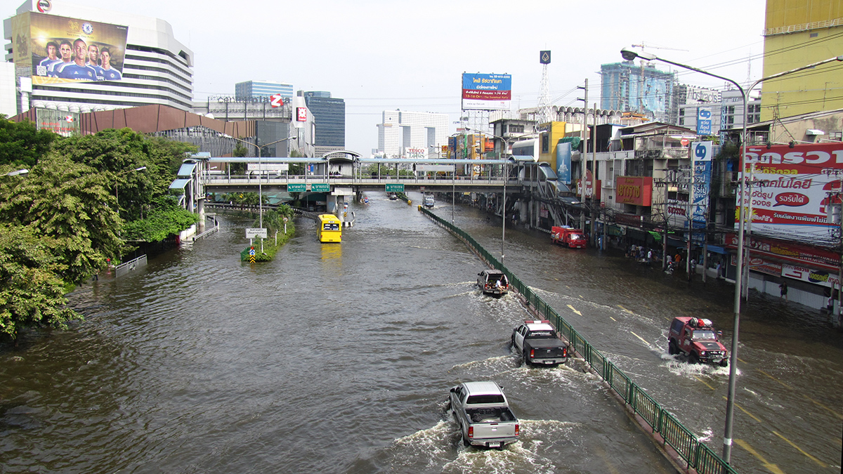
The researchers’ study site—the shore of the Chao Phraya River Delta—is particularly vulnerable to tropical storms. Over the past 2,000 years, the delta had been advancing into the Gulf of Thailand, but in the 1950s it started to retreat. It is now one of the fastest-eroding stretches of shore in the world.
“We used this familiar dating method in a different guise here.”
“We used this familiar dating method in a different guise here,” Burnett said. Lead-210 works as a paleostorm indicator because storms pick up older sediment from the retreating coast and dump it out at sea, he explained. “That older sediment will have a deficient lead-210 signature.” The researchers detailed the method in Quaternary Science Reviews.
In 2011, Tropical Storm Nock-Ten careered across northern Vietnam before spinning into Thailand, where it dumped heavy rainfall and triggered flash floods. Known as Thailand’s Great Flood, it is still one of the costliest floods in the global record.
“The 2011 storm was one of the most prominent storm deposits we identified,” Burnett said. Burnett and colleagues hauled up sediment cores from the edge of the delta and found, roughly 20 centimeters below the surface, a 5-centimeter-thick layer that contained lower lead-210 than expected for its position in the sediment profile. The layer had been deposited by the storm in 2011.
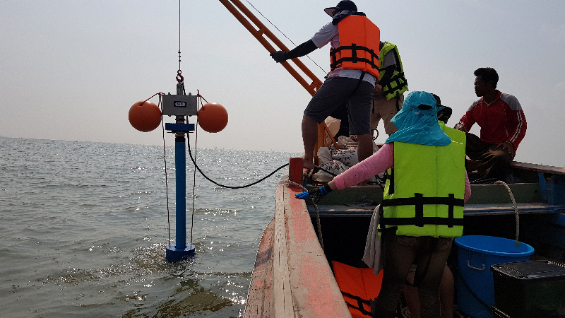
The researchers dated the layers by summing all lead-210 in the core and ratioing that total to the amount under each successive layer. In a lead-210-deficient storm layer, the ages flatten out, resulting in a distinctive age versus depth profile.
Farther down in the core they found six similar layers measuring 1–5 centimeters thick that were deposited by successive storm events over the past 50 years.
Study coauthor Butsawan Bidorn, a hydrologist from Chulalongkorn University in Bangkok, also interviewed local residents to get information on the inundation history.
“The dated layers matched the storm history,” said Wang. “That’s when we thought, maybe we can use this as a storm indicator.”
Testing, Testing…
Burnett said he feels confident that lead-210 is giving him and his colleagues useful storm information, at least at this location, but he added, “This is still a hypothesis. The next step for us is more testing.”
Mark Baskaran, an isotope geochemist from Wayne State University in Michigan who was not involved in the study, said he would be cautious about using lead-210 as a storm proxy before it is tested further. Factors other than storms could account for variations in lead-210 in sediments, he pointed out.
For that reason, Baskaran said that he would like to see the lead-210-deficient layers dated with independent methods, for instance, a bomb-derived spike in cesium-137. That way, the match to the instrumental storm record can be checked. He also added that to confirm that lead-210 really picks out signals, researchers could measure existing paleostorm proxies alongside it.
The tool is “promising,” Wallace said, but she noted that more work is needed. “I’ll be watching how this one develops.”
—Erin Martin-Jones (@Erin_M_J), Science Writer