
Limitations with resolving complex underground targets with sufficiently fine resolution may be alleviated through the adoption of meshless electromagnetic methods.
Editors’ Highlights
Posted inEditors' Highlights
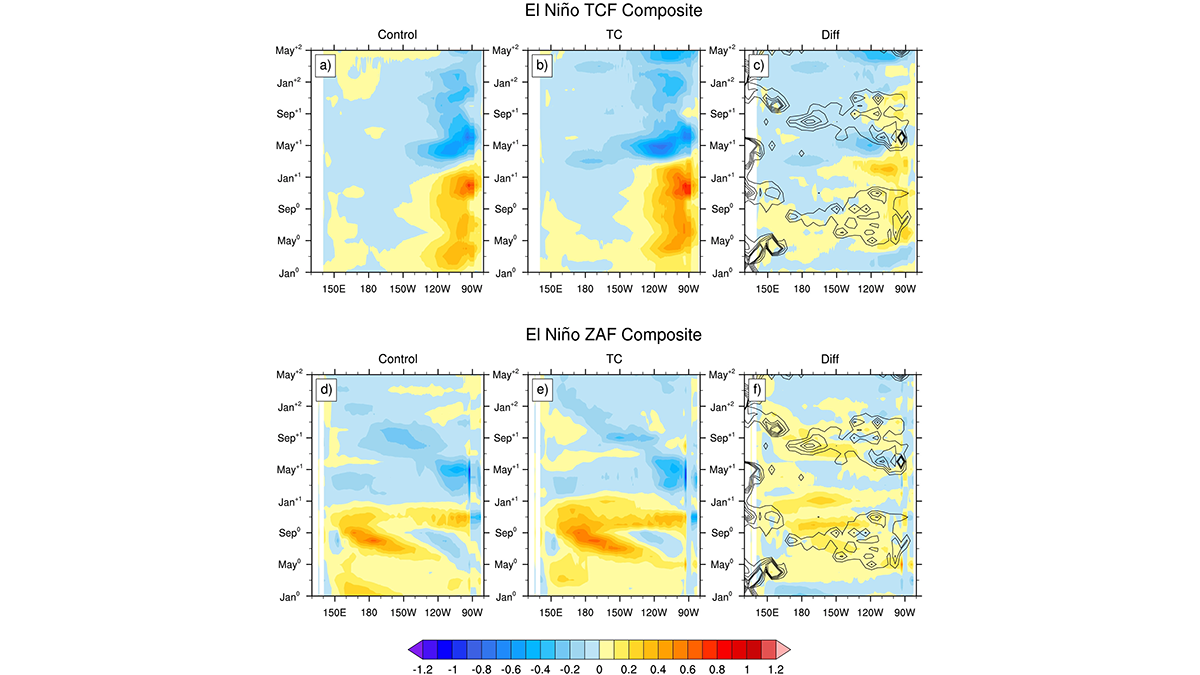
Impact of Tropical Cyclones on El Niño-Southern Oscillation
A suite of Earth Systems model experiments is used to explore how tropical cyclones influence the frequency, magnitude, and timing of El Niño-Southern Oscillation events.
Posted inEditors' Highlights
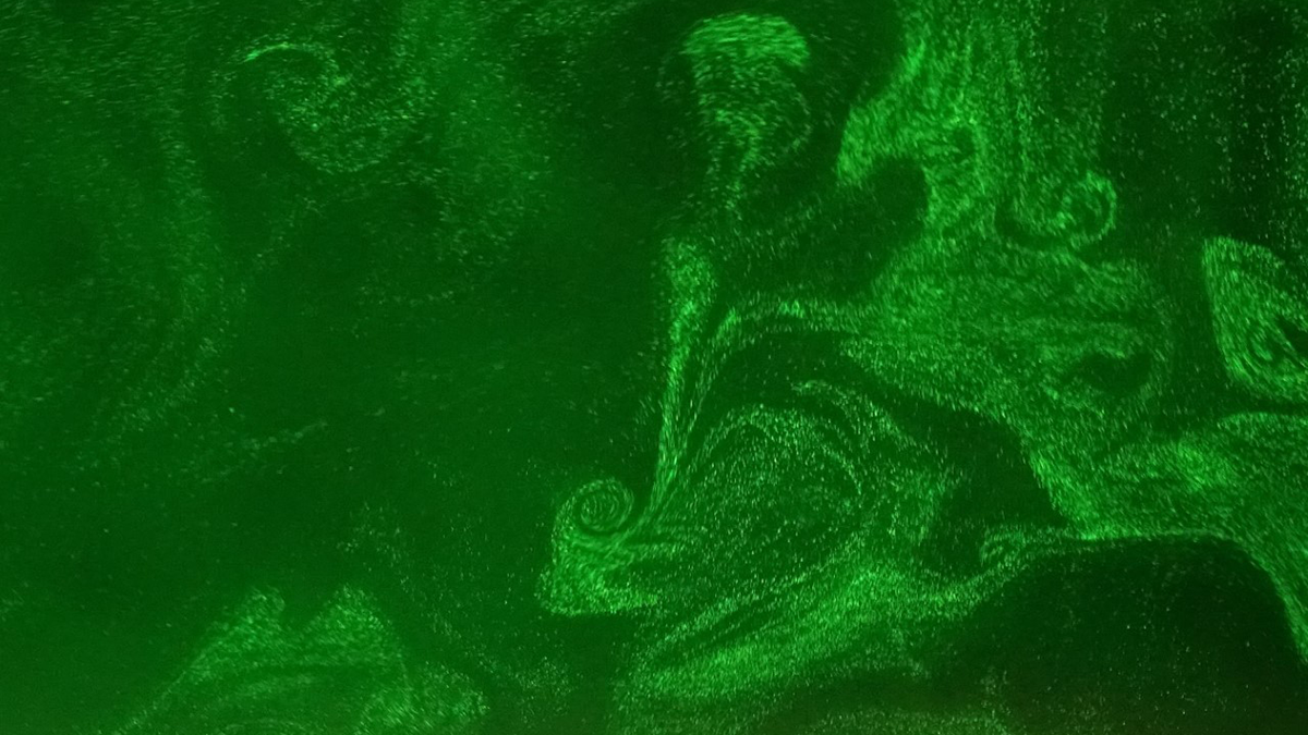
Taking Cloud Microphysics Experiments to the Next Level
Experiments in a cloud chamber have provided valuable insights into microphysical processes and will get more realistic as the height of the chamber increases.

Posted inEditors' Highlights
The Depleted Mantle Merry-Go-Round
Abyssal peridotites show through their isotopic composition a complex history. From differences we can infer the existence of ultra depleted mantle and an uneven contribution to ridge magmatism.
Posted inEditors' Highlights
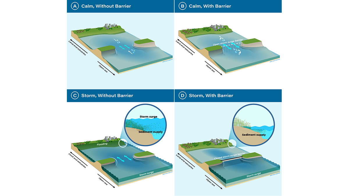
A Turning Point for Estuaries Worldwide
As estuarine barriers are built in response to sea level rise, flooding, and salinization, more research is needed to better understand their implications for human activities and ecosystems.
Posted inEditors' Highlights
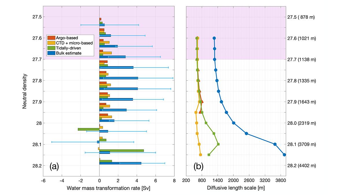
Diapycnal Mixing and the Atlantic Ocean Overturning Circulation
Quantitative observation-based estimates highlight the contribution of diapycnal mixing to the Atlantic Meridional Overturning Circulation, water mass formation, and tracer transfers and pathways.
Posted inEditors' Highlights
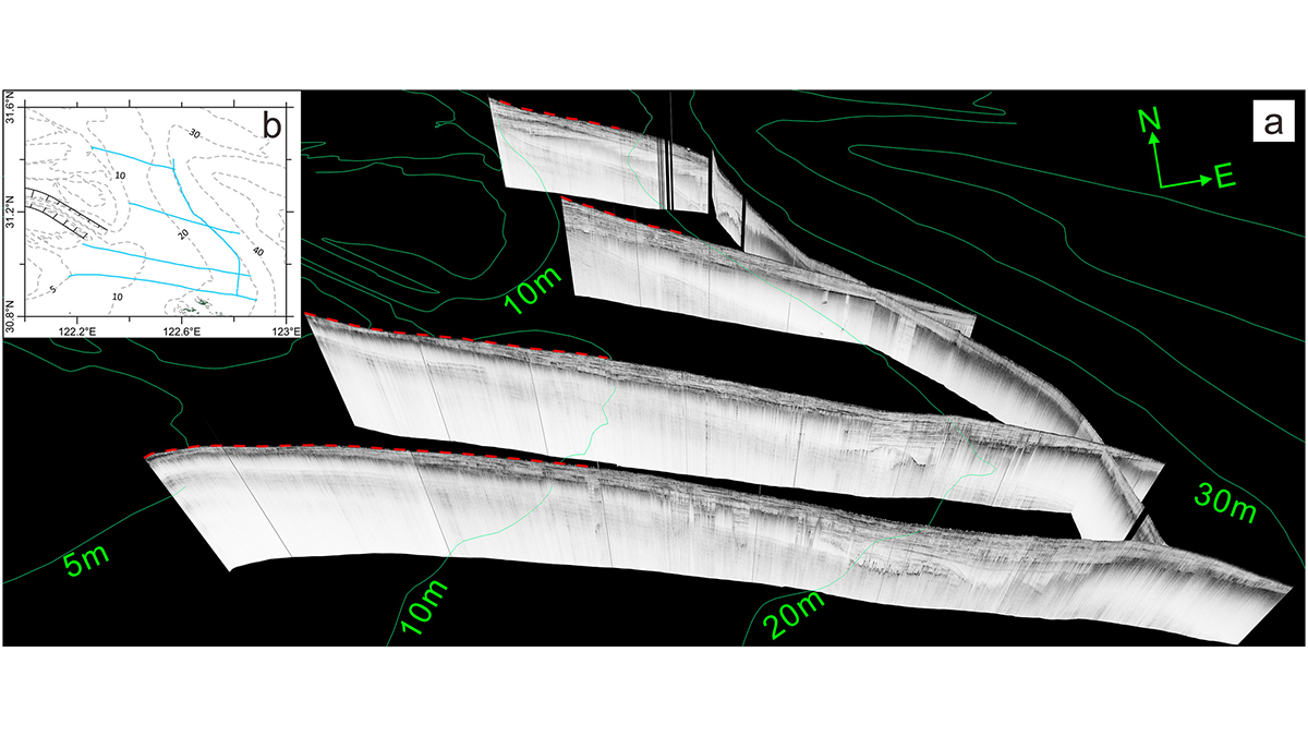
Delta Degradation Leads to Exacerbated Greenhouse Gas Emissions
Seismic ship surveys and seabed elevation maps of the Yangtze subaqueous delta reveal how the reduction of sediment supply to the coastal ocean can trigger increased greenhouse gas emissions.
Posted inEditors' Highlights
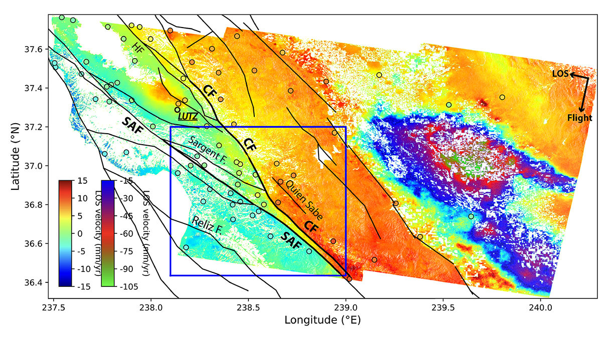
Radar Satellites Capture Subtle Slip Evolution on Faults
A five-year time series from radar satellite imagery tracks surface slip on major faults in the San Francisco Bay Area, capturing subtle velocity variations and controlling factors.
Posted inEditors' Highlights
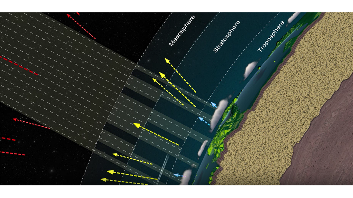
Updated Reference Standard for Total Solar Irradiance
Version 2 of the Total and Spectral Solar Irradiance Sensor-1 Hybrid Solar Reference Spectrum captures a spectral resolution spanning 0.115-200 micrometers and integrates nearly 100% of the TSI energy.
Posted inEditors' Highlights
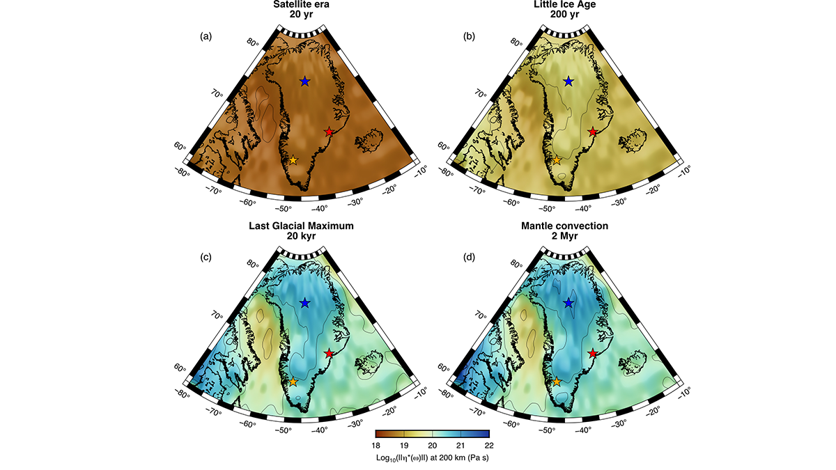
4D Viscosity Constraints from Greenland
The mantle’s resistance to flow appears different for glacial and plate tectonic timescales but this behavior can be reconciled with new thermo-mechanical models of the asthenosphere.