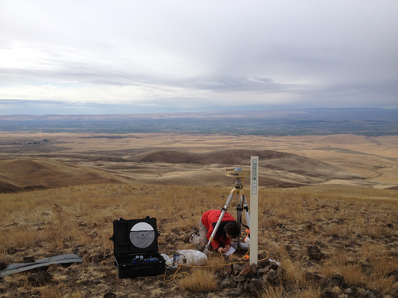
One essential component in forecasting seismic hazards is observing the gradual accumulation of tectonic strain accumulation along faults before this strain is suddenly released as earthquakes. Typically, seismic hazard models are based on geologic estimates of slip rates along faults and historical records of seismic activity, neither of which records actively accumulating strain. But this strain can be estimated by geodesy: the precise measurement of tiny position changes of Earth’s surface, obtained from GPS, interferometric synthetic aperture radar (InSAR), or a variety of other instruments.
Can we reduce apparent discrepancies between geologically and geodetically estimated fault slip rates?
Geodetic observations are included in the 2014 U.S. Geological Survey (USGS) National Seismic Hazard Model (NSHM) and in the Third Uniform California Earthquake Rupture Forecast (UCERF3), but significant challenges and questions remain. For example, how do we correctly assimilate the large and potentially disparate suite of published and ongoing tectonic geodesy studies? Can we reduce apparent discrepancies between geologically and geodetically estimated fault slip rates? How might we reconcile the apparently large amount of observed deformation that does not appear to be associated with major faults?
A group of geodesists, geologists, and geophysicists discussed these questions and others in a recent workshop in California sponsored by the USGS. They also discussed grand challenges of interpreting geodetically observed strain rates in terms of earthquake hazards and strategies to confront them. A primary challenge is that other sources of crustal deformation often interfere with measurements of tectonic strain and can lead to large uncertainties in even the best interpretation of geodetic observations. These deformation sources include rebound of the crust following glacial retreat and after nearby large earthquakes and aseismic fault slip events (which occur without shaking the ground).
Workshop participants identified a set of recommended practices to facilitate the use of geodesy in hazard models.
A key workshop goal was to devise strategies for comprehensively and systematically incorporating geodetic information into future iterations of the NSHM. Workshop participants identified a set of recommended practices to facilitate the use of geodesy in hazard models, including the following:
- production of a combined geodetic data set of the western continental United States
- consistent use of this combined data set in future modeling efforts directed toward the NSHM
- application of plate boundary–scale deformation models, rather than regional studies
- application of analyses, such as Bayesian analysis, that consider suites of possible models to capture more of the uncertainties based on modeling assumptions and to improve rigorous relative weighting of candidate models
By pursuing these lines of inquiry, we will ensure that future NSHMs are informed by the current state of the crust. A more detailed summary of the workshop, these recommendations, and strategies for implementation are available on the workshop website.
—Eileen L. Evans (email: [email protected]), Earthquake Science Center, U.S. Geological Survey, Menlo Park, Calif.
Citation:
Evans, E. L. (2017), Using strain rates to forecast seismic hazards, Eos, 98, https://doi.org/10.1029/2017EO067343. Published on 14 March 2017.
Text not subject to copyright.
Except where otherwise noted, images are subject to copyright. Any reuse without express permission from the copyright owner is prohibited.

