On terrestrial landscapes, soil moisture affects numerous ecological and environmental factors. These can include plant productivity, water yield and quality, carbon sequestration, soil erosion, wildfire vulnerability, insect and disease outbreaks, local weather modification, and response to extreme weather events. However, most research efforts and funding have focused on monitoring and understanding the dynamics of soil moisture as it pertains to agriculture and less so to forested ecosystems. As the climate becomes increasingly variable, soil moisture is expected to undergo drastic spatial and temporal shifts.
As the importance of forest responses to changes in climate are increasingly recognized, forest soil monitoring and research constraints are giving way to greater research efforts and collaboration.
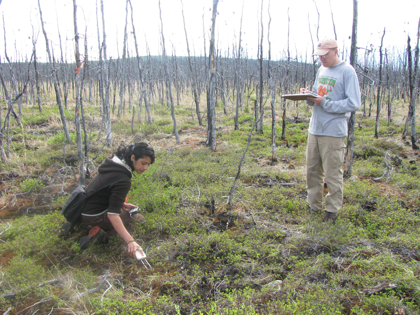
Forested lands provide an abundance of ecosystem services, which makes it critical to better monitor, predict, and understand soil moisture within these ecosystems. However, cost, access, and the challenge of measuring moisture in forest soils has constrained forest-focused soil moisture monitoring and research. As the importance of forest responses to changes in climate are increasingly recognized, these constraints are giving way to greater research efforts and collaboration.
In May 2018, the Michigan Technological University and U.S. Department of Agriculture (USDA) Forest Service hosted a facilitated workshop with an overarching goal of developing a strategic approach to monitoring and researching soil moisture in forested areas of the United States. Attending this workshop, held at Michigan Tech Research Institute, were speakers and participants from several universities and government agencies. They included the USDA’s Forest Service, Agricultural Resource Service, and Natural Resources Conservation Service; the National Snow Ice and Ice Data Center; the Michigan Department of Natural Resources; NASA; the Canada Centre for Mapping and Earth Observation; and the Colorado Climate Center.
The 2.5-day workshop featured facilitated discussions among research scientists with various stakeholders. Topics included contemporary and emerging soil moisture research and management issues, data availability, and data management. Specific objectives included identifying and addressing high-priority questions about soil moisture thresholds that may exist in forested lands, discussing currently available and emerging soil moisture information and technologies, and outlining opportunities to integrate and synthesize data sets from a suite of existing soil moisture networks and research sites with environmental sensor data. A hands-on, half-day tutorial focusing on NASA’s Soil Moisture Active Passive (SMAP) mission and data immediately followed the workshop.
A centralized data repository containing standardized data and supporting information would benefit all stakeholders.
Steve McNulty (USDA Forest Service) presented the plenary overview. His presentation was followed by 18 informative presentations on topics ranging from data applications for forest-focused soil moisture research to ground-based and remotely sensed data collection, data integration techniques, and modeling approaches. Attendees participated in breakout discussions to address three key topics: indicators, inventory assessment, and monitoring; knowledge, gaps, and current and future technologies; and data management and reporting systems.
Workshop participants reached a consensus that a centralized data repository containing standardized data and supporting information would benefit all stakeholders. With increased collaboration and integration, this database would spatially and temporally expand measurement collection, enabling scientists to develop and improve remote sensing soil moisture algorithms and data applications for research and management.
We thank organizing committee members Laura Bourgeau-Chavez, Nancy French, David Hollinger, Evan Kane, Larry Laing, Chelcy Miniat, Richard Pouyat, Michael Strobel, Cynthia West, and Bonnie Wyatt.
See the workshop’s website for complete details.
—Liza K. Jenkins (email: [email protected]) and Danielle N. Tanzer, Michigan Tech Research Institute, Michigan Technological University, Ann Arbor; and Duncan C. McKinley, Office of Sustainability and Climate, U.S. Forest Service, Washington, D. C.
Citation:
Jenkins, L. K.,Tanzer, D. N., and McKinley, D. C. (2018), Mapping and monitoring soil moisture in forested landscapes, Eos, 99, https://doi.org/10.1029/2018EO107251. Published on 23 October 2018.
Text © 2018. The authors. CC BY-NC-ND 3.0
Except where otherwise noted, images are subject to copyright. Any reuse without express permission from the copyright owner is prohibited.