
Plant life plays crucial roles in absorbing carbon and supporting biodiversity. Yet plants in ecosystems worldwide are under increasing stress from their changing environments. Recent research suggests some may be approaching dangerous temperature thresholds.
A groundbreaking 2022 study, for example, revealed that forest canopies are often significantly warmer than the surrounding air, indicating that many forests are approaching temperatures at which photosynthesis may slow—reducing their ability to take up carbon. Even more concerning, a study in 2023 found that a small, but increasing, percentage of tropical forests has already surpassed these critical temperatures, threatening their health and resilience.
These findings were made possible because of the unique capabilities of thermal infrared (TIR) remote sensing, both from space and near Earth’s surface. This technology is unlocking new ways to study ecosystems, from individual leaves to entire landscapes. By passively measuring longwave (infrared) radiation that surfaces emit and reflect, TIR sensing provides data that can be used to estimate surface temperatures and infer surface-atmosphere energy exchanges (e.g., evapotranspiration). When paired with eddy covariance measurements—which track the flows of carbon, water, and energy between ecosystems and the atmosphere—near-surface TIR data offer deep insights into how these flows interact.
A Need for Consistency
Near-surface thermal infrared (TIR) remote sensing bridges the gap between traditional ground-based tools and coarse-resolution satellite observations.
Near-surface TIR remote sensing involves using in situ thermal sensors and cameras mounted on towers or platforms. The technique’s biggest strength is its ability to provide temporally and spatially high-resolution measurements at leaf, crown, and canopy scales. This ability bridges the gap between traditional ground-based tools, like thermocouples and infrared thermometers, and coarse-resolution satellite observations.
Despite TIR’s potential, concerns over its accuracy and reliability and the lack of standardized protocols for field deployment and data processing have slowed its integration by environmental researchers. These were major topics of discussion at the 2023 Linking Optical and Energy Fluxes Workshop, where it became evident that consistent approaches are crucial for integrating different near-surface remote sensing techniques. Such consistency enhances the ability to combine data from various sources and improves the reliability of ecosystem assessments, which is particularly important when evaluating climate change impacts.
To follow up on the discussion from the 2023 meeting, 40 scientists from more than 10 countries convened at the Great Thermal Bake-off in August 2024. This workshop aimed to enhance cross-disciplinary participation and work toward tackling challenges of standardization and accessibility of near-surface TIR methods and technology in ecological research.
The event fostered a collaborative environment among a diverse group of ecosystem ecologists, climate scientists, and remote sensing experts from a wide range of career stages. Together this group developed new deployment and data protocols, conducted a comprehensive camera comparison, and strengthened the near-surface thermal research community in the process.
Comparing Data with Confidence
Several key factors influence TIR temperature readings. For example, the farther a sensor is from its measurement target, the more that TIR radiation emitted by the target interacts with the surrounding air before reaching the sensor. Different materials in air, including water vapor, can absorb and scatter TIR signals, causing signal loss and affecting readings. So longer distances and higher relative humidities, if unaccounted for, can lead to potential inaccuracies.
In addition, different surfaces emit varying amounts of thermal radiation at a given temperature, a property known as emissivity, requiring corrections based on the material being measured. Sensors can also detect background radiation from the sky, introducing errors that must be adjusted for.
Without consistent procedures for deploying near-surface TIR sensors and processing TIR data, various factors make it difficult to draw meaningful conclusions or integrate findings from different studies.
Without consistent procedures for deploying near-surface TIR sensors and processing TIR data, these factors make it difficult to draw meaningful conclusions or integrate findings from different studies. Standardization allows researchers to compare data confidently across locations and time periods, enhancing the accuracy and impact of ecosystem assessments.
These issues were the primary focus at the recent workshop, where participants also tested a novel data-processing package intended to streamline and cohere data processing across studies. Meeting participants provided feedback on the software that will help refine the package.
The group also began developing a comprehensive best practices document for deploying TIR, which will offer detailed guidelines for every aspect from the initial setup of instrumentation to final data interpretation. Specifically, the document will contain guidance and recommendations for the following topics:
- Lab testing to calibrate and assess instrument accuracy across a range of target (e.g., leaf) and ambient air temperatures prior to deployment
- Collecting required additional data like air temperature, relative humidity, and effective sky temperature
- Data quality assurance and uncertainty quantification in each step of the process, including implementations and protocols for reference panels (which provide known temperature and thermal emissivity values)
- Selecting regions of interest that minimize interference from nonvegetation surfaces and avoid the edges of the TIR camera’s view
- Key considerations for camera specifications, including power requirements, user control options, and optimal settings
- Postprocessing and interpretation to facilitate implementation of the new data-processing package
Each section of the document will offer tiered recommendations, providing baseline best practices as well as more comprehensive options. This approach will ensure that the protocols are accessible to a wide range of researchers, facilitating broader adoption and reliable use of thermal cameras in ecological studies.
Assessing Instruments in Person
A complexity in any near-surface remote sensing research is navigating the wide array of available cameras and sensors.
A complexity in any near-surface remote sensing research is navigating the wide array of available cameras and sensors, each of which varies in accuracy, performance, cost, and ease of use. To address the effects of this diversity of instrumentation on near-surface TIR data, bake-off participants brought their own thermal cameras to the event—14 models in total, ranging from consumer-grade handheld models to research-oriented systems and drone-mounted cameras—and evaluated their performance.
The evaluation process began with controlled lab testing, in which attendees assessed cameras against standardized targets calibrated to a wide range of ecologically relevant temperatures. In addition, testing was conducted at two different ambient air temperatures to evaluate camera performance under different conditions. In total, the lab comparison assessed all 14 cameras in two ambient temperatures, with 12 target temperature values.
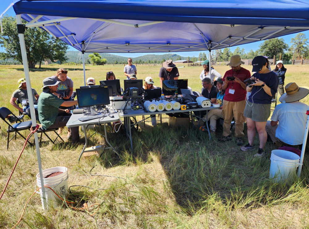
Following the lab tests, attendees moved to a field setting, where they tested the cameras at 40 and 20 meters from the targets (including a broadleaf tree canopy, tree bark, and grass) to simulate real-life field conditions. Data from several reference panels were crucial for calibrating the cameras and ensuring consistency across their measurements. When possible, cameras were also left to record data continuously for 24 hours, providing insights into their performance over extended periods and overnight.
These tests are important for determining whether data from different cameras can be reliably compared and whether certain cameras are better suited for specific environmental conditions. This work will be published in a forthcoming paper (separate from the best practices document) that suggests equipment standardization across sites and studies.
A Network of Cameras, a Community of Researchers
The 2024 Great Thermal Bake-off marked a pivotal moment in advancing near-surface TIR remote sensing for ecosystem studies, in part because of its focus on building and reinforcing a community of committed researchers. Structured small-group networking sessions during the workshop facilitated exchanges among participants from various career stages, geographies, and backgrounds (e.g., those with more technical interests in instrumentation and methods versus those whose work is driven by scientific questions).
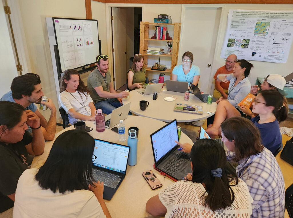
These cross-disciplinary discussions resulted in ideas for collaborative projects and created lasting connections for future joint research. They also produced clear action items that fed into the codevelopment effort to establish standardized protocols. Combined with the live hands-on equipment testing, real-time feedback, and joint writing effort to craft best practices guidelines, the workshop’s collaborative and solution-oriented approach has strengthened the TIR community and its ability to support diverse research efforts.
A growing and evolving Thermal Camera Network—akin to the phenology-focused PhenoCam Network—will be crucial for addressing many scientific questions.
The workshop also underscored the importance of expanding and sustaining collaborations beyond the event by, for example, joining the FLUXNET Canopy Thermal Imaging Committee. This working group provides a platform for ongoing communication and data sharing to ensure tangible, long-term connections in TIR research. Participants also made plans to engage other research networks with similar scientific focuses, such as the Integrated Carbon Observation System and the National Ecological Observatory Network, as well as with upcoming TIR satellite missions such as TRISHNA (Thermal Infrared Imaging Satellite for High-Resolution Natural Resource Assessment).
Building on the foundation established during the Great Thermal Bake-off, a growing and evolving Thermal Camera Network—akin to the phenology-focused PhenoCam Network—will be crucial for addressing many scientific questions, such as how plant temperatures deviate from air temperatures across ecosystems globally and whether these trends reveal broader climate patterns across spatial scales. The network will also enable researchers to track the impacts of extreme events like heat waves and droughts, as well as shifts in carbon, water, and energy fluxes.
Clearly, technology and methods for near-surface TIR remote sensing will remain hot topics for scientists investigating the current and future health of forests and other critical ecosystems.
Acknowledgments
This work benefited greatly from the insights and contributions of the following workshop participants and organizers: Adrian Rocha, Atefeh Hosseini, Chris Doughty, Chris Kibler, Christopher Still, Daphna Uni, David Trilling, Enrico Tomelleri, Eyal Rotenberg, Franklin Sullivan, George Koch, Jack Hastings, Jason Kelley, Jennifer Adams, John Lenters, Kai Begay, Li Ming Tan, Lindsey Bell, Mallory Barnes, Mark Irvine, Milagros Rodriguez-Caton, Mukund Palat Rao, Rae DeVan, Rui Cheng, Sandra Torres, Shannon Bayliss, Sophie Fauset, Sreenath Paleri, Stephanie Pau, Wen Zhang, William Hagan Brown, Xian Wang, Yujie Liu, and Zoe Pierrat. We acknowledge funding from the FLUXNET Co-op, the AmeriFlux Year of Remote Sensing, and Campbell Scientific, as well as from the following programs at Northern Arizona University: the T3 Option in Ecological and Environmental Informatics (supported by National Science Foundation award 1829075); the College of the Environment, Forestry, and Natural Sciences; the Department of Astronomy and Planetary Science; the School of Informatics, Computing, and Cyber Systems; the Center for Ecosystem Science and Society; and the Richardson Lab. This work was also supported by the National Science Foundation’s Accelerating Research through International Network-to-Network Collaborations (AccelNet) program under award 2113978. J.D. was supported by NASA under Future Investigators in NASA Earth and Space Science and Technology (FINESST) program award 80NSSC23K0138.
Author Information
Jen L. Diehl ([email protected]), School of Informatics, Computing, and Cyber Systems (SICCS) and Center for Ecosystem Science and Society (ECOSS), Northern Arizona University, Flagstaff; Benjamin C. Wiebe, SICCS, Northern Arizona University, Flagstaff; Mostafa Javadian, ECOSS, Northern Arizona University, Flagstaff; Stephanie Pau, Department of Geography, University of California, Berkeley; and Andrew D. Richardson, SICCS and ECOSS, Northern Arizona University, Flagstaff