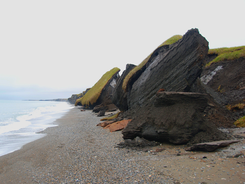
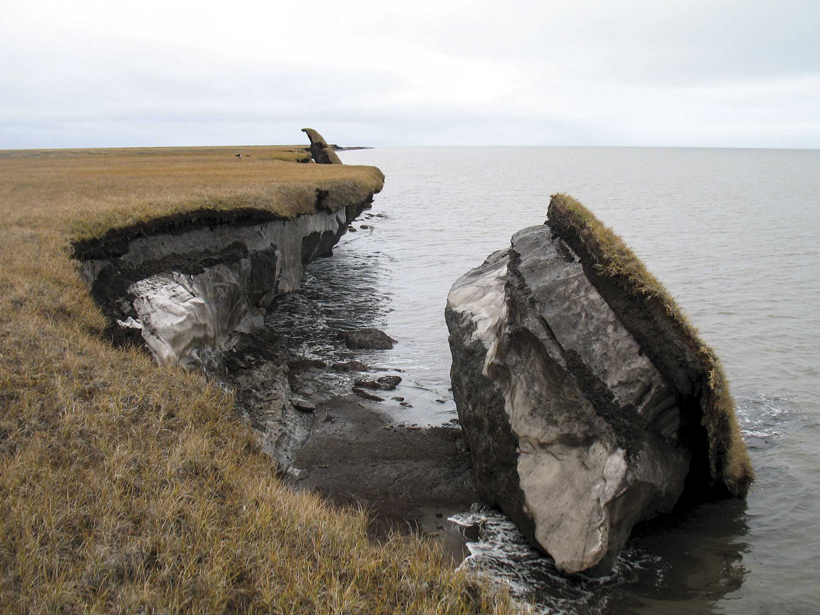
New findings highlight the need to account for large amounts of ground ice contained in frozen soil when assessing Arctic carbon cycling.
Arctic
Posted inScience Updates
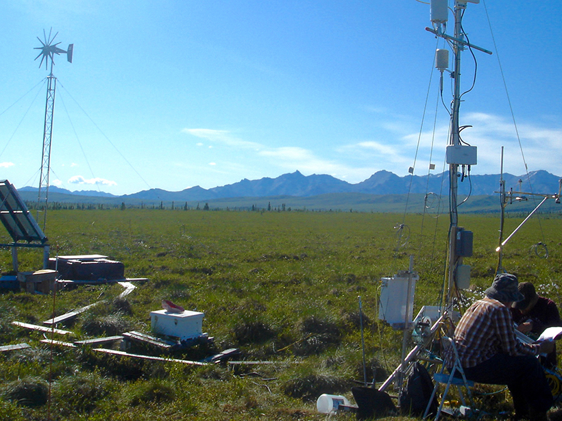
Understanding High-Latitude Methane in a Warming Climate
Climate change could spur greenhouse gas release from the Arctic. A new project will synthesize existing data to improve uncertain predictions.
Posted inNews
NSF’s Budget Details Provide Some Good News for the Geosciences
The budget features significant funding for polar region science, including efforts to document and understand rapid changes in the Arctic and to modernize Antarctic infrastructure.
Posted inNews
Arctic Is Experiencing a Warmer “New Normal,” NOAA Reports
The acting head of the National Oceanic and Atmospheric Administration, Timothy Gallaudet, says the Trump administration is addressing the findings of the agency’s latest annual update on the Arctic.

Posted inResearch Spotlights
Reducing Errors in Satellite-Derived Arctic Sea Ice Thicknesses
Salty snow throws off satellite-based estimates of Arctic sea ice thickness by up to 25%. A new method seeks to fix that.
Posted inResearch Spotlights
Satellites Accurately Capture Ocean Salinity in the Arctic
On-the-ground measurements are notoriously difficult in the harsh environment of the Arctic, but satellites could help close the gap in measuring sea surface salinity.
Posted inNews
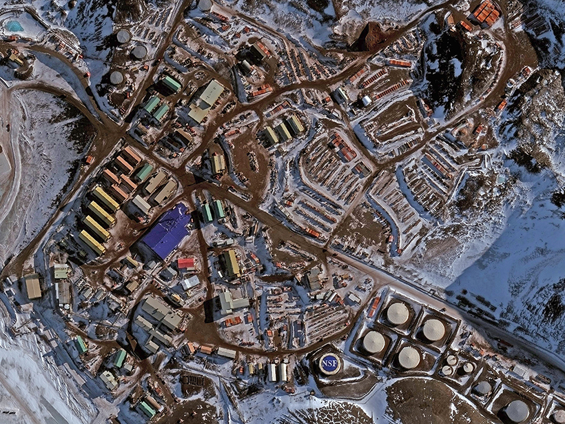
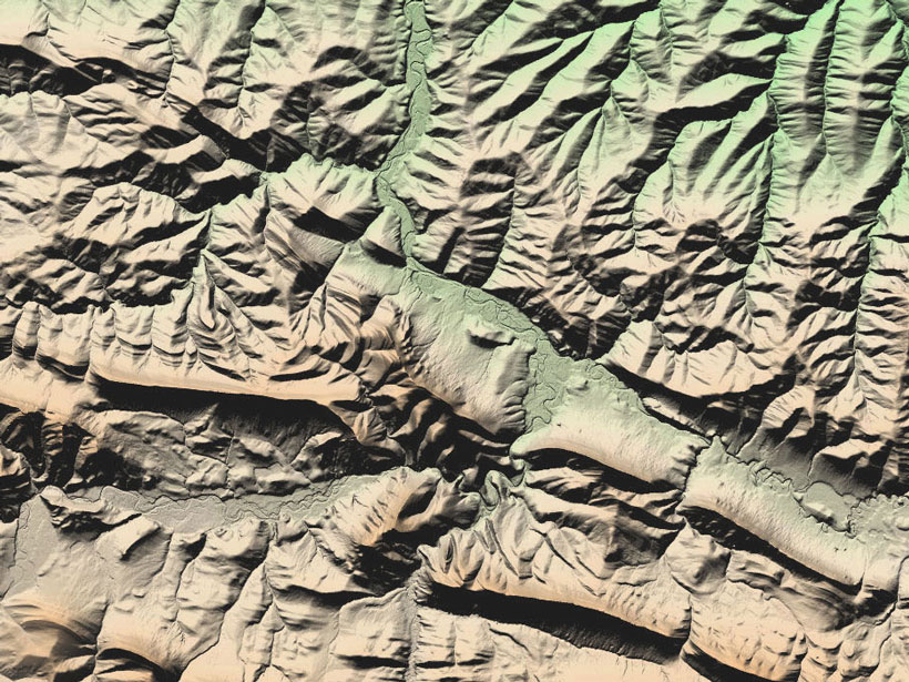
Map Provides High-Resolution Look at Nearly Entire Arctic Region
Researchers highlight the value of the time element incorporated into imagery and having a baseline for revisiting and comparing topography.

Posted inScience Updates
Airborne Platforms Help Answer Questions in Polar Geosciences
International Workshop on Airborne Geodesy and Geophysics with Focus on Polar Applications; Dresden, Germany, 19–21 April 2017
Posted inResearch Spotlights
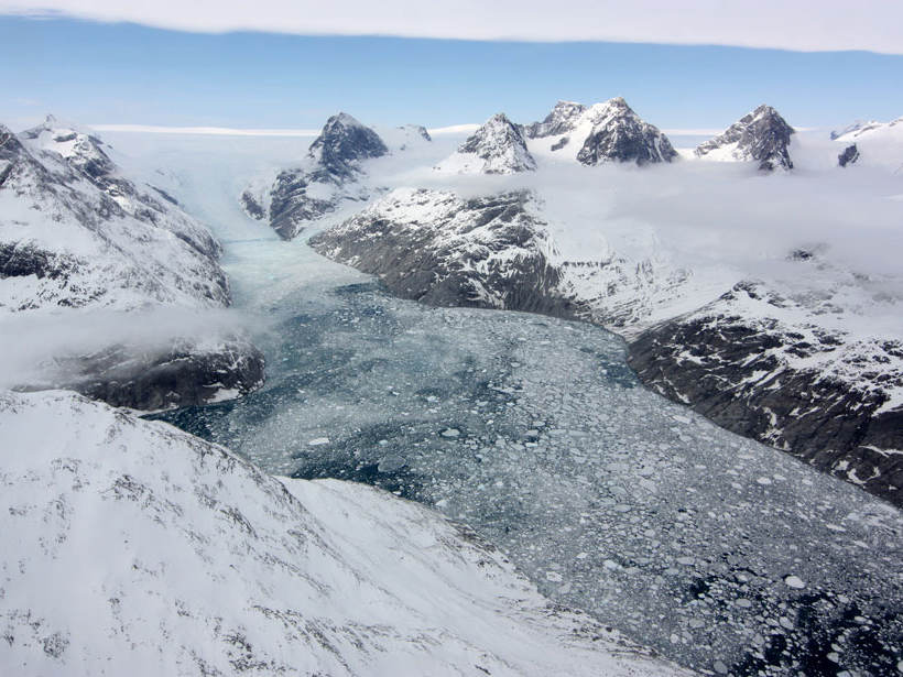
Why Are Arctic Rivers Rising in Winter?
Increased glacial melt is boosting winter streamflows by filling aquifers, a new study on an Alaskan river suggests.

Posted inNews
Engineering New Foundations for a Thawing Arctic
Researchers experiment with new building supports to prepare the Arctic for rapid shifts in permafrost and ground stability.