• About
  • Special Reports
  • Topics
    • Climate
    • Earth Science
    • Oceans
    • Space & Planets
    • Health & Ecosystems
    • Culture & Policy
    • Education & Careers
    • Opinions
  • Projects
    • Postcards From the Field
    • ENGAGE
    • Editors’ Highlights
    • Editors’ Vox
    • Eos en Español
    • Eos 简体中文版
    • Print Archive: 2015–2025
  • Policy Tracker
  • Blogs
    • Research & Developments
    • The Landslide Blog
  • Newsletter
  • Submit to Eos
  • AGU.org
  • Career Center
  • Join AGU
  • Give to AGU
  • About
  • Special Reports
  • Topics
    • Climate
    • Earth Science
    • Oceans
    • Space & Planets
    • Health & Ecosystems
    • Culture & Policy
    • Education & Careers
    • Opinions
  • Projects
    • Postcards From the Field
    • ENGAGE
    • Editors’ Highlights
    • Editors’ Vox
    • Eos en Español
    • Eos 简体中文版
    • Print Archive: 2015–2025
  • Policy Tracker
  • Blogs
    • Research & Developments
    • The Landslide Blog
  • Newsletter
  • Submit to Eos
Skip to content
  • AGU.org
  • Career Center
  • Join AGU
  • Give to AGU
Eos

Eos

Science News by AGU

Support Eos
Sign Up for Newsletter
  • About
  • Special Reports
  • Topics
    • Climate
    • Earth Science
    • Oceans
    • Space & Planets
    • Health & Ecosystems
    • Culture & Policy
    • Education & Careers
    • Opinions
  • Projects
    • Postcards From the Field
    • ENGAGE
    • Editors’ Highlights
    • Editors’ Vox
    • Eos en Español
    • Eos 简体中文版
    • Print Archive: 2015–2025
  • Policy Tracker
  • Blogs
    • Research & Developments
    • The Landslide Blog
  • Newsletter
  • Submit to Eos

cities

The skyline of San Francisco, shrouded by clouds and smog, sits against a pastel blue and orange background.
Posted inENGAGE, News

“Revolutionary” Instrument to Watch North American Skies

Damond Benningfield, Science Writer by Damond Benningfield 17 March 202317 March 2023

TEMPO, scheduled for launch this April, will monitor ozone and other pollutants during hourly daytime scans, providing data for better air quality forecasts and atmospheric models.

Flowchart to choose priority areas for urban forest management.
Posted inEditors' Highlights

Confronting Water Use and Heat Exposure in Urban Sustainability 

by Donald Wuebbles 6 March 20237 June 2023

A framework is proposed for urban forest management to mitigate heat exposure, lessen drought issues, and conserve water use for urban heat mitigation and resilience in environmentally stressed cities. 

Three ants crawl on a vine. The ants and the vine are seen in silhouette with a yellow sunset behind them.
Posted inNews

Ants Aren’t Adapting to Warmer Temperatures

Kimberly M. S. Cartier, News Writing and Production Intern for Eos.org by Kimberly M. S. Cartier 17 February 202317 February 2023

Foraging in hotter-than-desired temperatures could negatively affect ants’ biology and the forest ecosystems that they support.

Vista de satélite de Hong Kong y el mar adyacente. La ciudad se asienta principalmente en los valles de la zona y cercana a las costas, mientras que las montañas presentan pocas manchas urbanas.
Posted inResearch Spotlights

Mapeando estimaciones de la contaminación a nivel de calle para encontrar rutas más seguras

by Morgan Rehnberg 20 December 202220 December 2022

Un nuevo enfoque de alta resolución que combina múltiples tipos de datos detección remota de la contaminación permitió a investigadores desarrollar una aplicación que mapea las rutas más saludables para los transeúntes urbanos.

A 2017 landslide in Freetown, Sierra Leone, killed an estimated 1,100 residents, largely in informal settlements.
Posted inNews

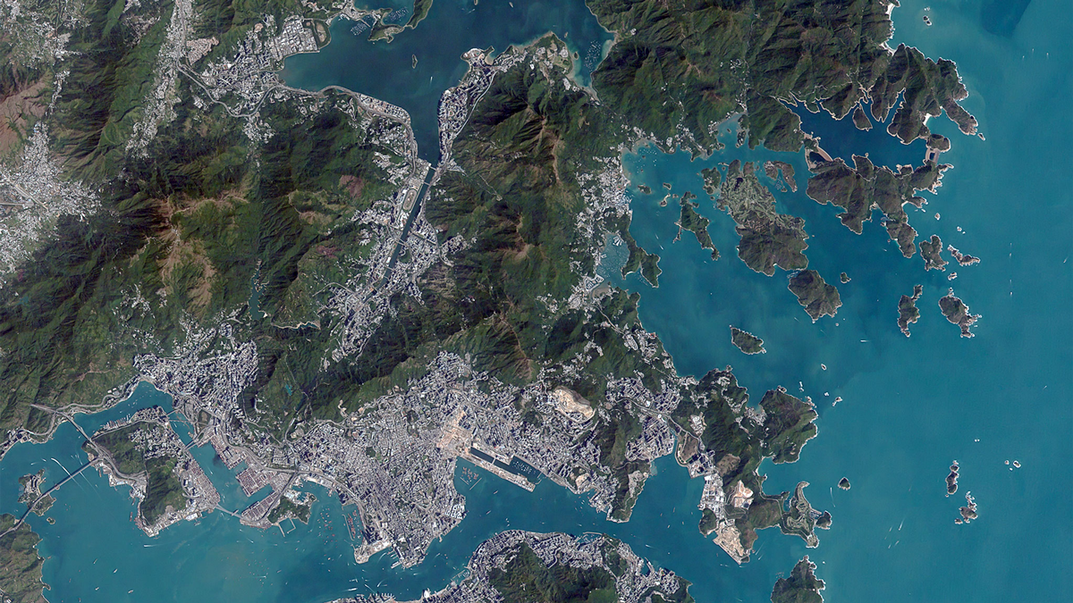
Protecting Poor Neighborhoods from Landslide Risk

by J. Besl 8 December 20221 June 2023

As low-income, informal settlements bloom in the tropics, their risk of landslides increases. A new modeling tool incorporates urbanization factors to protect the region’s poorest neighborhoods.

香港的卫星影像
Posted inResearch Spotlights

通过街道污染估计图选择更健康的通行路线

by Morgan Rehnberg 1 December 20221 December 2022

研究人员采用一种新的高分辨率方法结合多种类型的遥感污染数据,开发出一款应用程序,可为城市通勤者绘制最健康的路线。

Satellite view of Hong Kong
Posted inResearch Spotlights

Mapping Street-Level Pollution Estimates to Reveal Safer Routes

by Morgan Rehnberg 28 November 202220 December 2022

A new high-resolution approach combining multiple types of remotely sensed pollution data allowed researchers to develop an app that maps the healthiest routes for urban commuters.

An oil pump appears in the foreground against a background of buildings.
Posted inENGAGE, News

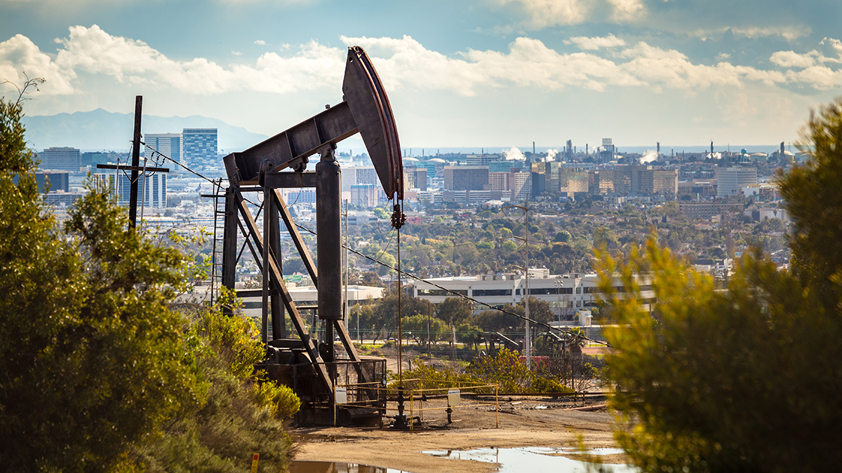
The “Black Gold” Flowing Under Los Angeles

Katherine Kornei, Science Writer by Katherine Kornei 15 November 202222 March 2023

Functioning oil fields, some with cleverly camouflaged infrastructure, are tucked into the urban sprawl of the Los Angeles basin. But recent legislation could change that.

Posted inEditors' Highlights

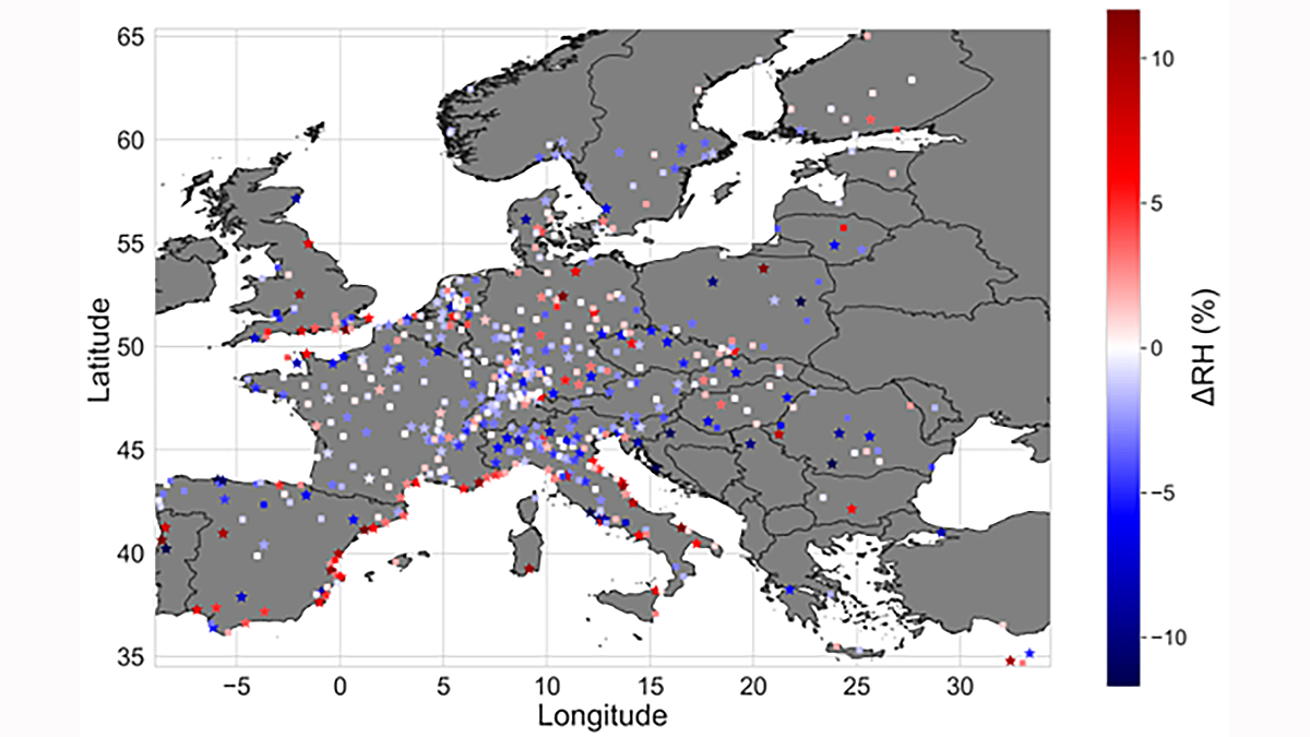
The Lower Humidity of Urban Areas Moderates Outdoor Heat Stress

by Donald Wuebbles 31 October 20222 February 2026

Data scarcity of traditional observations cannot reveal whether surface temperature capture the potential for urban heat stress. This study improves the dataset with 40,000 citizen weather stations.

Skyline of a construction site in Mumbai, India
Posted inENGAGE, News

Indian Cities Invest in Low-Cost Air Quality Sensors

by Deepa Padmanaban 19 October 202228 October 2022

The sensors help bridge gaps in air quality data due to critical shortages of government monitoring stations.

Posts pagination

Newer posts 1 … 4 5 6 7 8 … 17 Older posts
Over a dark blue-green square appear the words Special Report: The State of the Science 1 Year On.

Features from AGU Publications

Research Spotlights

Improving Eddy Tower Evapotranspiration Estimates

20 May 202620 May 2026
Editors' Highlights

Recycled Rocks Reveal Subduction Zone Dynamics Off Baja California

21 May 202621 May 2026
Editors' Vox

The Impact of Advocacy: American Geophysical Union’s Days of Action

14 May 202613 May 2026
Eos logo at left; AGU logo at right

About Eos
ENGAGE
Awards
Contact

Advertise
Submit
Career Center
Sitemap

© 2026 American Geophysical Union. All rights reserved Powered by Newspack