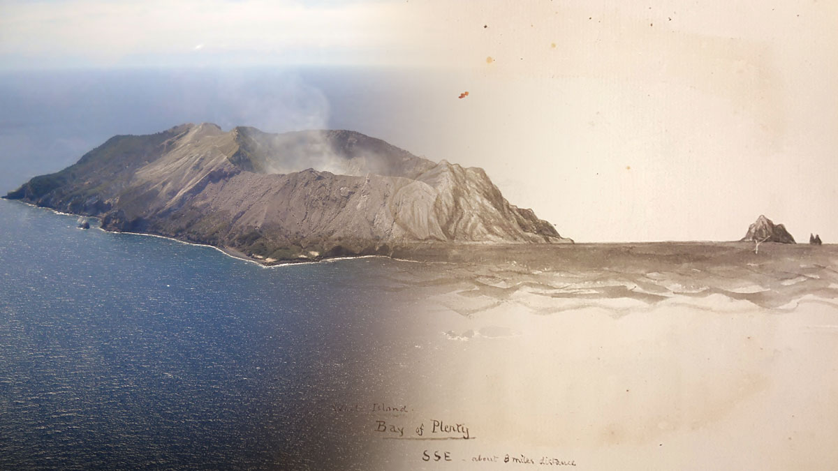
• About
  • Special Reports
  • Topics
    • Climate
    • Earth Science
    • Oceans
    • Space & Planets
    • Health & Ecosystems
    • Culture & Policy
    • Education & Careers
    • Opinions
  • Projects
    • Postcards From the Field
    • ENGAGE
    • Editors’ Highlights
    • Editors’ Vox
    • Eos en Español
    • Eos 简体中文版
    • Print Archive: 2015–2025
  • Policy Tracker
  • Blogs
    • Research & Developments
    • The Landslide Blog
  • Newsletter
  • Submit to Eos
  • AGU.org
  • Career Center
  • Join AGU
  • Give to AGU
  • About
  • Special Reports
  • Topics
    • Climate
    • Earth Science
    • Oceans
    • Space & Planets
    • Health & Ecosystems
    • Culture & Policy
    • Education & Careers
    • Opinions
  • Projects
    • Postcards From the Field
    • ENGAGE
    • Editors’ Highlights
    • Editors’ Vox
    • Eos en Español
    • Eos 简体中文版
    • Print Archive: 2015–2025
  • Policy Tracker
  • Blogs
    • Research & Developments
    • The Landslide Blog
  • Newsletter
  • Submit to Eos
Skip to content
  • AGU.org
  • Career Center
  • Join AGU
  • Give to AGU
Eos

Eos

Science News by AGU

Support Eos
Sign Up for Newsletter
  • About
  • Special Reports
  • Topics
    • Climate
    • Earth Science
    • Oceans
    • Space & Planets
    • Health & Ecosystems
    • Culture & Policy
    • Education & Careers
    • Opinions
  • Projects
    • Postcards From the Field
    • ENGAGE
    • Editors’ Highlights
    • Editors’ Vox
    • Eos en Español
    • Eos 简体中文版
    • Print Archive: 2015–2025
  • Policy Tracker
  • Blogs
    • Research & Developments
    • The Landslide Blog
  • Newsletter
  • Submit to Eos

disaster preparedness

Three rescue workers search through the rubble of a building destroyed by the 1999 Izmit earthquake in Turkey.
Posted inNews

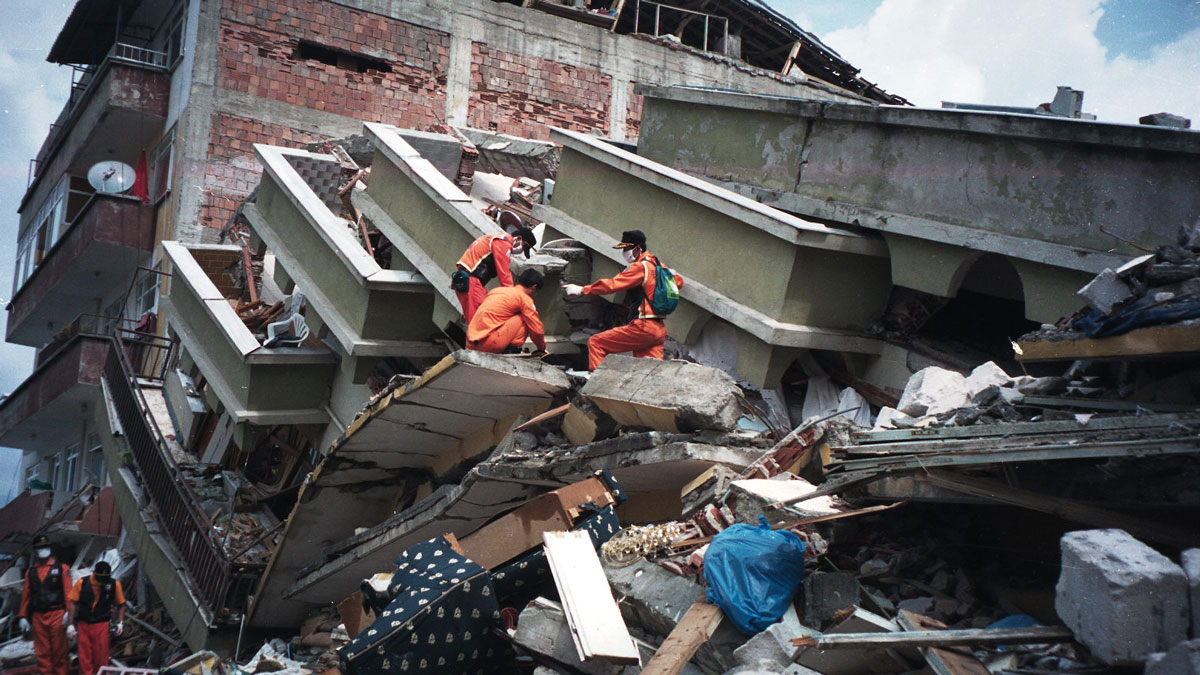
Do Earthquakes and Tectonic Plates Have a Two-Way Relationship?

Tim Hornyak, Science Writer by Tim Hornyak 18 April 20223 October 2022

A catastrophic earthquake in Turkey in 1999 changed the motion of the Anatolian plate, according to a study that could change the fundamentals of quake models.

Mangrove forest
Posted inNews

After a Hurricane, Coastal Systems Draw a Line in the Sand

by J. Besl 13 April 202213 April 2022

A new study finds nature can’t have it both ways: On the basis of thousands of case studies from dozens of hurricanes, there’s always a trade-off between resistance and resilience.

Maps of debris flow similarity index (DFSI) and the corresponding lengths of those debris flow channel segments.
Posted inEditors' Highlights

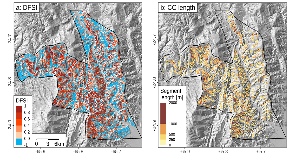
Debris Flows Keep the Landscape on the Straight and Narrow

by Adam Booth 6 April 20223 May 2022

New methods for identifying debris flow-shaped channels improve hazard quantification and highlight how high uplift rates and fractured bedrock facilitate debris flow-dominated landscape evolution.

A volcanic eruption spews molten rock into the sky.
Posted inNews

Magma Lingers at Different Depths on the Basis of Its Water Content

Katherine Kornei, Science Writer by Katherine Kornei 4 April 202225 April 2022

The discovery, gleaned from observations of volcanoes on four continents, could help constrain models of volcanic eruptions.

Skyline of the downtown business district of Addis Ababa, Ethiopia
Posted inNews

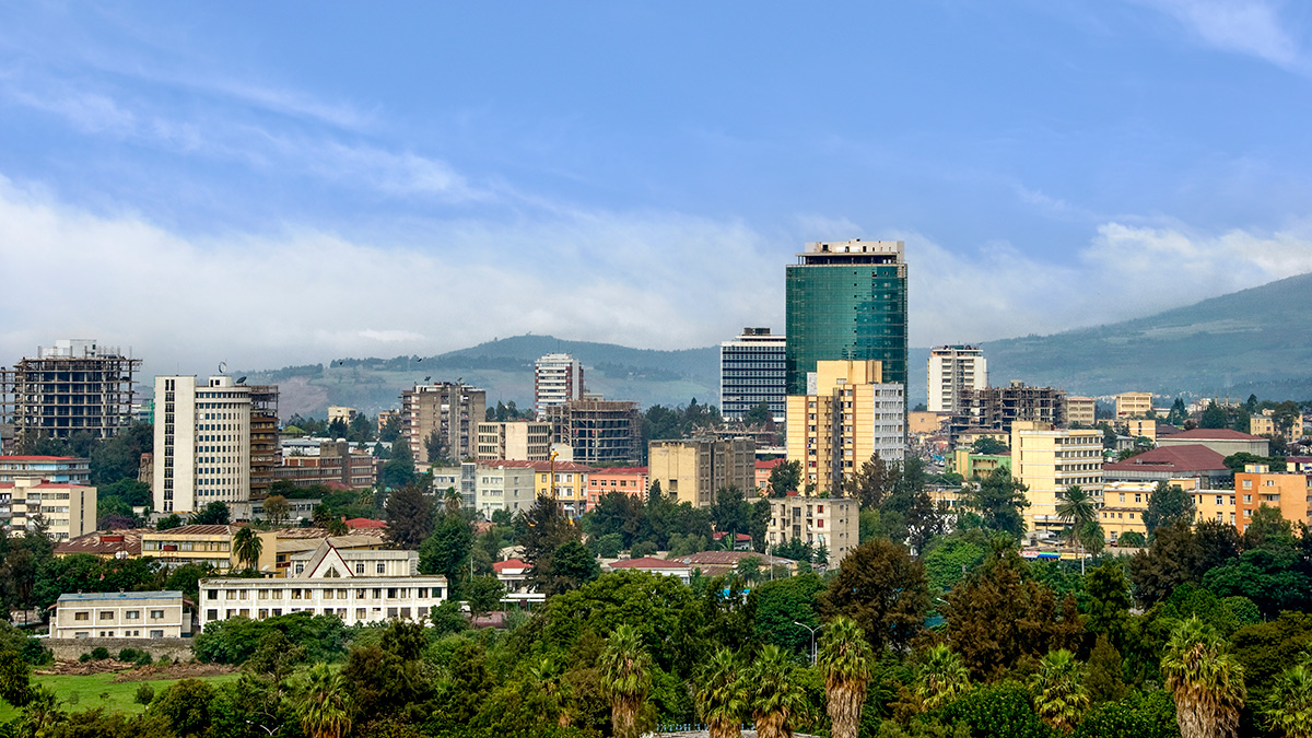
New Hazard Exposure Model for Africa

by Munyaradzi Makoni 31 March 202231 March 2022

The rapid pace of urbanization could encroach on hazard-prone regions without adequate land management and building design regulations, a new modeling project shows.

Fires burn over the mountains close to Lake Elsinore, Calif., on 9 August 2018.
Posted inNews

Wildfires Will Worsen, Warns U.N. Report

by Meghie Rodrigues 30 March 20227 September 2022

From the equator to the Arctic, wildfires are likely to increase, and climate change can make them worse, according to a new United Nations report. Action is still possible, say the authors.

An image of the Bean (Cloud Gate) located in Millennium Park in Chicago
Posted inResearch Spotlights

Estimating Heat Wave Frequency and Strength: A Chicago Case Study

by Saima May Sidik 10 March 202220 April 2022

Numerical modeling shows widespread impacts of the 2012 Chicago heat wave, shedding light on heat wave and urban heat island impacts on the city’s temperature.

Overhead shot of a flooded river in the center of Hue, Vietnam
Posted inNews

New Tool Crafts Fast, Free Flood Maps for the Global South

by J. Besl 2 November 202130 September 2022

A new online program can quickly map the outlines of past floods, allowing data-scarce countries to prepare for future disasters.

Supercell thunderstorm over Kansas
Posted inNews

Supercell Thunderstorms Shake Up the Stratosphere

by Jordan Wilkerson 28 October 20218 March 2022

Supercell storm tops may act like mountains that obstruct winds, transforming their flow into violent turbulence that mixes near-surface air with the stratosphere above.

Snow-covered Fimmvörðuháls, close to Eyjafjallajökull, where white ash and steam are tinged red by lava erupting from a fissure
Posted inENGAGE, News

The Understudied Risks of Low-Magnitude Eruptions

Kate Wheeling, freelance science writer by Kate Wheeling 14 September 202129 March 2023

Volcanologists have historically focused on the risks of large-scale eruptions, but new research highlights how small eruptions can combine with human-made vulnerabilities to cause catastrophic impacts.

Posts pagination

Newer posts 1 … 7 8 9 10 11 … 20 Older posts
Over a dark blue-green square appear the words Special Report: The State of the Science 1 Year On.

Features from AGU Publications

Research Spotlights

How Wildfires Worsen Flood Risk

30 April 202630 April 2026
Editors' Highlights

Drivers of Day-to-Day Temperature Swings Across Continents

1 May 20261 May 2026
Editors' Vox

Hydrothermal Heat Flow as a Window into Subsurface Arc Magmas

28 April 20261 May 2026
Eos logo at left; AGU logo at right

About Eos
ENGAGE
Awards
Contact

Advertise
Submit
Career Center
Sitemap

© 2026 American Geophysical Union. All rights reserved Powered by Newspack