
Supercell storm tops may act like mountains that obstruct winds, transforming their flow into violent turbulence that mixes near-surface air with the stratosphere above.
disaster preparedness
Posted inENGAGE, News
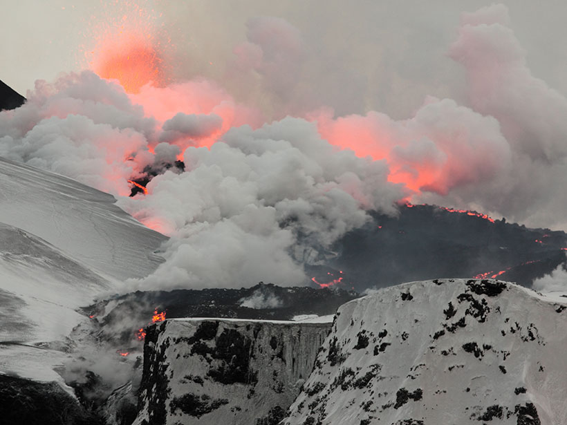
The Understudied Risks of Low-Magnitude Eruptions
Volcanologists have historically focused on the risks of large-scale eruptions, but new research highlights how small eruptions can combine with human-made vulnerabilities to cause catastrophic impacts.
Posted inScience Updates
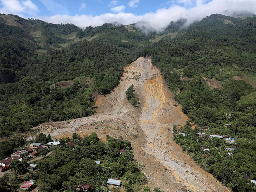
Satellites Support Disaster Response to Storm-Driven Landslides
Extreme precipitation can trigger deadly landslides. Satellite-based tools provide regional perspectives on landslide hazards, help assess risks in near-real time, and guide emergency responses.

Posted inNews
A Road Map for Climate Retreat
Scientists say managed retreat from climate-related dangers has to start now, and they are exploring potential guidelines for response and adaptation.
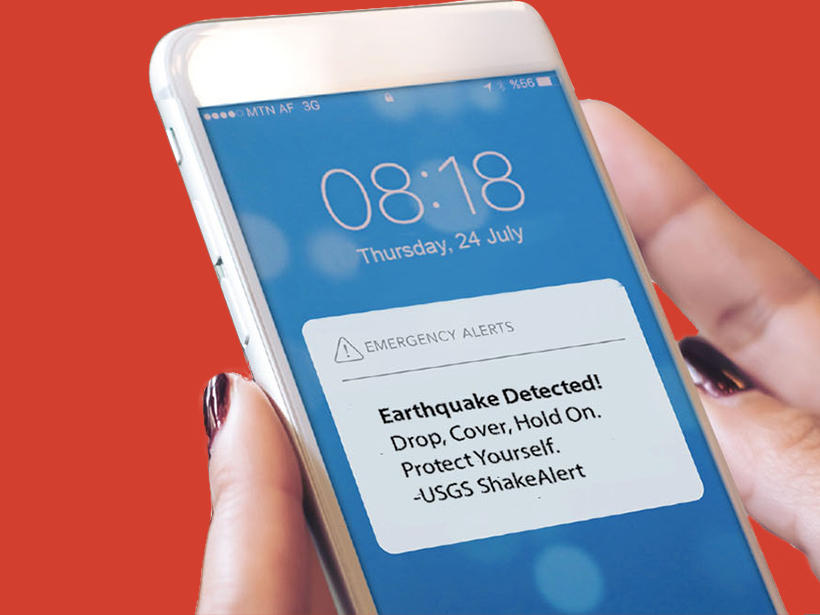
Posted inEditors' Highlights
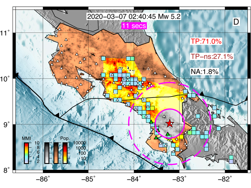
Good, Soon, and Cheap – Earthquake Early Warning by Smartphone
Fixed smartphone networks can provide robust early warning of earthquakes at far lower costs than traditional scientific arrays, which is an important consideration for regions with limited resources.

Posted inFeatures
Better Subseasonal-to-Seasonal Forecasts for Water Management
Emerging methods that improve precipitation forecasting over weeks to months could support more informed resource management and increase lead times for responding to droughts and floods.

Posted inNews
Indian Cities Prepare for Floods with Predictive Technology
The number and intensity of floods are increasing—they can inundate neighborhoods in Chennai in just 15 minutes. New models can pinpoint and help warn vulnerable areas hours or even days in advance.
Posted inFeatures
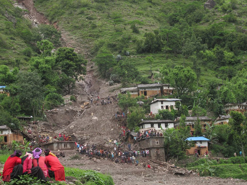
Nepal’s Communities Brace for Multihazard Risks
From its high mountains to its low plains, Nepal faces growing risks from natural hazards. Preparing for these risks requires accurate, locally relevant risk assessments and effective communications.

Posted inNews
Forecasters Navigate a Highway to Success Around Lake Victoria
An early-warning system establishes international networks to help communities manage severe weather on Africa’s largest lake.
Posted inNews
Earthquake Alerts Go Live in the Pacific Northwest
Oregon and Washington residents will receive an alert on their cell phones if they are in danger from an incoming quake.