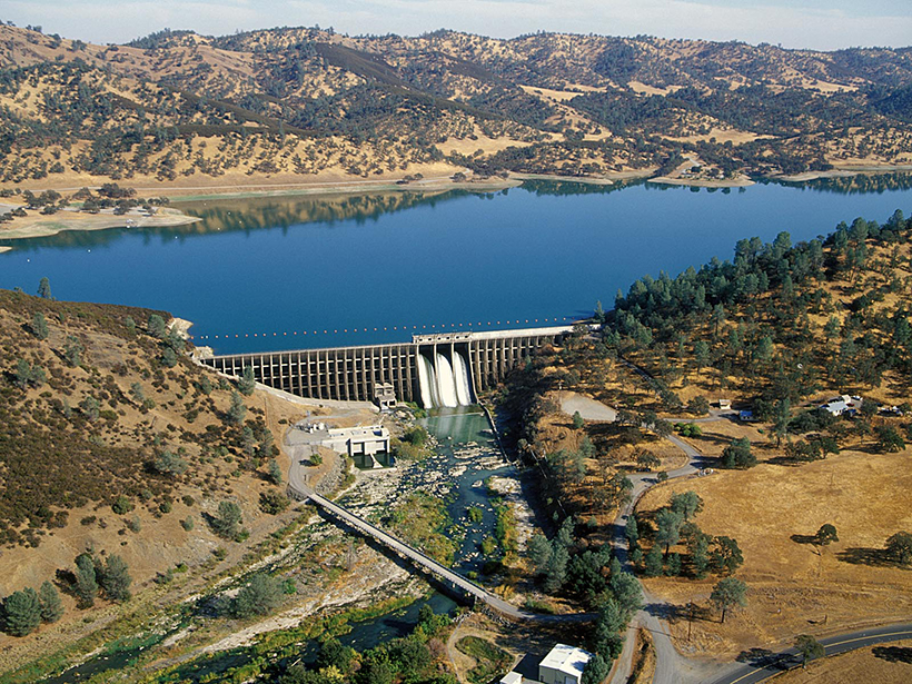
Researchers have created a framework to trace the impacts of climate change and adaptation across energy and water systems in California.
drought

Posted inNews
Simultaneous Drought and Heat Wave Events Are Becoming More Common
As the world heats up, the number and duration of combined stress events are increasing, causing harmful environmental and human impacts.

Posted inResearch Spotlights
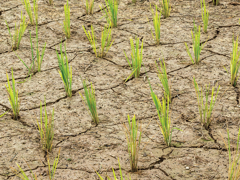
How Heavy Rain and Drought Influence California Crustal Strain
New research using continuous GPS data reveals how multiyear precipitation patterns can amplify the effects of hydrological loading on crustal deformation.
Posted inFeatures
Climate Change Uproots Global Agriculture
Climate change is shifting where ideal growing conditions exist and is leaving farmers behind. How can we secure our future food supply and support the people who grow it?
Posted inNews
Empeora la Crisis Hídrica en el Caribe Oriental
Científicos, políticos y pobladores temen que la actual escasez de agua y los largos períodos de sequía puedan empeorar a medida que cambie el clima y que el Acuerdo de París se haya quedado corto.
Posted inNews
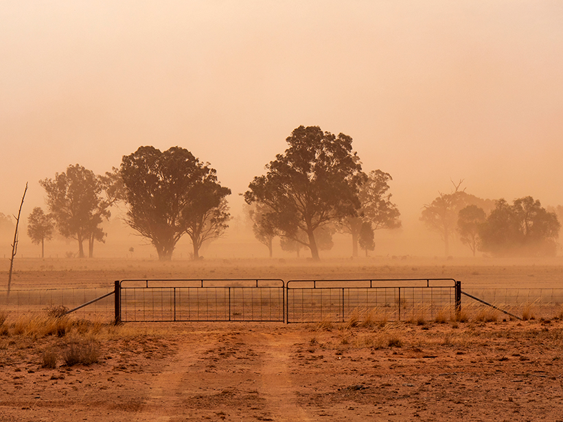
Long-Term Drought Harms Mental Health in Rural Communities
In rural and remote communities in Australia, psychological distress worsened during the first few years of a prolonged drought. Other signs of poor mental health persisted beyond that time.

Posted inNews
Coastal Brazil Is Likely to Face More Heat Waves and Droughts
In 2014, São Paulo experienced its greatest water crisis ever, caused by an intense drought. New research indicates that it is likely to happen again and be even more severe.
Posted inEditors' Highlights
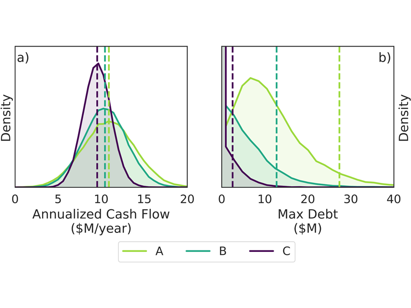
How to Hedge the Risk of Reduced Snowpack for Hydropower
A new index insurance contract – a financial product innovation seeking to cope with climatic variability – could help hydropower operators to manage climate risks.
Posted inResearch Spotlights
Different Models, Different Answers in Water Resource Planning
The experimental design used in climate vulnerability assessments can strongly influence the assessments’ findings and skew decisions about which factors are most important for informing adaptation.

Posted inResearch Spotlights
Megadrought Caused Yellowstone’s Old Faithful to Run Dry
Scientists studying wood samples preserved by Old Faithful have determined that the famous geyser was dormant for several decades during the 13th century due to a megadrought.