
Research unveiled a surprising plateau in plants’ ability to absorb carbon through stomata, which could mean more carbon left in the atmosphere.
everything atmospheric
Posted inEditors' Highlights
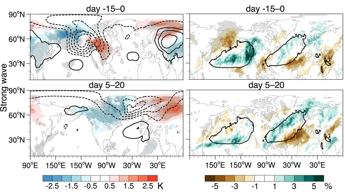
Modeling Stratospheric Impacts on North American Extreme Events
A new study quantifies the tropospheric and surface impacts of extreme stratospheric wave events and evaluates their representation in state-of-the-art climate models.

Posted inENGAGE, News
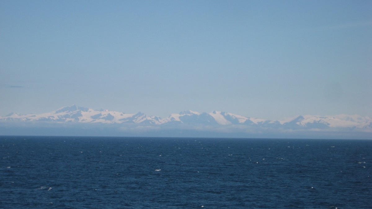
Protein Powder Makes Ice Crystals Flower
Dust from Alaska is particularly effective at forming ice crystals because it contains biological components, researchers believe. The finding has implications for cloud physics and our planet’s climate.
Posted inEditors' Highlights
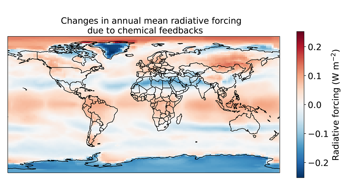
Unexpected Consequences of Solar Geoengineering
Solar engineering is not a substitute for mitigation, and concerns about its risks and unintended impacts are supported by the recent discovery of overlooked atmospheric chemical feedback.

Posted inEditors' Highlights
Observing the Impact of Convective Aggregation on Water Vapor
Remote sensing measurements for water vapor isotopic composition enable us to assess how convective aggregation influences the atmospheric hydrological cycle.
Posted inEditors' Vox
Marine Sediments Reveal Past Climate Responses to CO2 Changes
Climate records stored in marine sediments reveal different ice sheet and ocean responses to falling atmospheric CO2 concentrations from the warm Pliocene to the ice ages of the Pleistocene.
Posted inEditors' Highlights
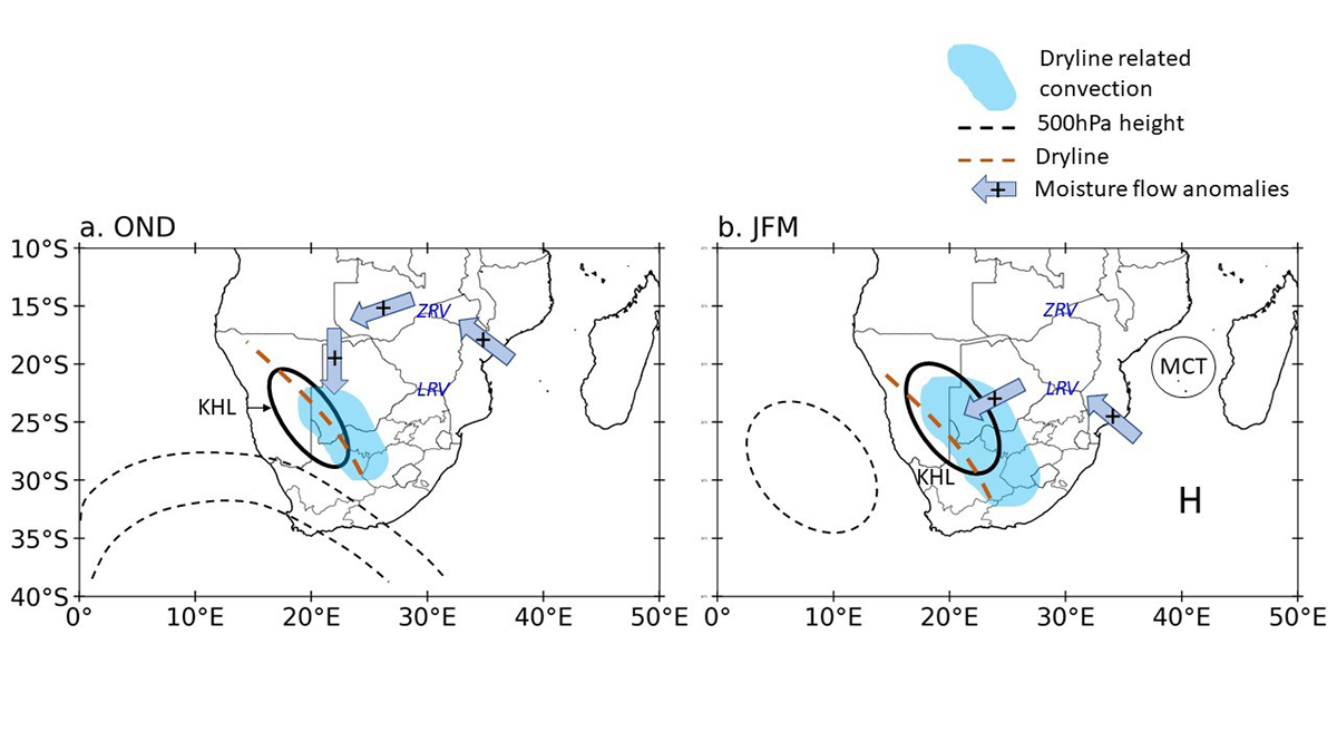
Dryline-Induced Thunderstorms Over the Southern Africa Plateau
Scientists present the first comprehensive study of dryline formation and associated thunderstorms over the southern African plateau from 2010 to 2021.

Posted inResearch Spotlights
Probing Rare Hot Plasma Flows in the Upper Atmosphere
Postmidnight flows appear to be triggered by the same mechanism that drives more frequently observed evening flows.

Posted inEditors' Highlights
Wet Conditions Delay Wildfire Detection
When accompanied by a considerable amount of rainfall, ignition of wildfire by lightning over forested land may not be detected until days later.

Posted inResearch Spotlights
When It’s Too Hot for Fans
Electric fans keep vulnerable people cool in a warming world. But new research shows there are increasing numbers of hours when—and places where—using fans may be dangerous.