
Researchers working on Hawaiian mountain tops precisely synchronized two clocks with unprecedented efficiency, demonstrating the potential to create networks of such clocks for geodesy and more.
geodesy

Posted inNews
Groundwater Pumping Is Causing Mexico City to Sink
Researchers say knowing how much water is being extracted is crucial for addressing infrastructure and water supply crises in the capital.


Posted inResearch Spotlights
New Tectonic Plate Model Could Improve Earthquake Risk Assessment
A new model of tectonic plates in New Zealand may identify areas of increased earthquake likelihood.

Posted inResearch Spotlights
Enhancing Earthquake Detection from Orbit
A new application of machine learning boosts scientists’ ability to use data from satellite navigation systems to detect and warn of earthquakes.

Posted inResearch Spotlights
Models Oversimplify How Melting Glaciers Deform Land
When glaciers melt, the land below deforms. Sea level data show that widely used models oversimplify the process.
Posted inFeatures
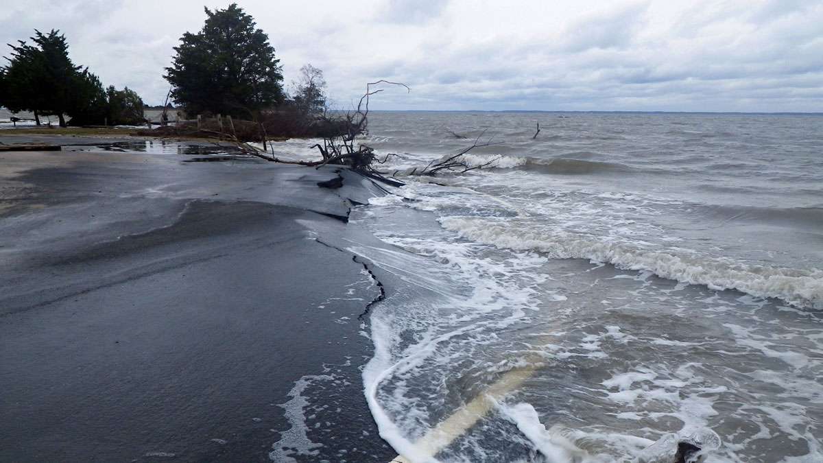
Sea Level Science and Applications Support Coastal Resilience
Known for precise, planetary-scale measurements, NASA is improving its decades-long effort to observe and understand sea levels to help communities prepare for the effects of Earth’s rising ocean.
Posted inResearch Spotlights
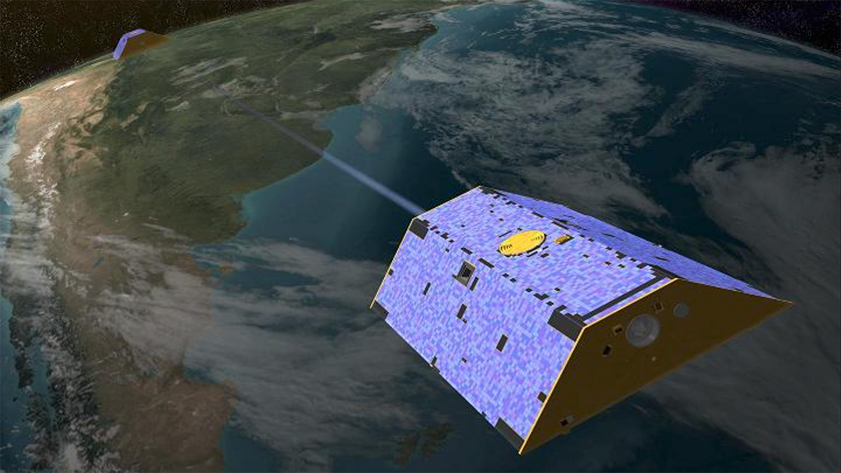
Fresh Approaches to Processing GRACE Data
Two studies showcase new methods for analyzing GRACE data that better match the land surface, producing clearer estimates of mass variations.
Posted inEditors' Highlights
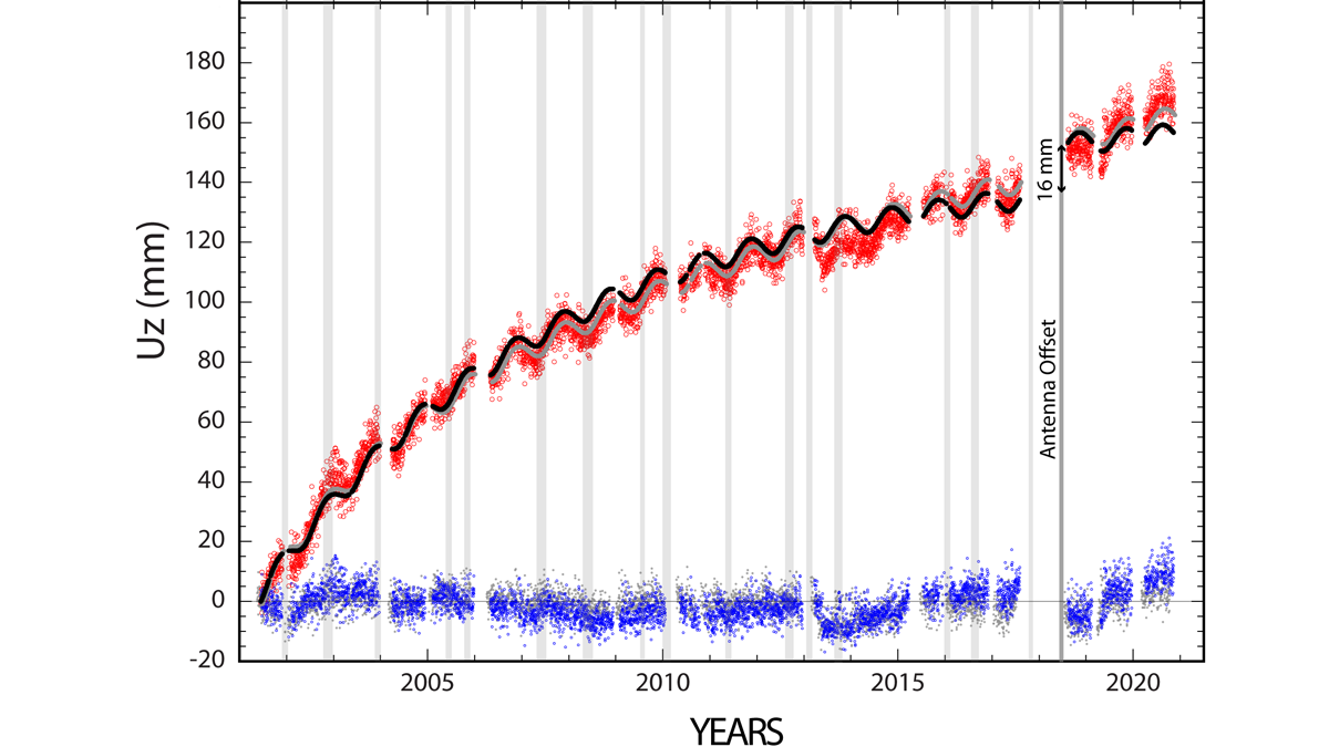
Continuity is the Father of Success
Geodetic measurements indicate that Three Sisters Volcano uplifted by almost 300 millimeters in the past 25 years without significant anomalies at the surface.

Posted inFeatures
Lasers and Ultracold Atoms for a Changing Earth
Applying new technology rooted in quantum mechanics and relativity to terrestrial and space geodesy will sharpen our understanding of how the planet responds to natural and human-induced changes.