A physics-based method estimates the duration of earthquakes’ coseismic phase and can help improve the precision of coseismic slip models and magnitude estimates.
geodesy
Posted inEditors' Highlights
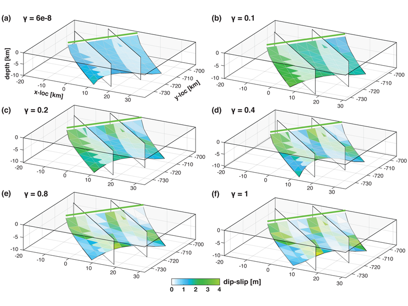
New Inversion Method Improves Earthquake Source Imaging
A new method uses Bayesian inference to jointly invert for non-planar fault geometry and spatially variable slip (with associated uncertainties) in earthquake source modeling, based on geodetic data.
Posted inNews
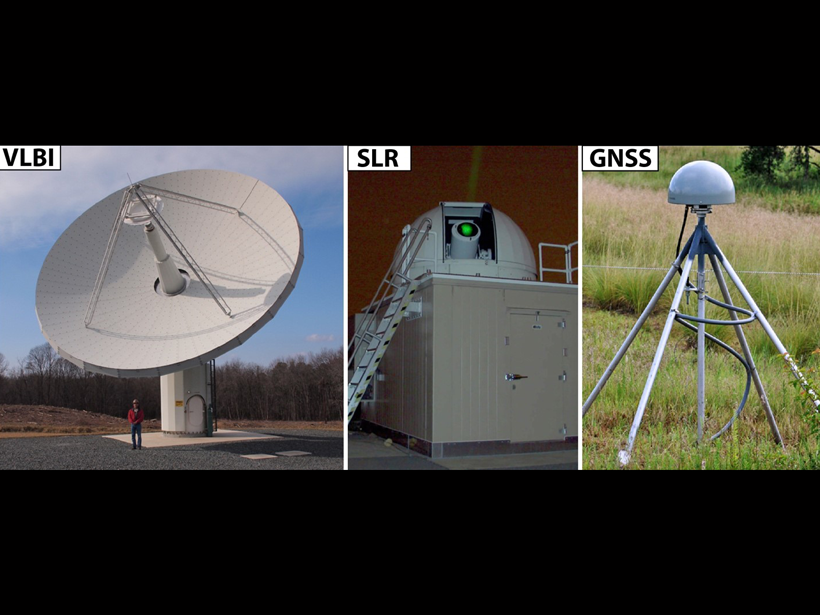
Evolving the Geodetic Infrastructure
Enhancements to the largely invisible framework will enable researchers to investigate pressing questions about our planet’s future.
Posted inAGU News
Kristine M. Larson Receives 2020 Charles A. Whitten Medal
Kristine M. Larson was awarded the 2020 Charles A. Whitten Medal at the virtual AGU Fall Meeting in December. The medal is for “outstanding achievement in research on the form and dynamics of the Earth and planets.”

Posted inEditors' Highlights
Understanding Where and How Magma is Stored
Gravity measurements reveal depth and storage conditions of rhyolitic magma reservoirs beneath the Laguna del Maule volcanic field in Chile.

Posted inScience Updates
Slipping and Locking in Earth’s Earthquake Factories
Geodetic observations collected during back-to-back decadal research campaigns have revealed crucial new insights into the start–stop and slow-motion behavior of subduction zones.

Posted inResearch Spotlights
How Heavy Rain and Drought Influence California Crustal Strain
New research using continuous GPS data reveals how multiyear precipitation patterns can amplify the effects of hydrological loading on crustal deformation.

Posted inOpinions
Charting Satellite Courses in a Crowded Thermosphere
As the number of satellites in low Earth orbit grows by leaps and bounds, accurate calculations of the effects of atmospheric drag on their trajectories are becoming critically important.

Posted inScience Updates
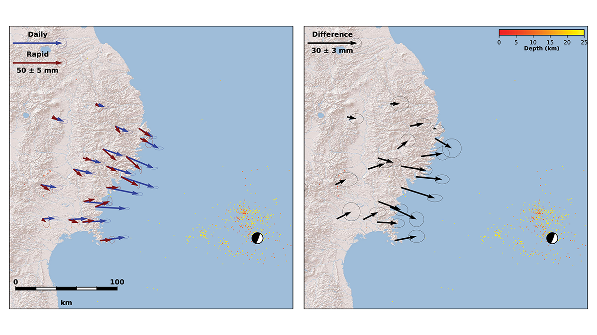
Using Earthquake Forensics to Study Subduction from Space
Researchers combined satellite geodetic measurements of surface motion with a new geophysical data inversion method to probe the Chilean subduction zone in the wake of the 2010 Maule earthquake.

Posted inResearch Spotlights
First Detection of a Built-In Wobble on Another Planet
Spacecraft find that Mars oscillates 10 centimeters off its axis of rotation.