Navigation satellites are enabling high-precision, real-time tracking of ground displacements, supplementing traditional methods for monitoring and assessing earthquakes.
geodesy
Posted inEditors' Highlights
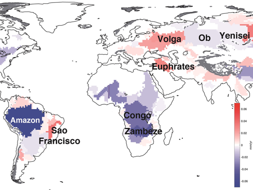
A Closure on Sea Level Rise Budget
Terrestrial water loss may explain the lack of previous budget closure in global mean sea level rise.

Posted inFeatures
Einstein Says: It’s 309.7-Meter O’Clock
Atomic clocks are now so accurate that Earth’s gravity can be seen to slow them down. Geodesy is preparing to use this relativistic effect to measure elevation.
Posted inEditors' Highlights
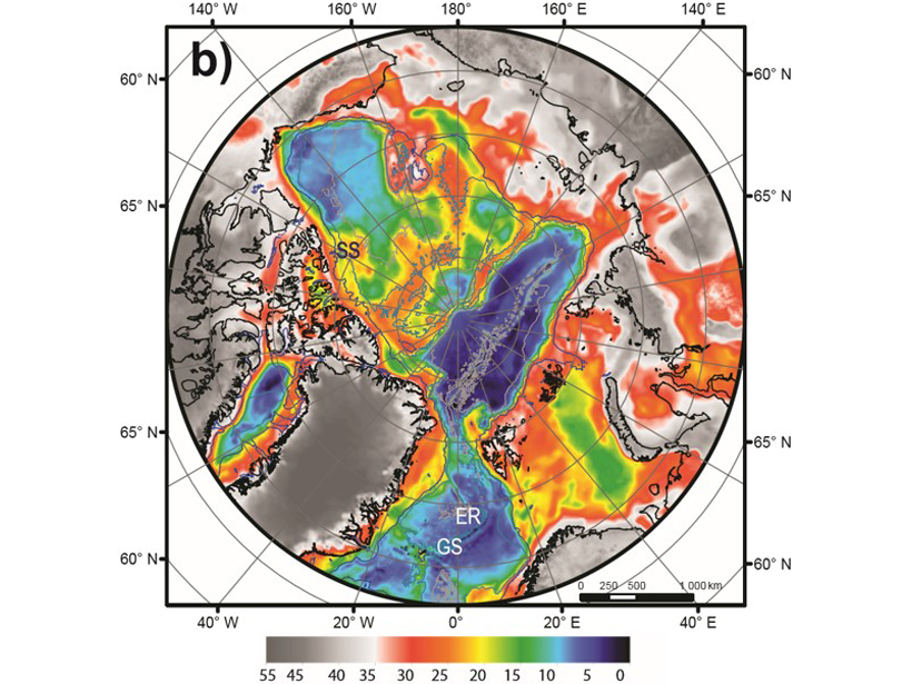
Revealing the Arctic Crust
A new model, ArcCRUST, reveals with unprecedent resolution the geometry and the thermal state of the oceanic crust of the High Arctic and Circum-Arctic domain.

Posted inNews
How Satellite Data Improve Earthquake Monitoring
Case studies from around the world illustrate the power of geodetic data in earthquake monitoring.

Posted inResearch Spotlights
Tracking Earth’s Shape Reveals Greater Polar Ice Loss
Researchers offer a solution to better track mass changes in ocean water and polar ice.

Posted inResearch Spotlights
Déjà Vu: Understanding Subduction Zones’ Cycle of Seismicity
A unique geodetic data set from Japan’s Nankai subduction zone offers an unparalleled opportunity to study surface deformation spanning almost an entire seismic cycle.
Posted inNews
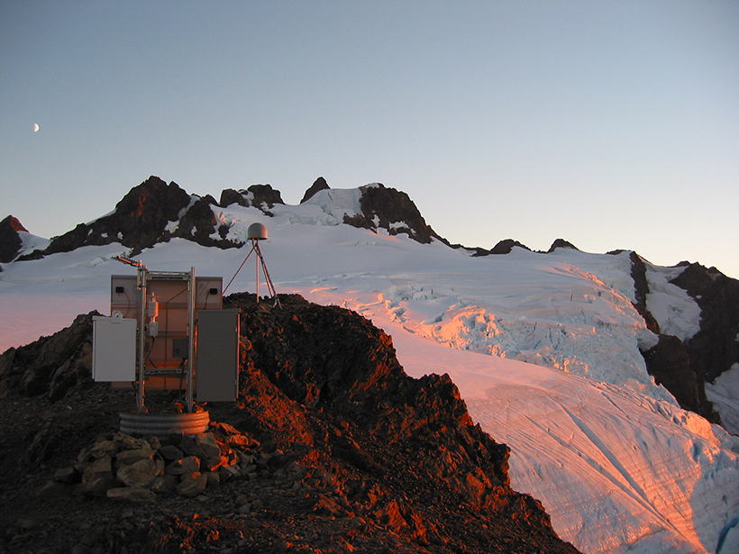
Airborne Gravity Surveys Are Remaking Elevations in the U.S.
Measuring gravity’s tiny fluctuations is giving the United States an upgraded system of elevations.
Posted inResearch Spotlights
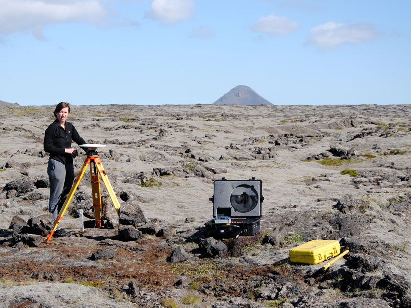
A New Way of Visualizing Iceland’s Crustal Deformation
A novel method of calculating strain rates from GPS data shows the South Iceland Seismic Zone is experiencing rapid deformation, including inflation near the island’s most active volcano.
Posted inScience Updates
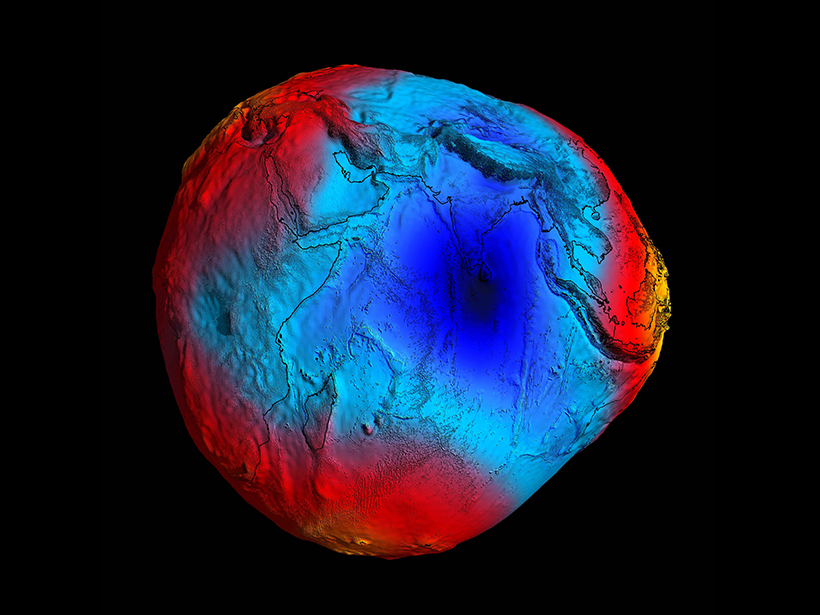
Seismologists Search for the Indian Ocean’s “Missing Mass”
An Indian scientific team set out to sea last year to find clues to the source of an unusually weak gravitational potential in the middle of the Indian Ocean.