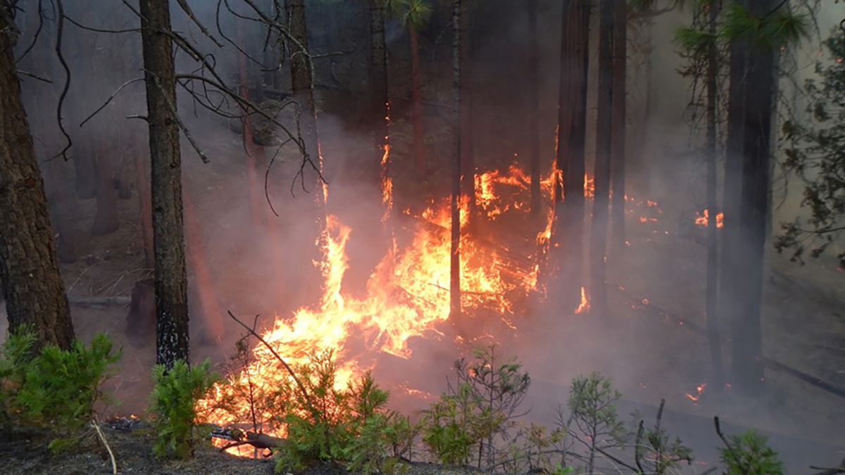
Changes including intensifying drought, expansion into burnable land, and an increase in human-caused ignitions have led to a shift in fire patterns.
mapping
Posted inENGAGE, News
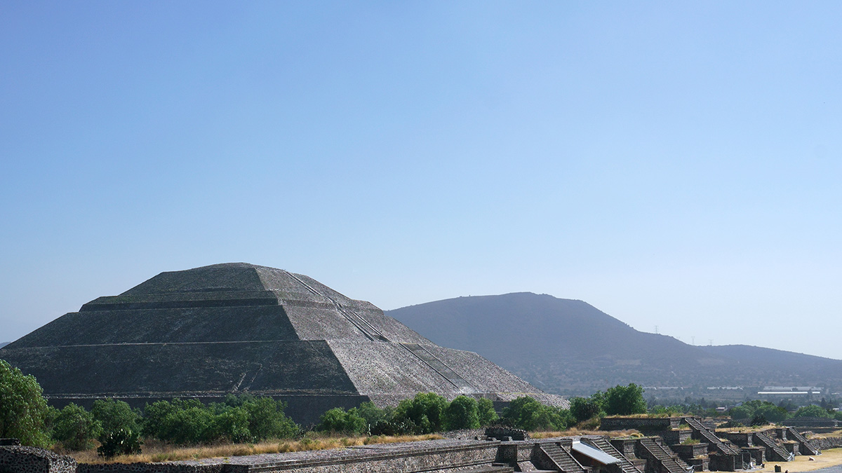
Mapeando el pasado, presente y futuro de Teotihuacan
Un nuevo proyecto con tecnología lidar revela cómo la minería y la expansión urbana han puesto en riesgo a uno de los sitios del patrimonio cultural más icónicos de México.
Posted inNews
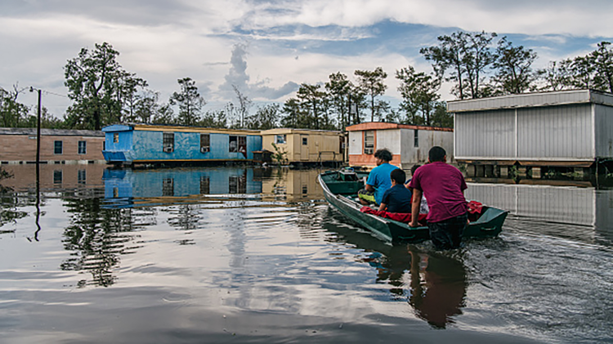
Black Neighborhoods Will Bear Future Flood Burden
Climate change, shifting populations, and infrastructure development in risky areas compound future flood loss risk.
Posted inEditors' Highlights
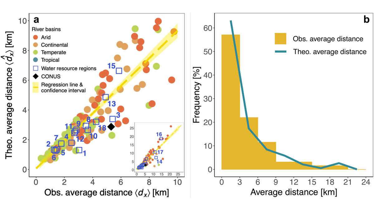
Urbanization and Surface Water Loss Go Together
Mapping surface water loss from satellite data confirms decreases away from urban areas. A simple exponential distance-decay model approximates the impact of urbanization.
Posted inResearch Spotlights
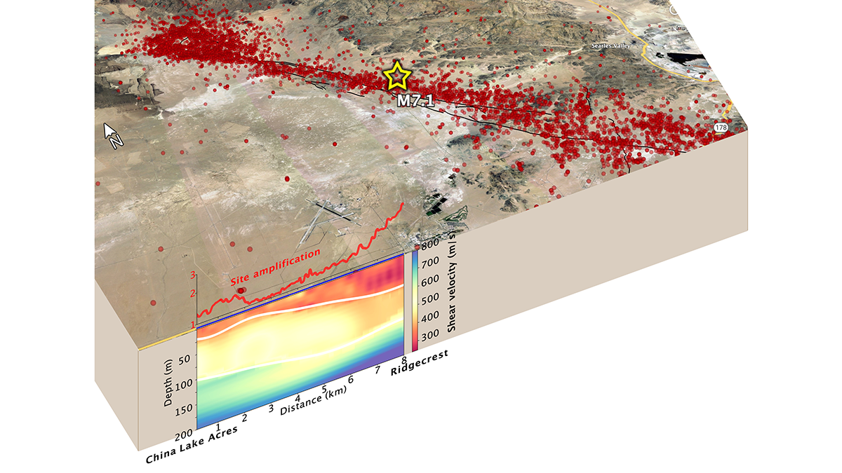
Fiber-Optic Cables Can Produce High-Resolution Underground Maps
Telecom fiber repurposed as distributed acoustic sensing arrays can image near-surface structure and potentially improve seismic hazard mapping in urban areas.

Posted inScience Updates
Mapping a River Beneath the Sea
A recent expedition mapped one of the world’s longest submarine channels, revealing previously undiscovered physical features and raising questions about its unusual origin and shape.

Posted inResearch Spotlights
Machine Learning Algorithms Help Scientists Explore Mars
Researchers applied machine learning algorithms to several distinct chemical compositions of Mars and suggest that these algorithms could be a powerful tool to map the planet’s surface on a large scale.

Posted inENGAGE, News
Mapping Teotihuacan’s Past, Present, and Future
A new lidar project reveals how mining and urban expansion have put one of Mexico’s most iconic cultural heritage sites at risk.
Posted inENGAGE, News
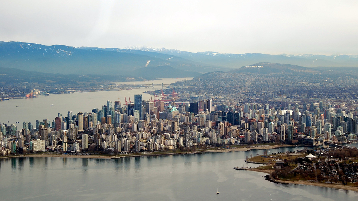
Crowdsourced Science Helps Map Vancouver’s “Smellscape”
Exposure to stinky odors can affect human health, but quantifying smells can be difficult.