Exposure to stinky odors can affect human health, but quantifying smells can be difficult.
mapping

Posted inNews
Una nueva herramienta crea rápida y gratuitamente mapas de inundaciones para el sur global
Un nuevo programa en línea puede trazar rápidamente los contornos de inundaciones pasadas, permitiendo que los países con escasez de datos se preparen para futuros desastres.
Posted inENGAGE, News
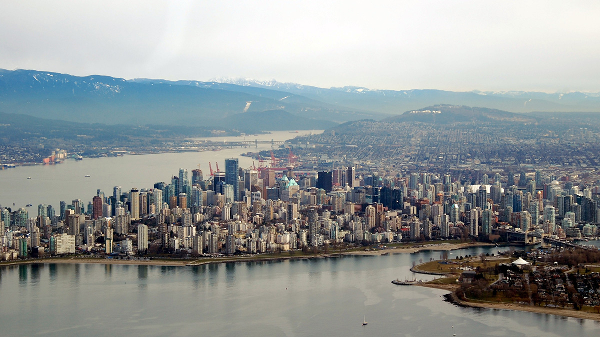
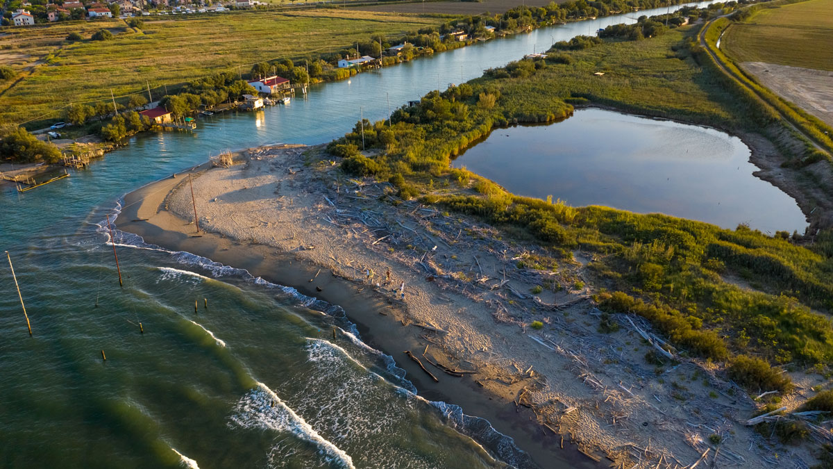
A Global Map of Human Sewage in Coastal Ecosystems
Prodigious quantities of nitrogen from human waste flow into coastal waters, a study of nearly 135,000 watersheds reveals.

Posted inNews
New Tool Crafts Fast, Free Flood Maps for the Global South
A new online program can quickly map the outlines of past floods, allowing data-scarce countries to prepare for future disasters.
Posted inENGAGE, Research Spotlights
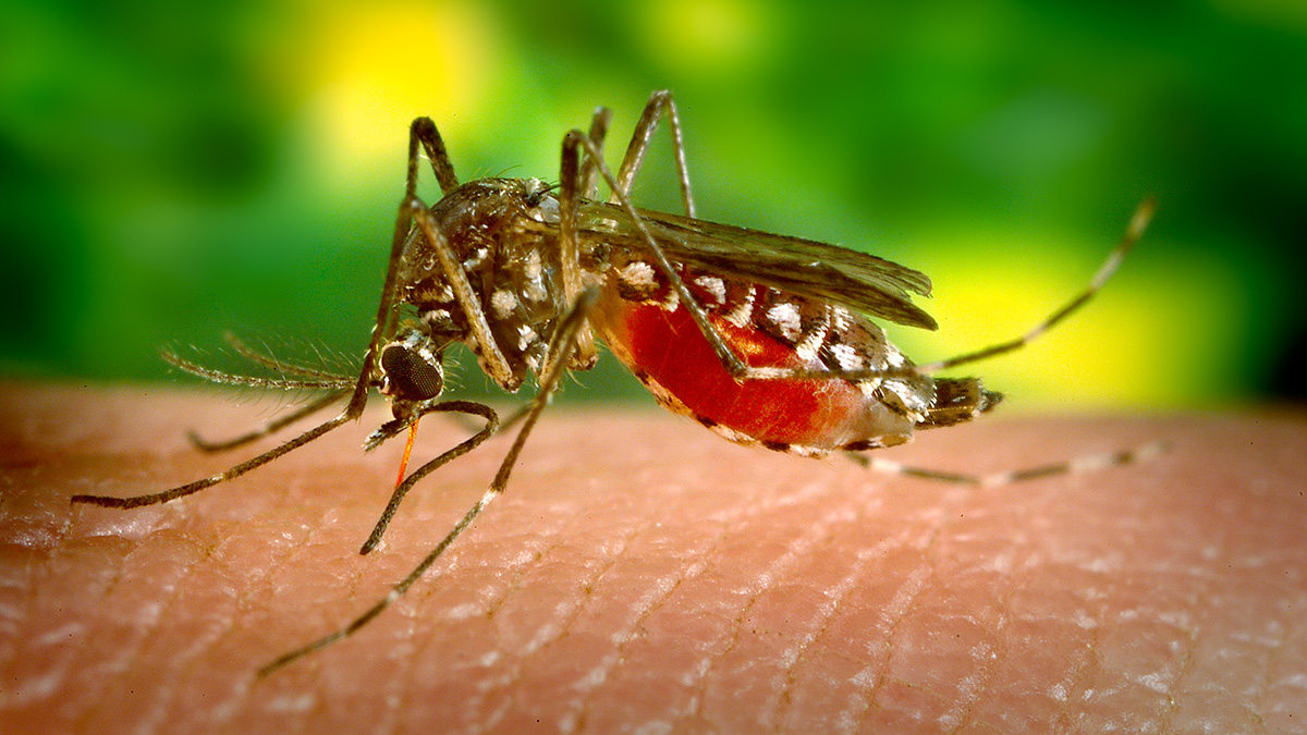
App Tracks Harmful Mosquitos with Help from Crowdsourced Science
While collecting data using an app, volunteers have the chance to support research and fight mosquito populations on the ground.

Posted inFeatures
Joy Santiago: Charting Safety Through Mapmaking
An environmental planner proudly “helping the Filipino people.”

Posted inNews
Cosmological Tool Helps Archaeologists Map Earthly Tombs
A new study employs a method originally developed to help map stars and galaxies to describe how ancient tombs are clustered. The research helps archaeologists studying remote or inaccessible sites.

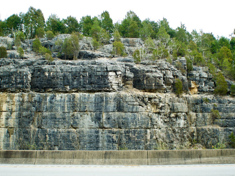
Posted inNews
Detailed Geologic Mapping Helps Identify Health Hazards
A team of geologists and nursing researchers created an interactive radon hazard map for Kentucky residents—and it was possible only because of the high-resolution bedrock mapping in the state.
Posted inNews
Mapping the People, Places, and Problems of Permafrost Thaw
By combining demography data with permafrost maps, researchers provide a first count of the population on permafrost and predict its imminent decline.
Posted inResearch Spotlights
Ciertas formaciones rocosas pueden provocar riesgos de radón en los hogares
Investigadores de Kentucky han combinado resultados de kits de pruebas domésticas con el mapa geológico del estado para elaborar un mapa del potencial de radón en interiores basado en la geología subyacente a las viviendas del estado.