
The mostly unknown Callisto’s H corona is created by a global tenuous H2 atmosphere and not by surface water as previously believed, providing the first evidence for H2 in Callisto’s atmosphere.
Modeling
Posted inResearch Spotlights
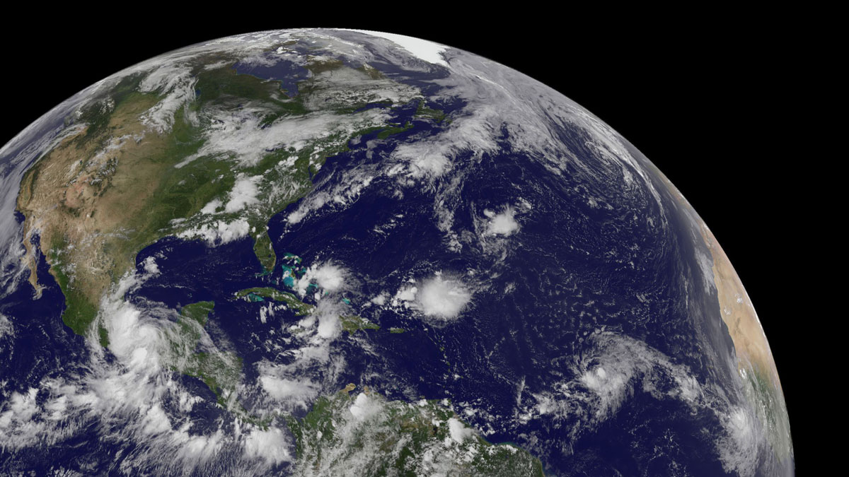
Linking African Winds to Atlantic Storms
Simulations suggest that waves in the atmosphere above northern Africa influence the intensity, timing, and location of formation of Atlantic tropical cyclones.

Posted inEditors' Highlights
Accurate Ocean Tides for Earth System Models
Accurate tide models require self-attraction and loading terms, but can this calculation be done accurately and efficiently for use in global tide and Earth system models?
Posted inEditors' Highlights
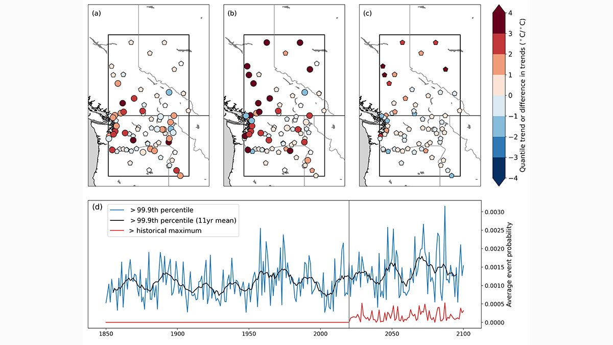
Characteristics of the 2021 Pacific Northwest Heatwave
Examining the 2021 Pacific Northwest heatwave using both historical observations and model simulations.


Posted inFeatures
Are We Entering the Golden Age of Climate Modeling?
Thanks to the advent of exascale computing, local climate forecasts may soon be a reality. And they’re not just for scientists anymore.

Posted inNews
A Day in the Life Used to Be 17 Hours
The Moon was a lot closer to Earth 2.46 billion years ago, and the shorter distance contributed to shorter days.

Posted inResearch Spotlights
Measuring the Ins and Outflows of Estuaries
Scientists modeled monitoring schemes in three different estuaries to determine instrument layouts that could effectively and efficiently measure exchanges of salt water and freshwater.
Posted inEditors' Highlights
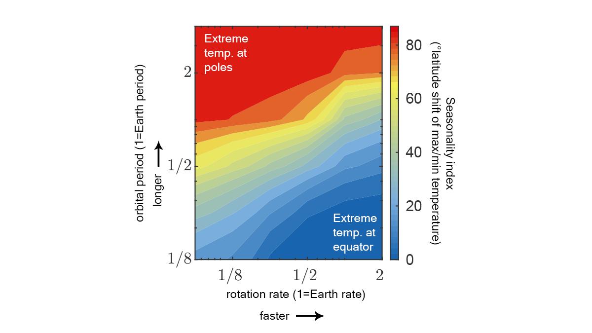
Extremeness of Seasons Determined by Planetary Motion Parameters
We’ve long known that a planet’s orbital period and tilt determine length and intensity of seasons. We now see rotation rate matters too: max temperature shifts poleward as rotation slows.

Posted inEditors' Vox
Machine Learning Helps to Solve Problems in Heliophysics
A new special collection invites papers pertaining to the use of machine learning techniques in all sub-fields of heliophysics.