
Airborne radar from the Recovery Glacier system demonstrates the importance of characterizing the underlying causes of ice flow speedup to understand how glacial discharge could change in the future.
radar & radio

Posted inResearch Spotlights
New Antenna Design Could Improve Satellite Communications
A novel antenna design promises to improve bandwidth and allow for better communication between Earth stations and satellites.
Posted inNews
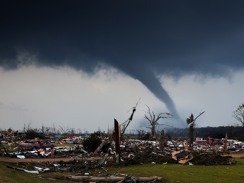
Westward Expansion, Technology, and Tornado Fatalities
By mining records from 1808 to 2017, researchers can now show just how many lives have likely been saved by technology like radar.
Posted inEditors' Highlights
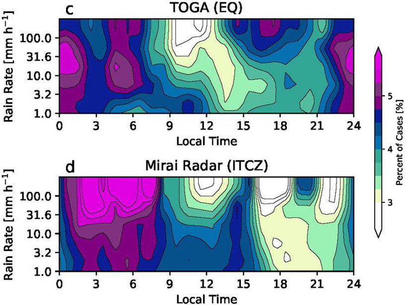
Diurnal Variation of Rainfall over the Equator Revisited
Radar data show an afternoon precipitation maximum in the equatorial Indian Ocean in addition to the nocturnal maximum; this occurs under light surface winds and suppressed large-scale convection.

Posted inOpinions
Wireless Frequency Sharing May Impede Weather Satellite Signals
The delivery of weather satellite imagery is reliable today, but will it stay that way in the future?

Posted inResearch Spotlights
Peering Beneath the Powder: Using Radar to Understand Avalanches
High-resolution radar images from Switzerland’s experimental test site show that snow temperature is a key factor in classifying avalanche behavior.
Posted inEditors' Highlights
Continental Convection Reaches New Highs
Ten years of high-resolution gridded NEXRAD radar data provide a new data set to quantify tropopause-overshooting convection over the continental United States.
Posted inNews
A Decade of Atmospheric Data Aids Black Hole Observers
Astrophysicists are using a global atmospheric model to help them coordinate a multicontinent, radio-frequency observing campaign to gaze at the black hole at the center of the Milky Way.
Posted inEditors' Highlights
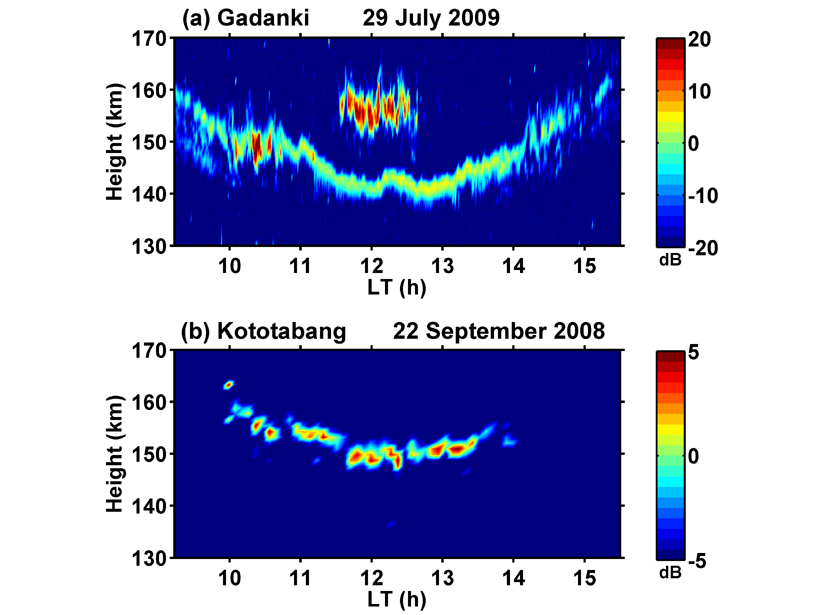
New Observations of Mysterious Radar Echoes
Exploring the relationship between solar extreme ultraviolet radiation flux and 150-km radar echoes.

Posted inResearch Spotlights
A Better Way to Probe Peat
Florida scientists use ground-penetrating radar to image underground carbon stores in the Disney Wilderness Preserve.