
Naval radio signals may cause the formation of a barrier observed during geomagnetic storms that is seemingly impenetrable by relativistic electrons.
radar & radio

Posted inEditors' Highlights
Streamer Corona Discharges in Thunderstorms Detected from Space
Concurrent detection from space and the ground of blue optical flashes from streamer corona discharges at altitudes between 8.5 and 14 kilometers and radio waves.

Posted inNews
Space Weather Lessons from a 1928 Dirigible Debacle
Analysis of a disrupted SOS signal during an early polar expedition showcases the importance of taking space weather into account when exploring new frontiers.
Posted inNews
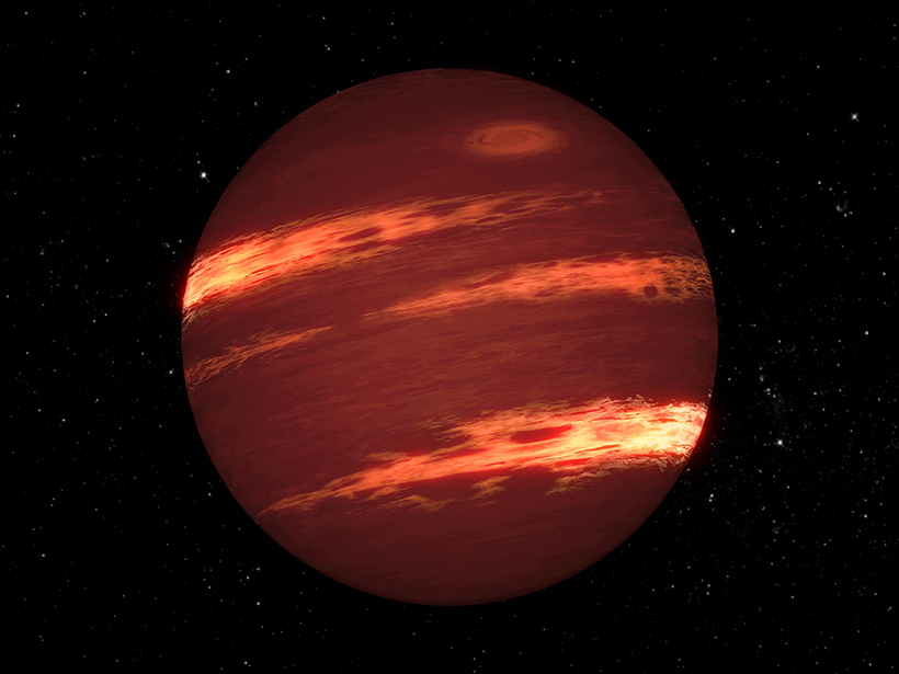
Record-Setting Winds on a Nearby Brown Dwarf
Infrared and radio observations reveal zonal winds moving faster than 2,000 kilometers per hour on a “failed star” in our celestial neighborhood.

Posted inEditors' Highlights
Using Earth’s Atmosphere as a Solar Flare Monitor
Measurements of very-low frequency radio signal phase and amplitude can detect upper atmosphere changes caused by solar flares, enabling us to monitor flare occurrence and intensity.
Posted inNews
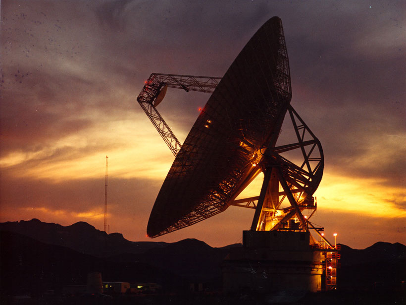
More Than Just Astronomy: Radio Telescopes for Geophysics
Linking an existing network of radio telescopes with satellite radar would make it possible to measure ground displacements in a globally consistent way, scientists propose.

Posted inEditors' Highlights
Machine Learning Improves Satellite Rainfall Estimates
A new deep learning approach bridges ground rain gauge and radar data with spaceborne radar observations of Tropical Rainfall Measuring Mission to improve precipitation estimation.

Posted inNews
Vintage Radar Film Tracks What’s Beneath Antarctic Ice
The newly digitized data double the timescale of ice-penetrating radar monitoring in some of the fastest changing areas of Antarctica.
Posted inEditors' Highlights
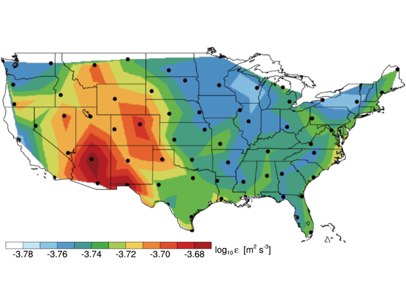
Radiosondes Measure Atmospheric Turbulence Over North America
Analyses of high-resolution radiosonde balloon measurements have provided a novel climatology of atmospheric turbulence parameters in the troposphere and lower stratosphere.

Posted inResearch Spotlights
Missing Lakes Under Antarctic Ice Sheets
New radio sounding study finds little evidence of lakes under Antarctica’s Recovery Glacier.