
Studies since 2018 have provided competing explanations of bright radar reflections from the base of the south polar ice cap.
radar & radio

Posted inEditors' Highlights
Can Aurora Enhance Radar Monitoring of Arctic Aviation?
Enhanced E-region ionization produced by the aurora can be used to reflect signals from over-the-horizon radars and thus enable those radars to better monitor aviation in Arctic regions.
Posted inEditors' Vox
Expanding the Scope of Radio Science
AGU’s Radio Science journal announces an expansion in scope in response to technological developments and welcomes Technical Reports presenting measurements and experimental studies.

Posted inResearch Spotlights
A Transition Zone Below Jupiter’s Clouds
The microwave radiometer aboard NASA’s Juno spacecraft reveals the hidden atmospheric circulations at work deep below Jupiter’s colorful clouds.
Posted inEditors' Highlights
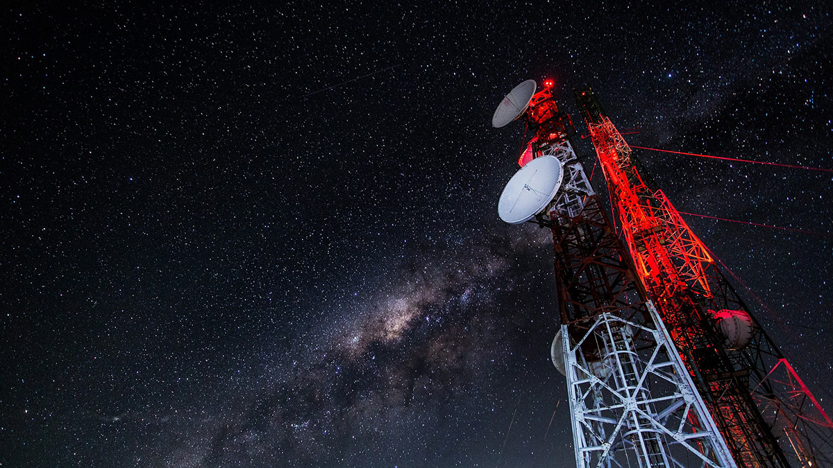
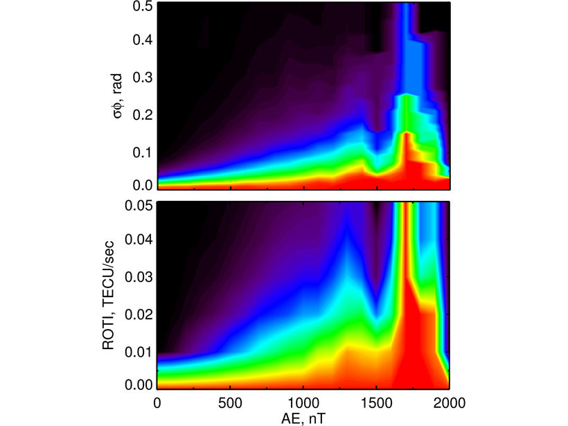
The Auroral E-region is a Source for Ionospheric Scintillation
Observations reveal a connection between auroral particle precipitation and scintillation, indicating that the ionospheric E-region is a key source region for phase scintillation at auroral latitudes.
Posted inAGU News
Elliott Receives 2020 John Wahr Early Career Award
John R. Elliott received the 2020 John Wahr Early Career Award at AGU’s virtual Fall Meeting 2020. The award recognizes “significant advances in geodetic science, technology, applications, observations, or theory.”

Posted inFeatures
Chasing Cyclones from Space
The pioneering use of satellite-based synthetic aperture radar to characterize tropical cyclones in near-real time has provided a crucial new tool with which to forecast powerful storms.

Posted inScience Updates
Amateur Radio Operators Help Fill Earthquake Donut Holes
Ham radio networks gear up to provide real-time, on-the-ground information about earthquake shaking and damage when other communication pathways are knocked out of commission.
Posted inFeatures
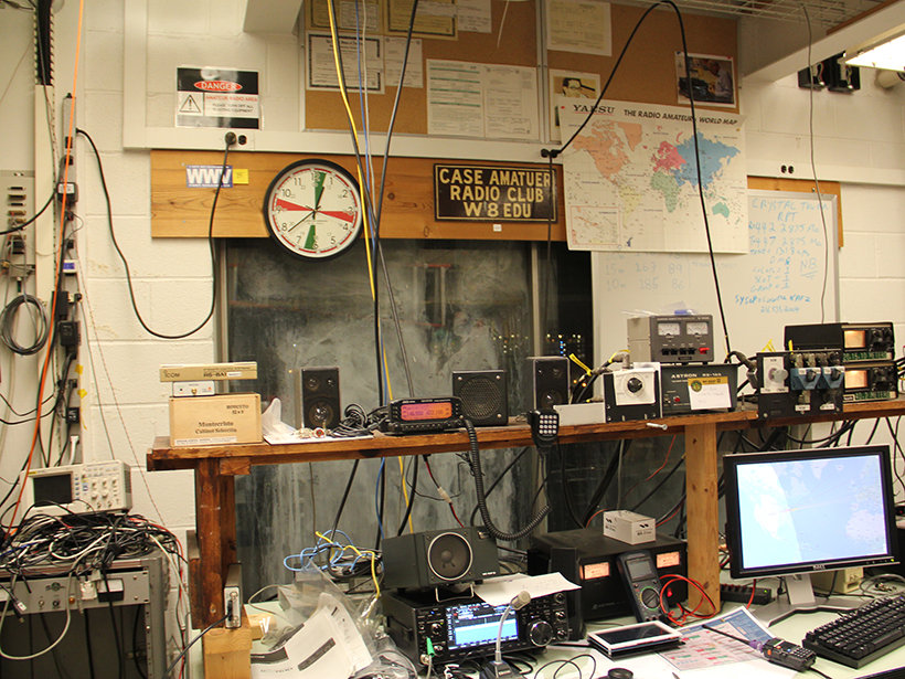
Ham Radio Forms a Planet-Sized Space Weather Sensor Network
For researchers who monitor the effects of solar activity on Earth’s atmosphere, telecommunications, and electrical utilities, amateur radio signals a golden age of crowdsourced science.

Posted inEditors' Highlights
Radio on Jupiter, Brought to You by Ganymede
Another first from NASA’s Juno spacecraft: the detection of Jupiter radio emissions influenced by the moon Ganymede, over a range of about 250 kilometers in the polar region of Jupiter.