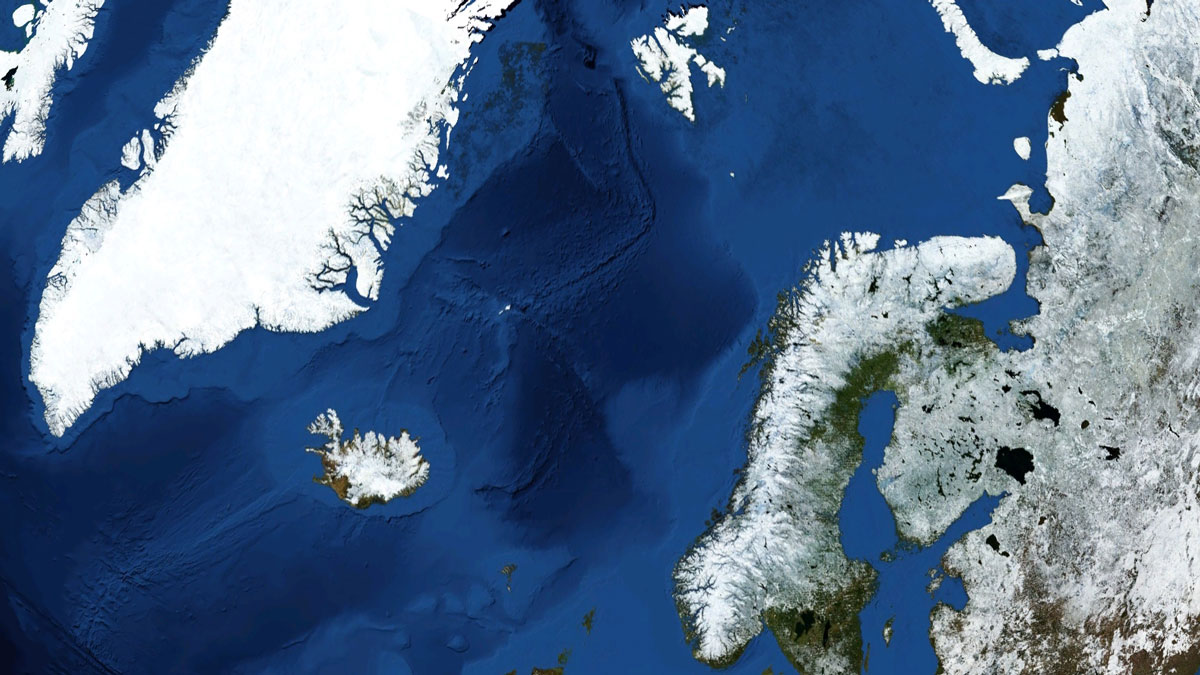
Researchers have mapped the ancient Stad Slide off the coast of Norway to better understand what triggered it, and the hunt is on for the tsunami it might have unleashed.
sediments

Posted inNews
Glass Sand Grows Healthy Mangroves
In places with lots of glass waste, sand made from recycled material could be another tool in the coastal restoration toolbox.
Posted inNews
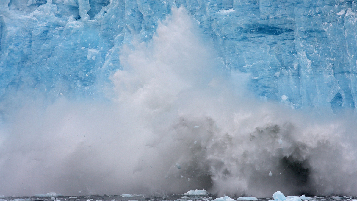
Glacier Runoff Becomes Less Nutritious as Glaciers Retreat
Sediment from retreating, land-terminating glaciers contains proportionally fewer micronutrients such as iron and manganese, reducing the glaciers’ value to microorganisms at the base of the food web.

Posted inNews
Sediments Hint at Large Ancient Martian Moon
Regular, alternating layers in Gale Crater may have been deposited as the result of tides raised by a moon at least 18 times the mass of Phobos, a study says.

Posted inNews
When Cascadia Gives Way, the San Andreas Sometimes Follows
Roughly half of the earthquakes that occurred along the southern Cascadia subduction zone over the past 3,000 years were temporally associated with earthquakes along the northern San Andreas fault.
Posted inResearch Spotlights
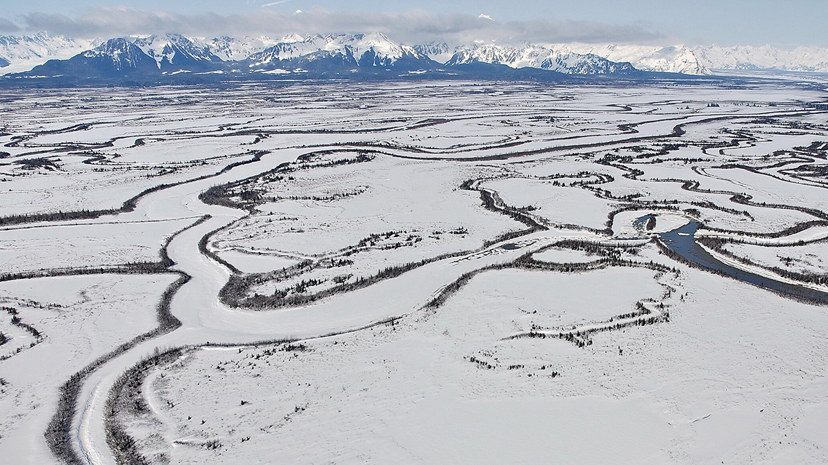
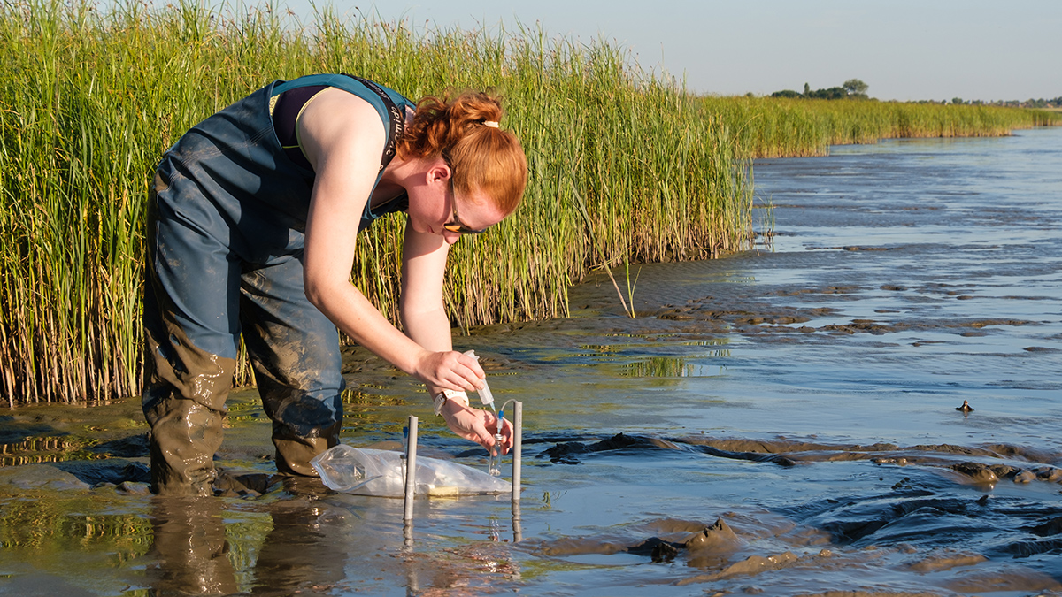
Tectonics and Climate Are Shaping an Alaskan Ecosystem
Biogeochemical research reveals the web of forces acting on a high-latitude microbe community in the Copper River Delta.
Posted inResearch Spotlights
New 3D Model Reveals Geophysical Structures Beneath Britain
Using magnetotelluric data to identify subsurface electrically conductive and resistive areas, scientists can identify underground features and predict how space weather may affect infrastructure.
Posted inNews
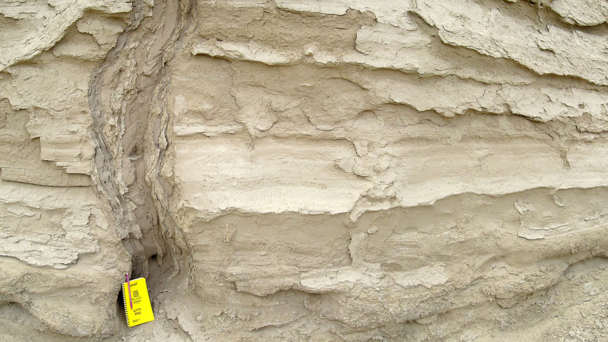
Spiky Sand Features Can Reveal the Timing of Ancient Earthquakes
Icicle-shaped features known as sand dikes form during ground shaking. New work reveals how these features can be used to date long-ago earthquakes.
Posted inScience Updates
Tracing Iron’s Invisible Transformations Just Beneath Our Feet
A new method that adds synthetic iron minerals to soils sheds light on hard-to-observe soil and sediment processes and may have a host of other applications in the Earth sciences and beyond.
Posted inEditors' Highlights
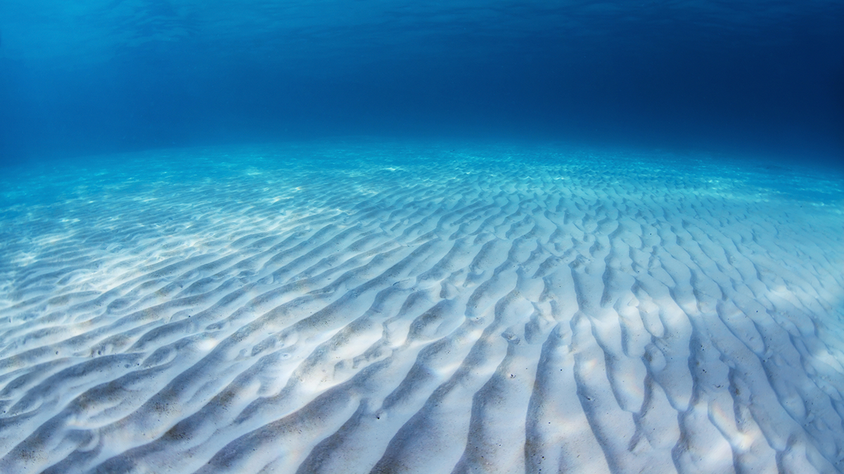
A First Look at How Sand Behaves Inside a Rippled Bed
A detailed numerical model shows how sediment particles experience wave-driven shear stress inside and above a sea bed with sand ripples.