
Students and community members monitor the health of mountain water reserves, which capture and release water, evening out wet and dry periods downstream.
water supply
Posted inResearch Spotlights
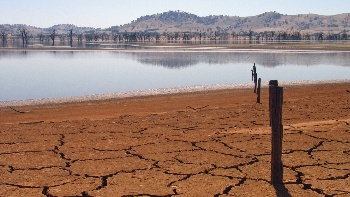
Surprise Hydrological Shifts Imperil Water Resources
Mounting evidence suggests the need for improved water planning strategies and revamped hydrological models.

Posted inEditors' Highlights
Oceans Warming Increases Xinjiang’s Precipitation, but Scarcity Stays
A transition toward an unusually wet condition due to ocean surface warming-induced increased precipitation will not alleviate the water scarcity risk in Xinjiang, China.
Posted inEditors' Highlights
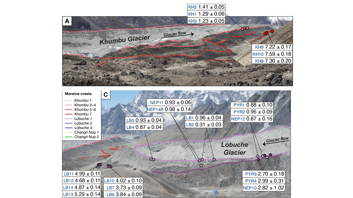
Glacier Advance and Retreat: Insights From the Top of the World
New dating of glacial features reveals predictable glacier behavior in response to climate warming and cooling in the Everest region in the past 8,000 years.
Posted inResearch Spotlights
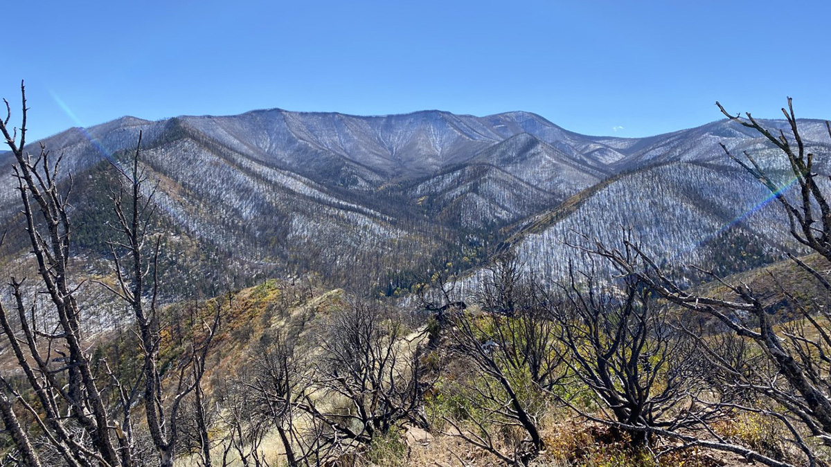
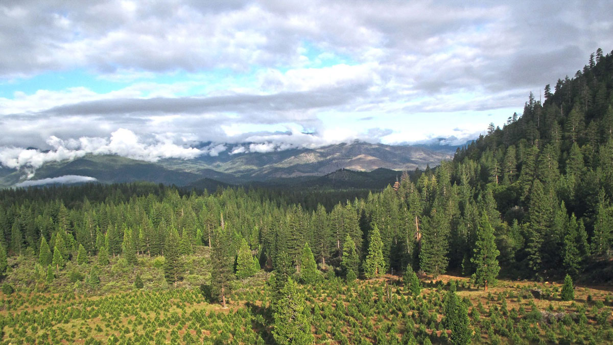
How Wildfires Affect Snow in the American West
Data from 45 burned sites help researchers better understand climate change and wildfires’ impact on snowpack.
Posted inEditors' Highlights
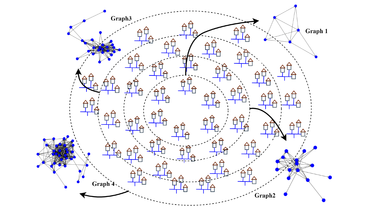
AI Algorithm Provides More Accurate Forecasts of Water Use
The new graph convolutional recurrent neural network (GCRNN) will enable water utilities to forecast water use, even if some sensors fail.

Posted inNews
Maui Endures More Drought and Drier Streams
Drought continues to threaten Maui’s native land-based and marine ecosystems, water resources, and traditional ways of life. But conservationists have hope—and ways to fight back.
Posted inNews
Large-Scale Reforestation Efforts Could Dry Out Landscapes Across the World
The complex interactions between forests and the water cycle might end up with more rain falling in the ocean—far from a thirsty land.
Posted inResearch Spotlights
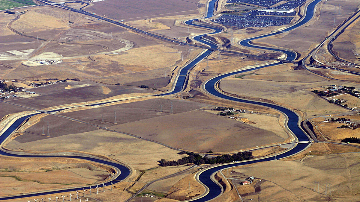
Assessing Water Infrastructure Investments in California
Exploratory modeling in California’s Central Valley indicates that evaluating the costs, benefits, and risks to individual providers is necessary to ensure the viability of future water projects.
Posted inEditors' Highlights
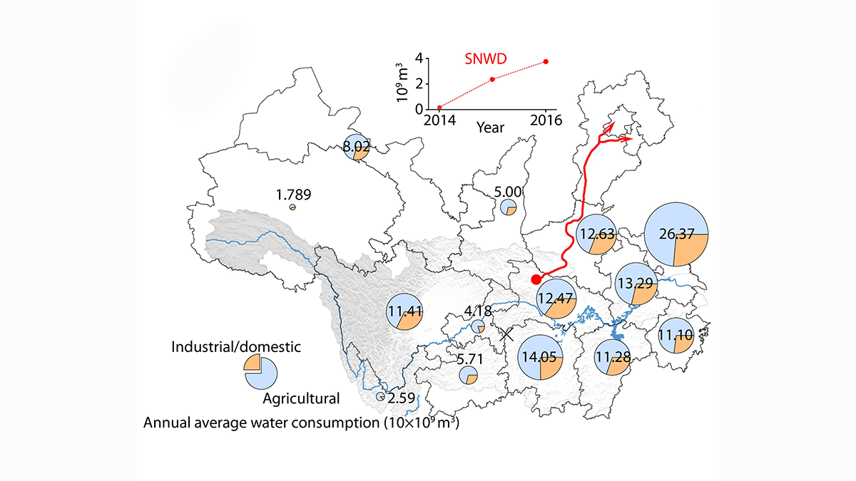
Improved Understanding of Runoff Dynamics in the Yangtze River Basin
Satellite data combined with in-situ observations on terrestrial water storage change and human water consumption provides a more accurate picture of runoff dynamics at sub-basin scale.