
Gravity measurements reveal depth and storage conditions of rhyolitic magma reservoirs beneath the Laguna del Maule volcanic field in Chile.
Editors’ Highlights

Posted inEditors' Highlights
New Spherical Cap Field Model for Europe and Direct Environs
New data on ancient burnt structures is integrated into a superior spherical cap field model for Europe.
Posted inEditors' Highlights
Earthquake Rates Enhanced by Triggered Creep
Analysis of California earthquakes solidifies links between shaking due to remote earthquakes and increased local earthquake activity that persists for times longer than for regular aftershocks.
Posted inEditors' Highlights
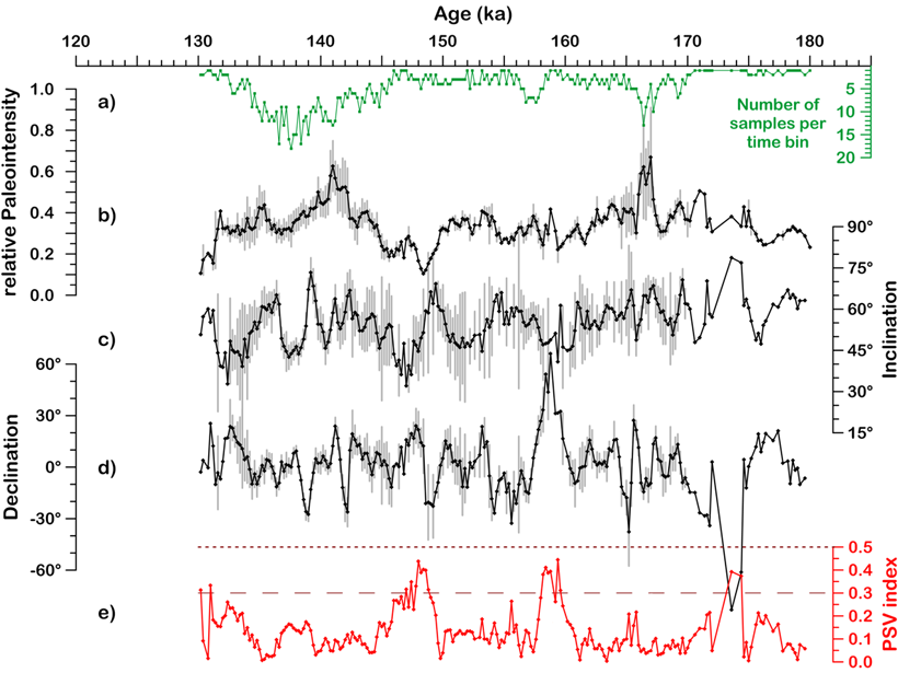
Marine Isotope Stage 6: First High-Resolution Field Record
A 200-year resolution record from the Black Sea for marine isotope stage 6 (130-180 ka) shows a stable geomagnetic field.
Posted inEditors' Highlights
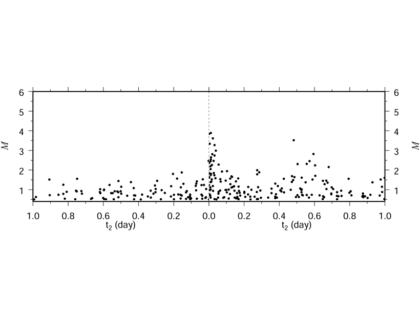
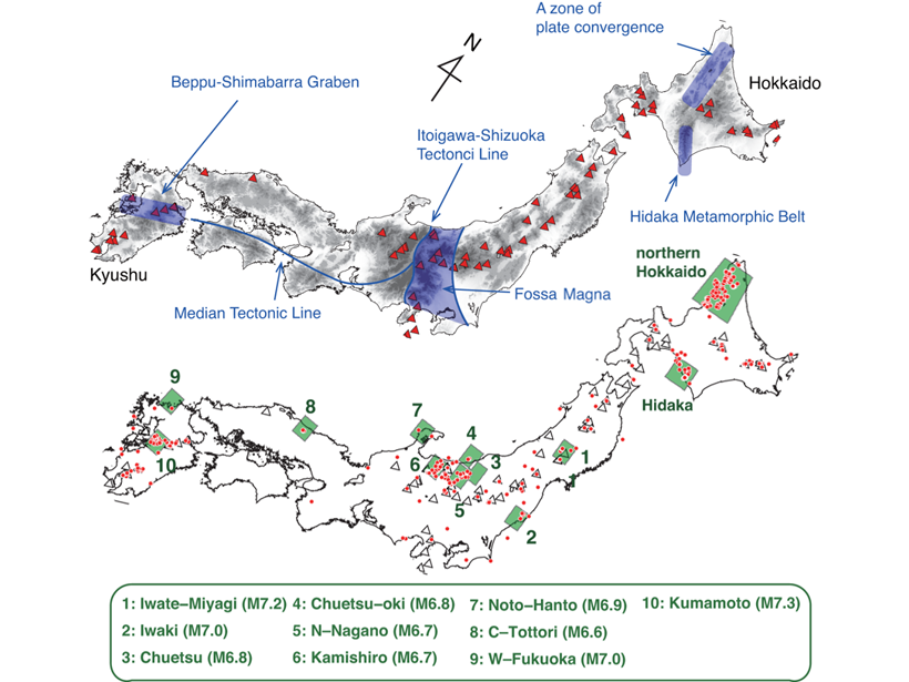
The First Systematic Search for Enervated Earthquakes
High quality data from Japan provides answers on where and when “enervated” earthquakes occur.
Posted inEditors' Highlights
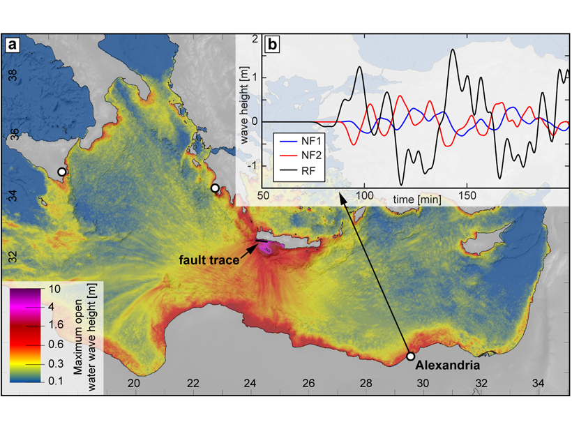
Was the AD 365 Mediterranean Earthquake Normal?
The great AD 365 earthquake at Crete has implied a locked Hellenic subduction zone that can produce more earthquakes to threaten Mediterranean coastlines. But what if wasn’t a subduction zone event?

Posted inEditors' Highlights
The Promise of Spaceborne High Spectral Resolution Lidar
New spaceborne high spectral resolution lidar measurements provide a new view of global aerosols.
Posted inEditors' Highlights
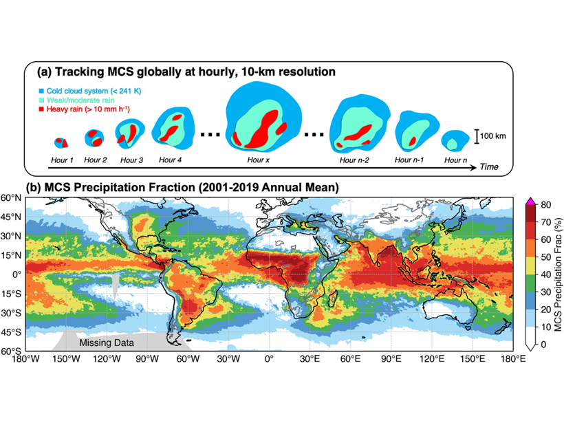
New Global Mesoscale Convective System Tracking Database
A 20-year high-resolution global mesoscale convective system tracking database reveals the characteristics of mesoscale convective systems and their significant contributions to global rainfall.

Posted inEditors' Highlights
A 2700-year Record of Permafrost Thaw Sensitivity to Climate
Changes in the 14C ages of carbon and biomarkers deposited at the mouth of a river draining a permafrost watershed track responses of regional thaw depth to past warming and cooling.

Posted inEditors' Highlights
Saturn’s Dynamo Illuminates its Interior
Saturn’s oddly symmetrical magnetic field can be explained by models in which the active dynamo region is overlain by a thick, stable layer cooled more strongly at the poles.